A Dubai climate strategy built as something you wear
Pinned
Physical mapping and research that chose Beacon’s program
Camber
One week charette for a bridge that is also a house
Virtuous Book
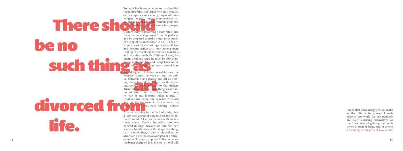
Typographic exploration inspired by Bruno Munari and Michael Bierut
From Elsewhere
Digital scrapbook cookbook with worldwide recipes
professional work
Custom Revit Families
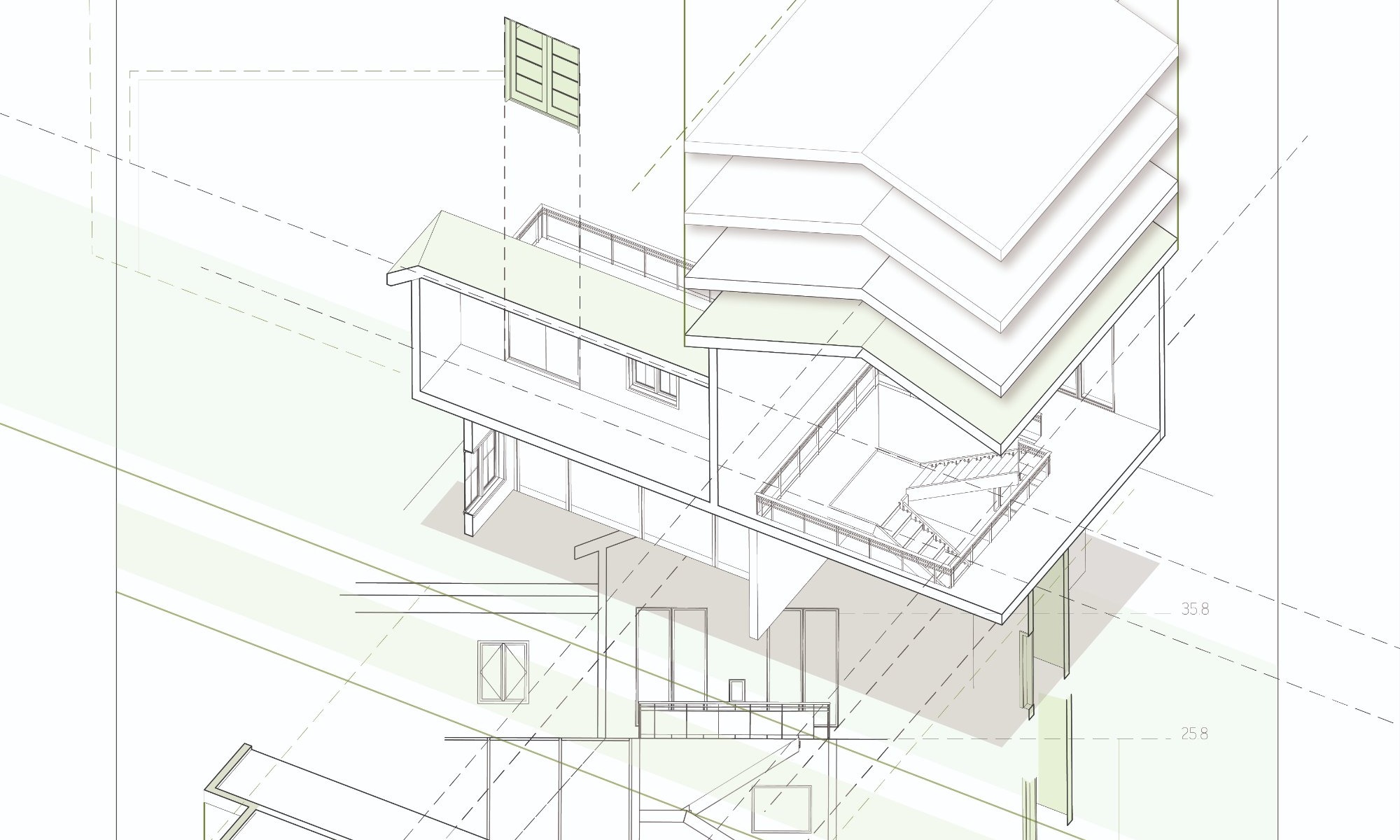
Parametric Revit families for hospitality guestrooms and public spaces
about
Hey, I’m Khushi! I’m an M.Arch candidate at the Savannah College of Art and Design (SCAD), where I also did my undergrad.
Design, to me, isn’t really about the aesthetics, it’s about how people move through it, gather in it, and feel while they’re there. That’s the question I keep coming back to across everything I make, from studio work asking big civic and ecological questions to firm work where those questions get grounded in what actually gets built. Most of what I design starts with a site, a river, a park, a community that’s been overlooked, and works outward from there.
SCAD’s pushed me to be versatile, comfortable moving between hand drafting and BIM, between concept sketches and construction documents, always with an eye toward sustainability and craft. I’ve also picked up a real appreciation for architectural history along the way, it’s hard not to, walking through Savannah every day. I’m excited to learn more and expand my perspective while I get deeper into this beautiful profession.
A complete nineteen sheet set drawn at graduate level: life safety plan with occupancy and exit calculations, site and floor plans, elevations, building sections, wall sections and details, and a full structural package with foundation, framing and roof framing plans, structural sections and calculations.
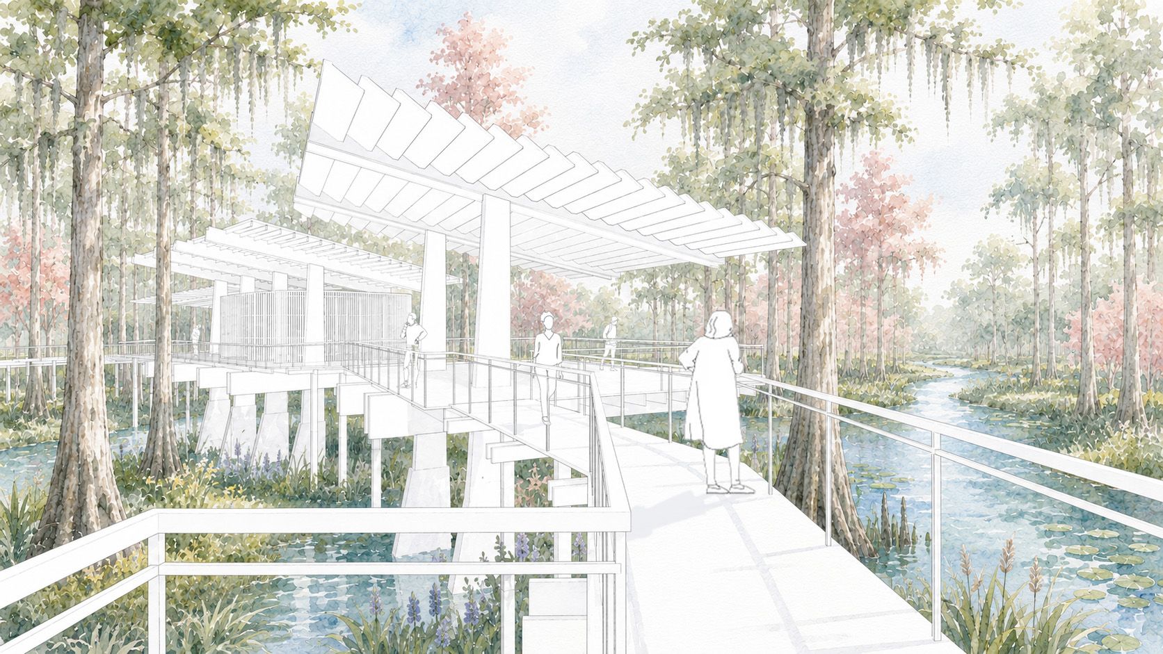
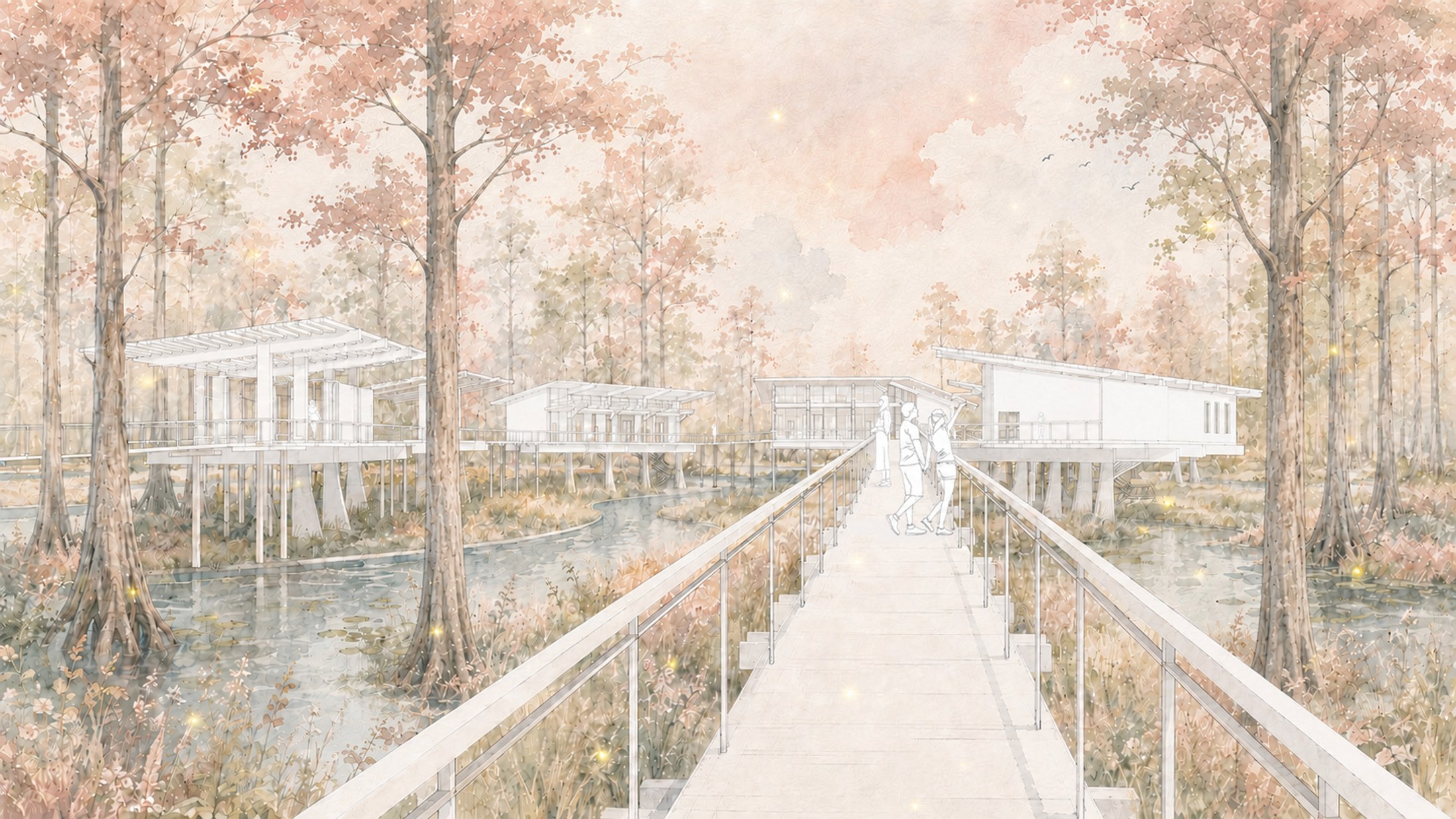
The project is a pause along the river, meant to slow the body and sharpen perception. Movement is intentional and slow, encouraging moments of stopping, looking, and listening as light shifts, water moves, and the landscape subtly changes. Spaces are oriented to frame these moments, making awareness the primary experience rather than arrival or destination.
The architecture stays quiet and restrained, acting as a background to nature instead of competing with it. Human-scaled spaces, warm materials, filtered light, and softened sound create an atmosphere that invites reflection and presence, offering a deliberate contrast to speed and distraction while deepening one’s connection to the river and its movements.
Design for Integration
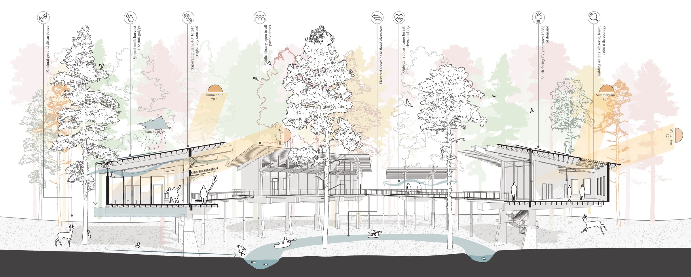
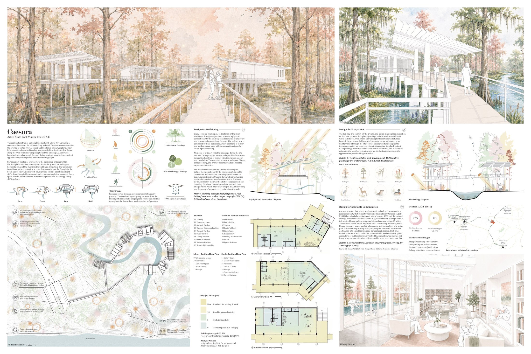
A single structural decision generates the entire environmental and programmatic strategy. Lifting the building above the floodplain kept the site intact, opened the section to cross ventilation, tilted the roof toward rainwater collection, and placed a free library, studio, and outdoor classrooms inside a state park that doesn't have them anywhere else. Water, wildlife, and air move beneath the structure — no part of the building works alone.
Metric: One structural move generates the entire environmental and programmatic strategy.
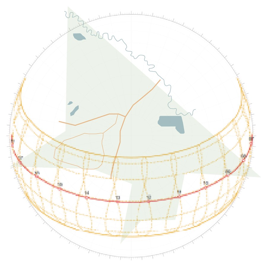
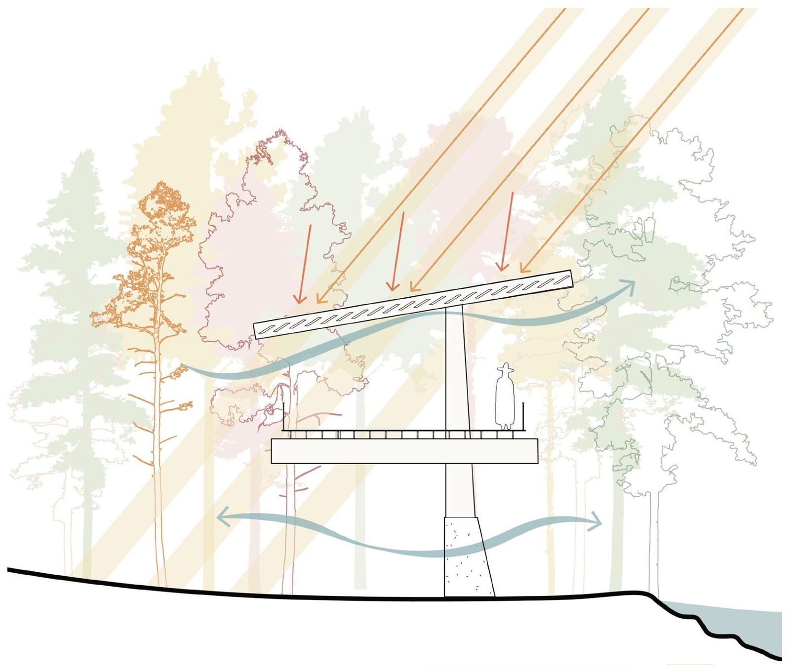
Sun Path
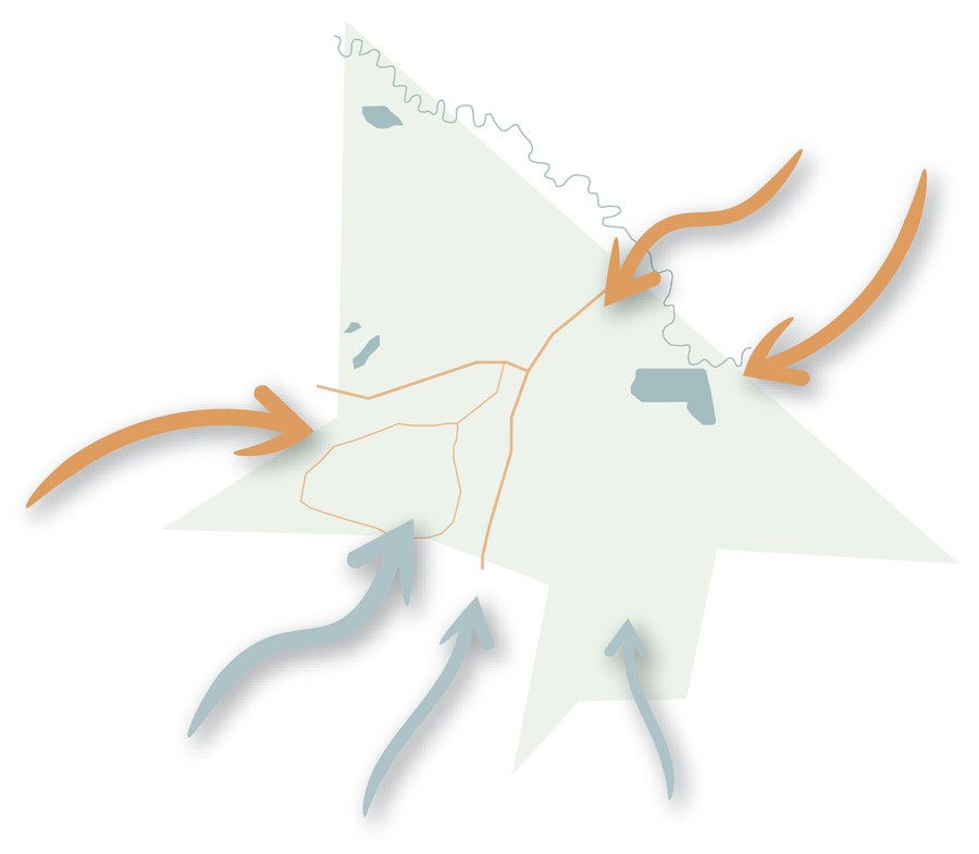
Prevailing Winds
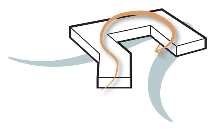
Carve Bend the massing to follow the river's edge.
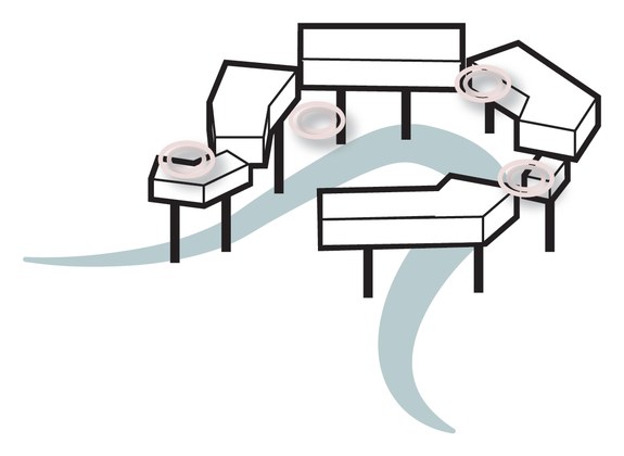
Frame Open sightlines and circulation toward forest and water.
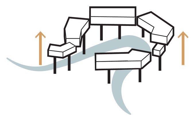
Raise Lift the structure clear of the floodplain.
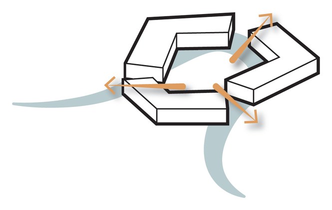
Hold Consolidate into distinct pavilions connected by boardwalk.
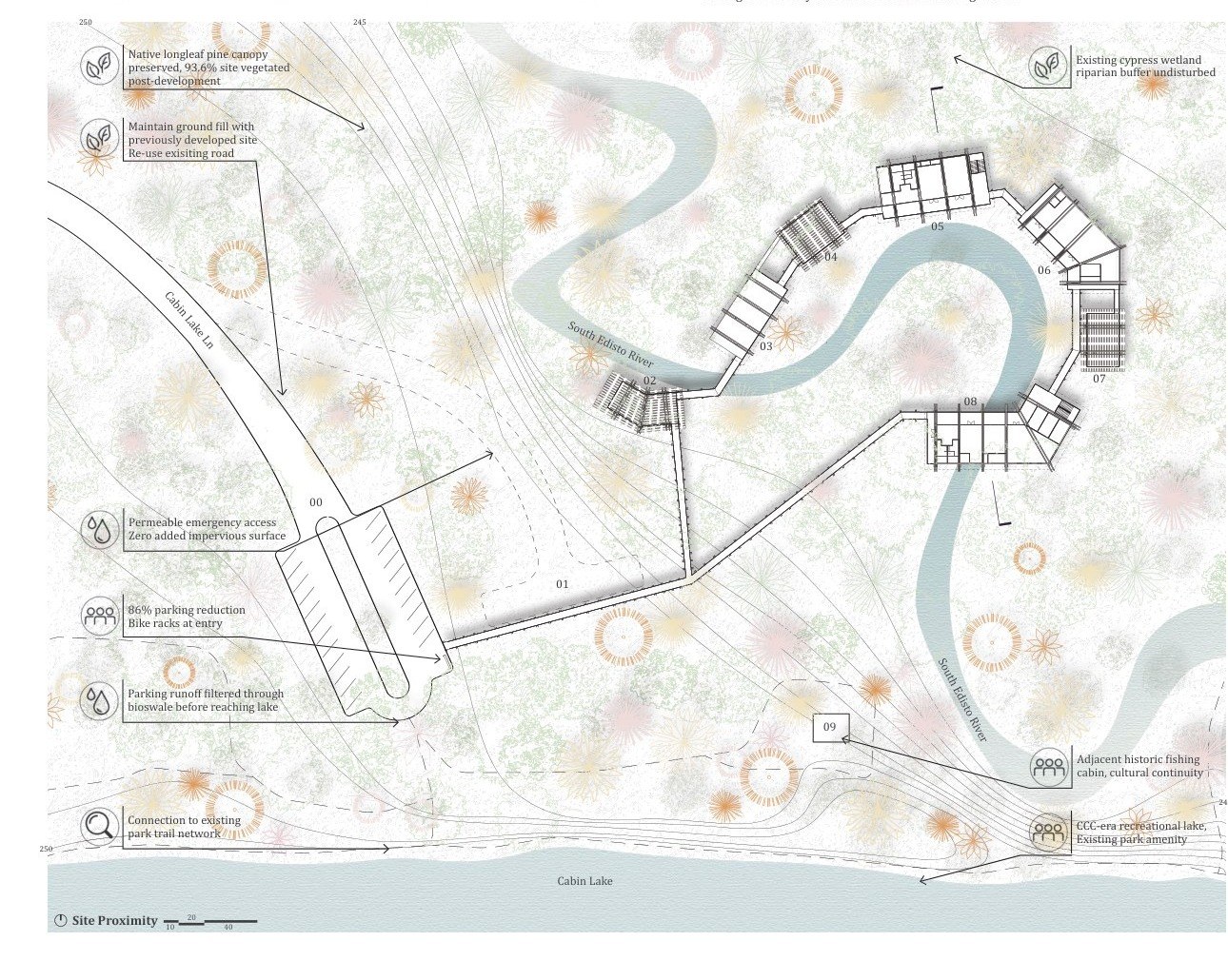
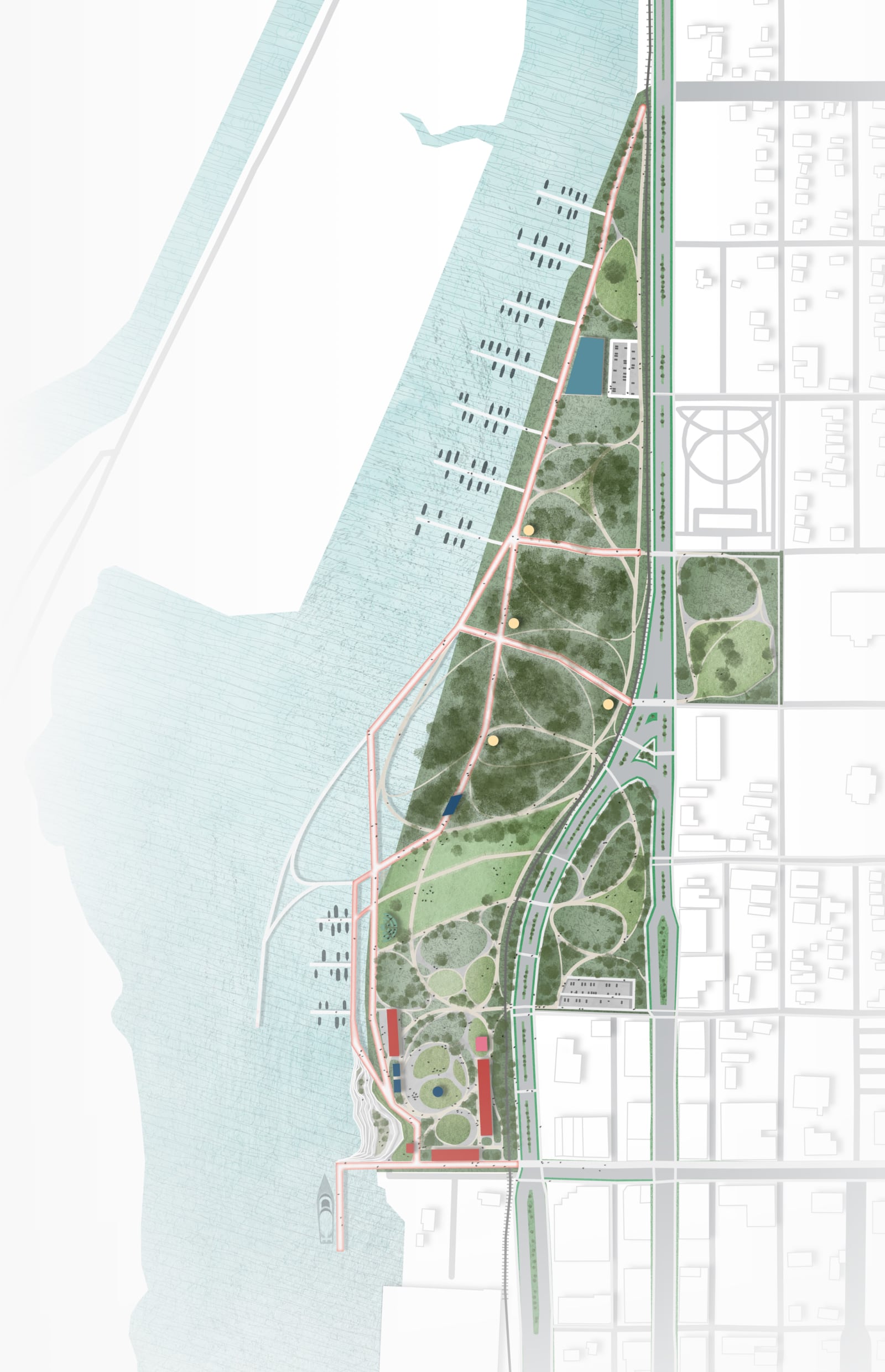
Seven pavilions follow the bend of the South Edisto, linked by an elevated boardwalk that keeps the floodplain intact. Parking and the emergency lane stay at the tree line, so arrival happens on foot. The sequence moves from welcome to library to studio, with open air pavilions holding the pauses between.
Site Plan Key
00 Parking
05 Studio Pavilion
01 Emergency Lane
06 Library Pavilion
02 Open-Air Pavilion
07 Open-Air Pavilion
03 Outdoor Classroom Pavilion
08 Welcome Pavilion
04 Open-Air Pavilion
09 Historic Fishing Cabin
Design for Discovery
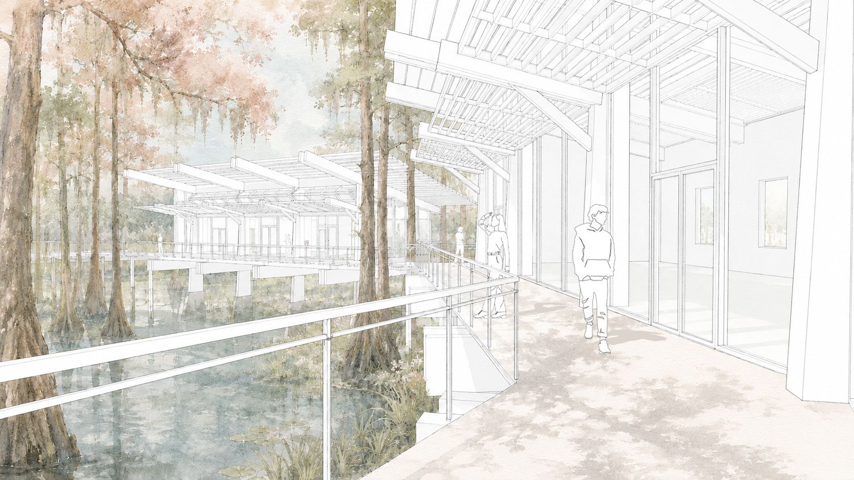
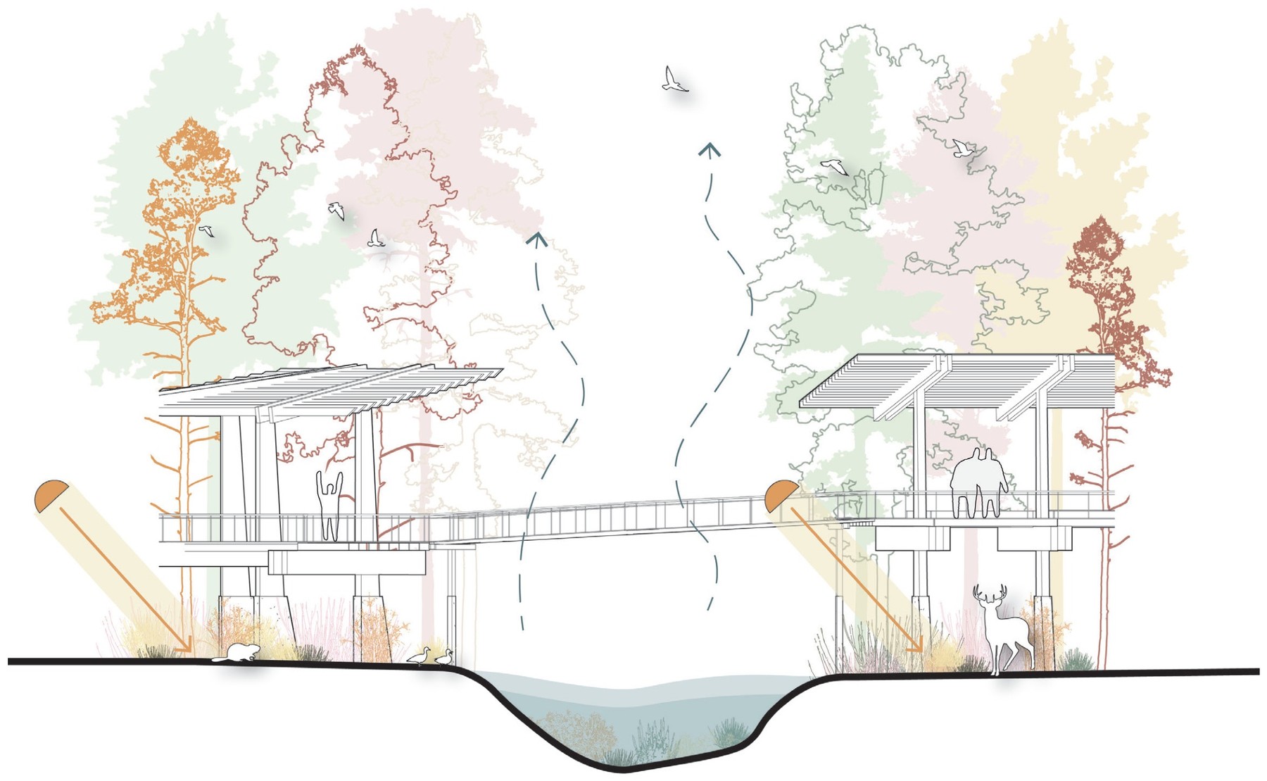
The elevated boardwalk moves visitors through the cypress canopy at eye level with branches, birds, and filtered light. Pavilions frame the river, then the forest, then the sky through sightlines, positioning people inside the landscape rather than simply looking at it. The library, studio, and outdoor classrooms give structure to that attention, turning a visit into sustained contact with the site.
Metric: Constant contact and awareness of the South Edisto River landscape.
Open air pavilion along the boardwalk
Design for Economy
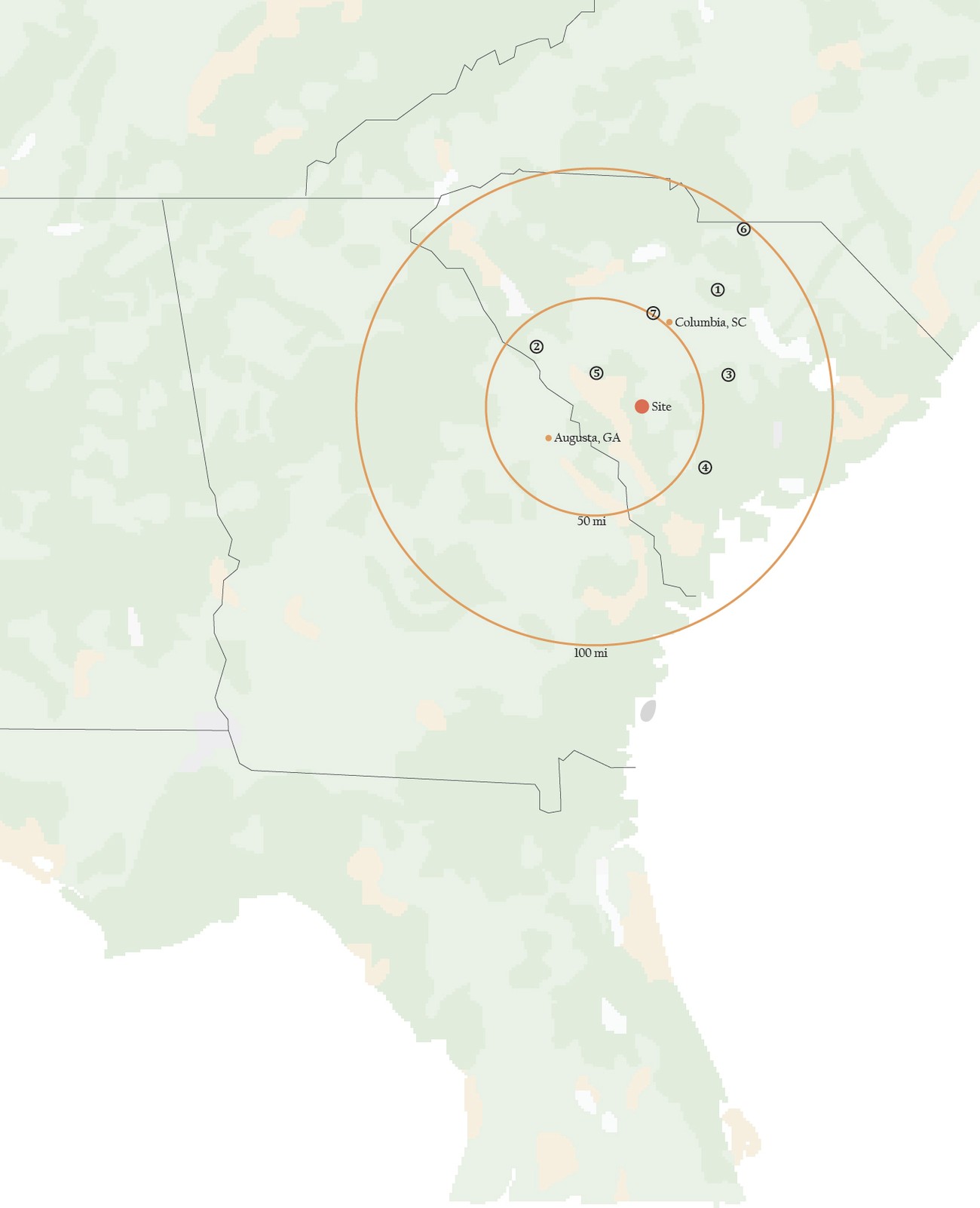
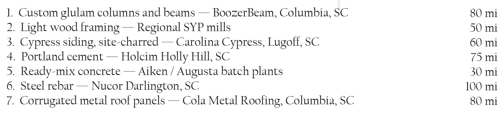
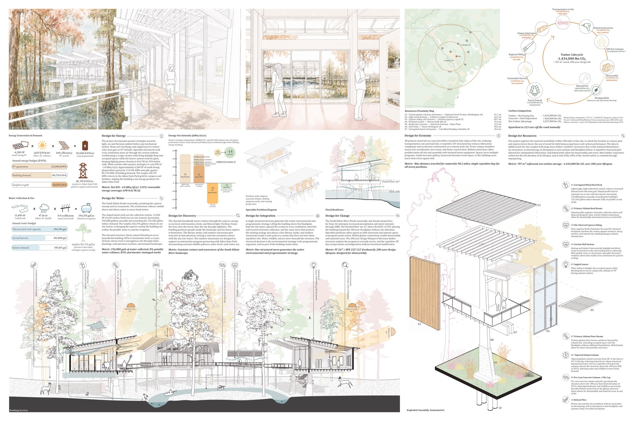
All primary materials are sourced within a hundred-mile radius of the site, reducing transportation cost and lead time. A repetitive 20' structural bay reduces fabrication complexity and accelerates construction, and bolted connections allow prefabrication off-site and assembly with minimal heavy equipment. Spaces serve multiple programs — studio becomes gallery, classroom becomes event space — so the building earns more from every square foot.
Metric: Max distance traveled for materials 98.2 miles; single repetitive bay for all seven pavilions.
Resources Proximity Map
Design for Equitable Communities
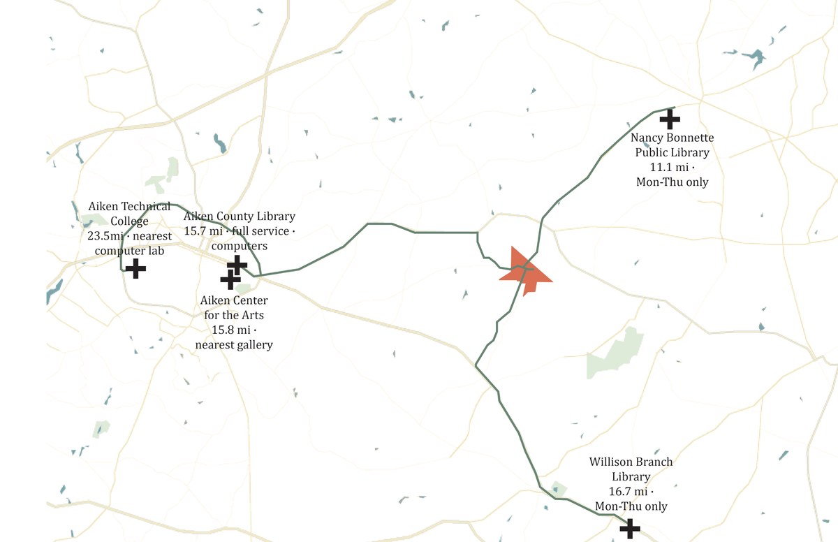
Caesura provides free access to educational and cultural resources in a rural community with limited availability. Windsor, SC has a bachelor's attainment rate roughly half the national average and no full-service library, gallery, computer lab, or classroom within 25 miles. Every program space — the library, computer access, outdoor classrooms, gallery, and studio — is universally accessible, open year-round, and free.
Metric: 5 free educational/cultural program spaces serving ZIP 29856 (pop. 2,698).
Educational and cultural access gap
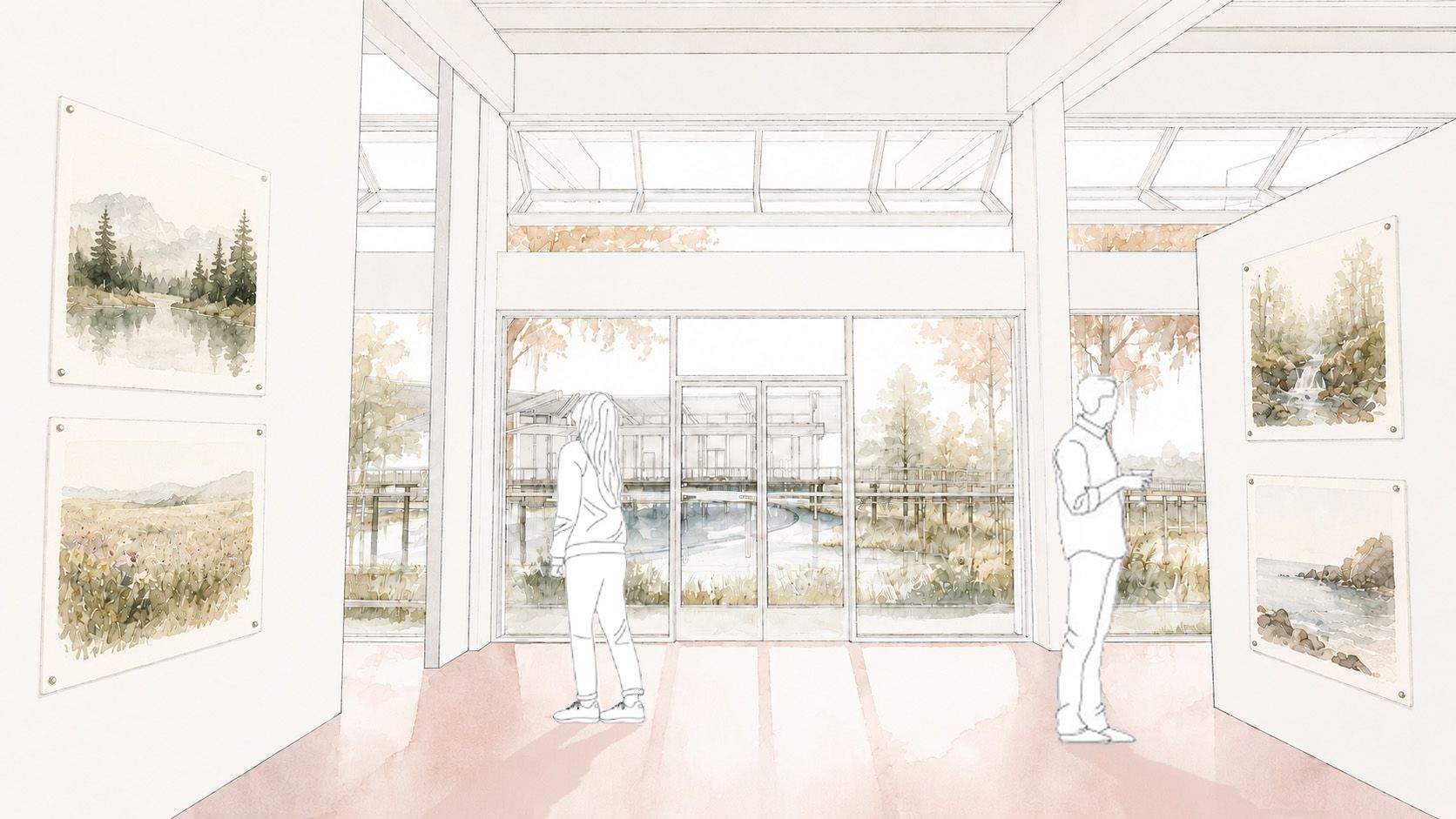
View outside the library pavilion
Design for Well-Being
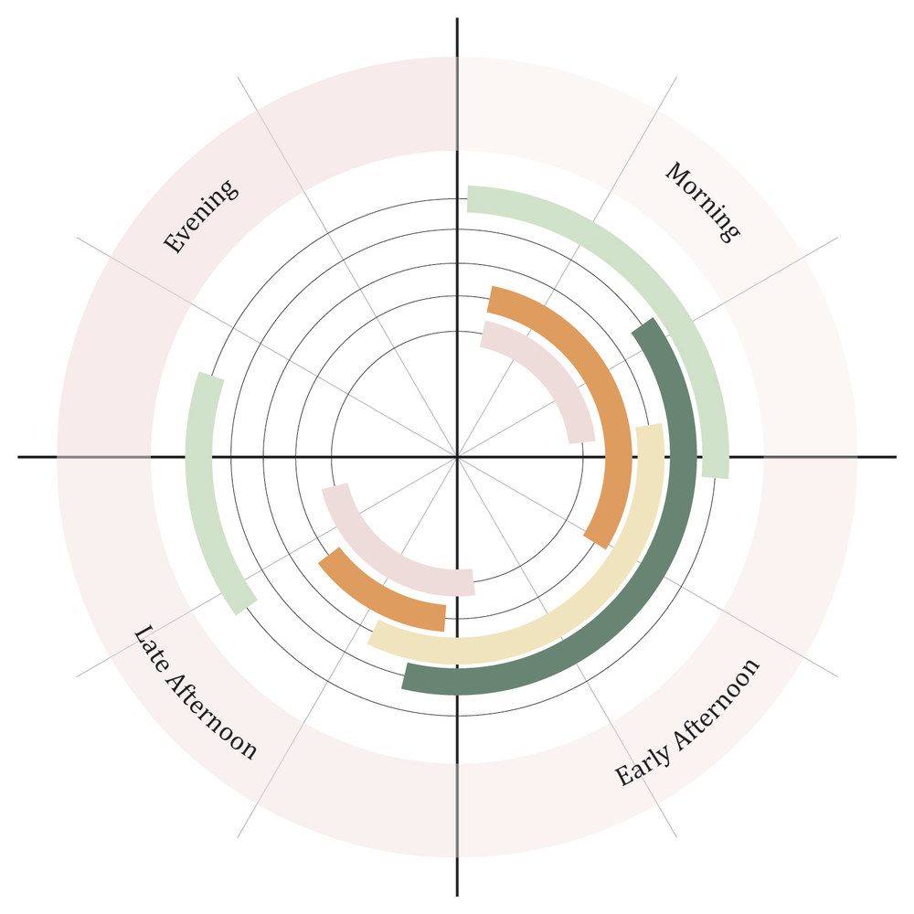
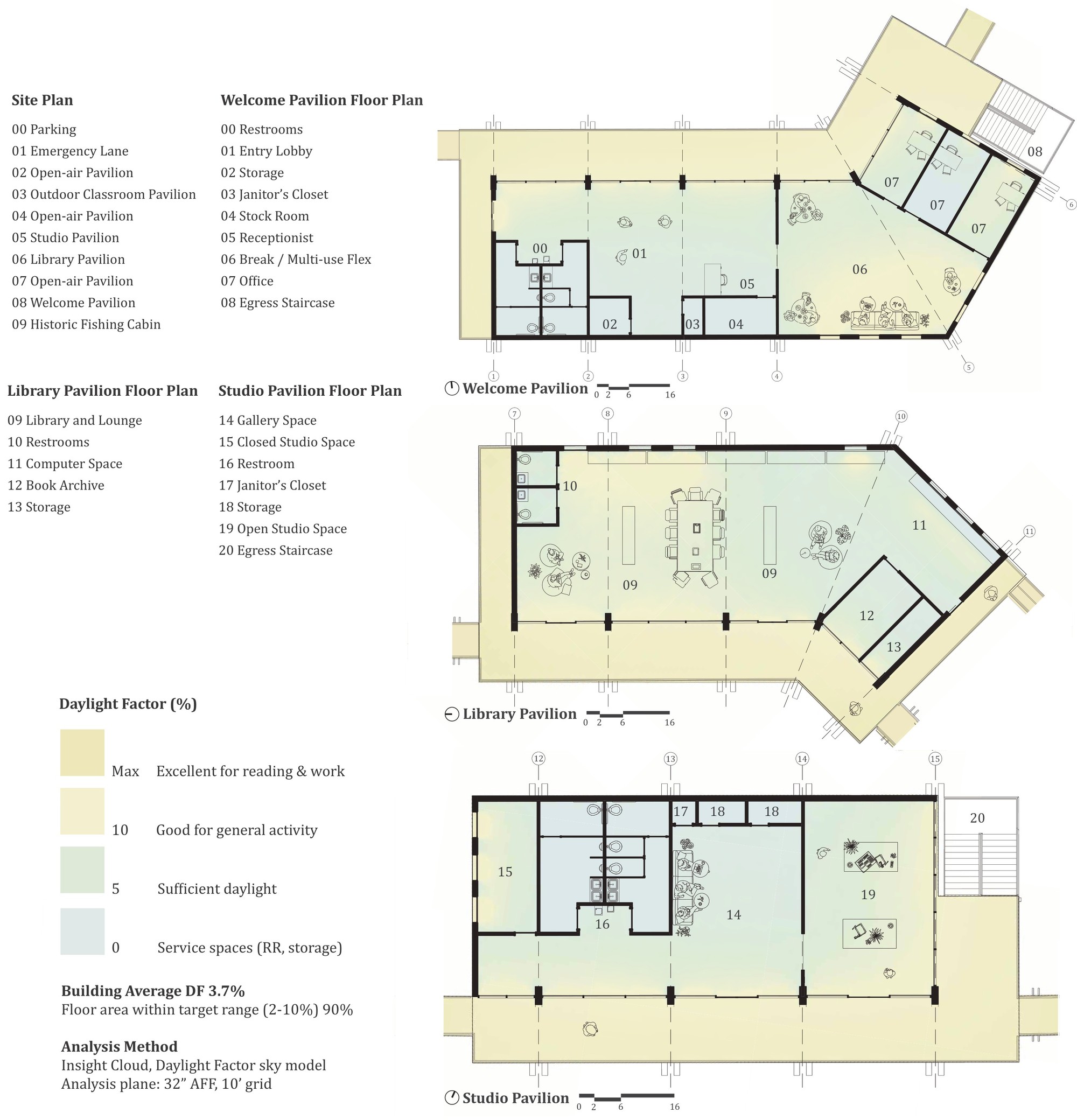
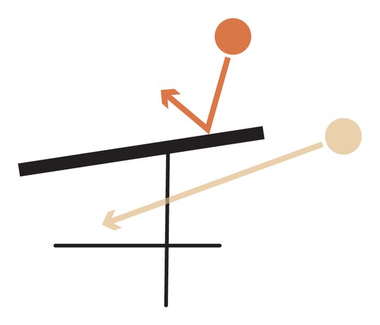
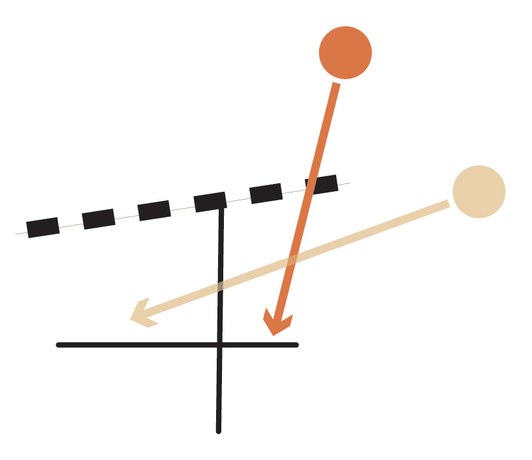
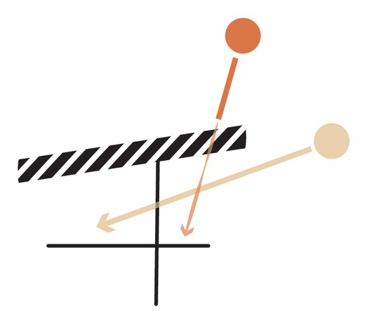
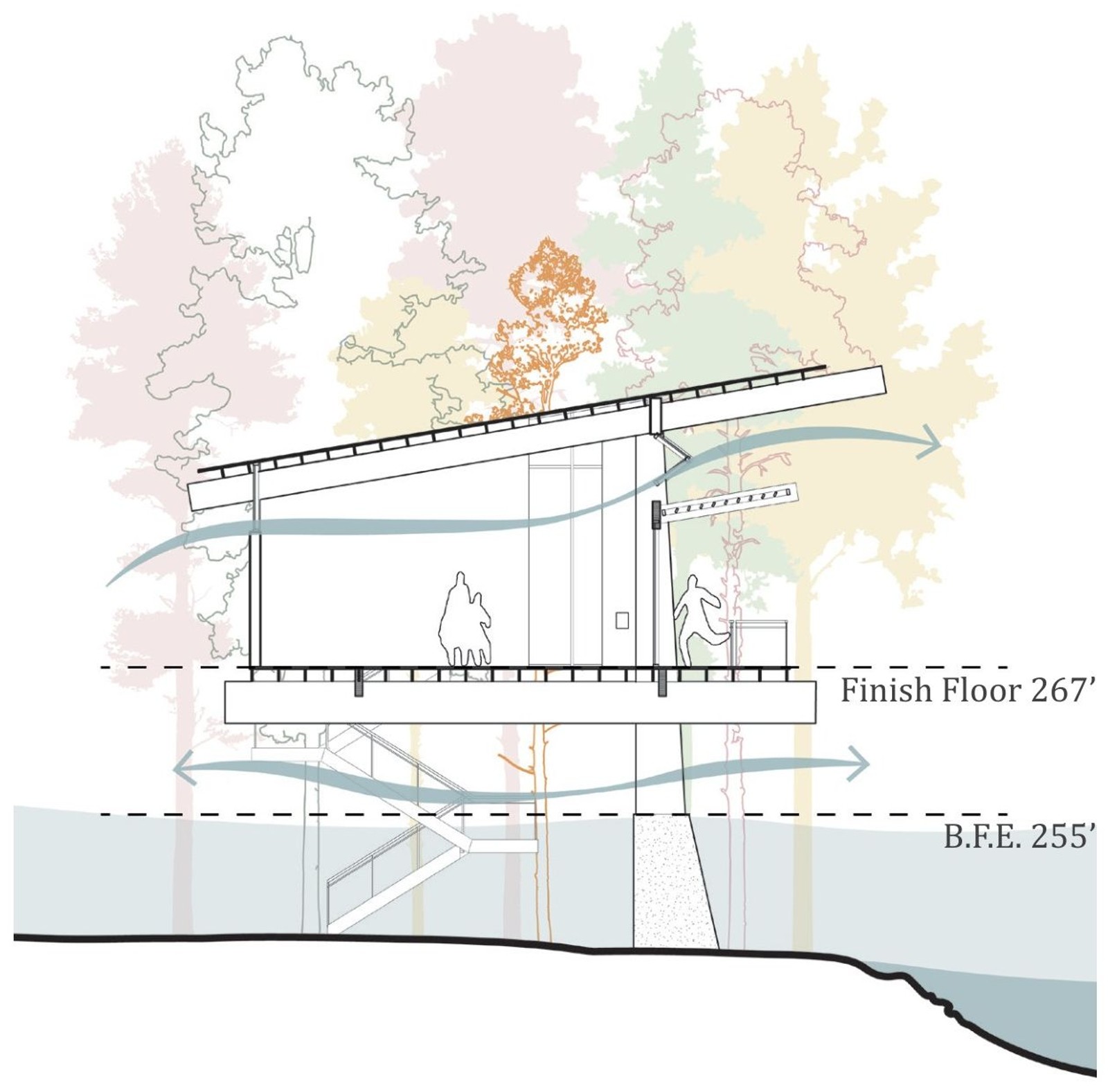
Every occupied space opens to the forest or the river, and moments of enclosure and exposure alternate along the path through the pavilions. The plans map daylight factor across all three, averaging 3.7%, which keeps the reading rooms and work areas in the range that supports sustained use without glare. Three louver studies tested how to get there: a solid panel darkened the interior, straight louvers admitted too much direct sun, and the angled profile filtered daylight while blocking the high summer sun. The section carries that through, drawing light in above the louvers and moving air across the plan and beneath the raised floor, so comfort comes from the section itself before any mechanical system.
Metric: Building average daylight factor 3.7%; 90% of user area within target range (2-10% DF); 95% with direct views to nature.
Solid Panel Blocks light completely, creating excessive shade and dark spaces.
Straight Louvers Allow permeability and airflow but admit too much direct sunlight.
Angled Louvers Filter daylight, allowing indirect light while blocking direct sun rays.
Daylight and Ventilation Diagram
Design for Ecosystems
The building lifts entirely off the ground, and helical piles replace excavation so that root systems, floodplain hydrology, and the wildlife corridors of white-tailed deer, river otters, and wading birds continue undisturbed beneath the structure. All plantings are native to the South Edisto watershed, and surplus rainwater from the roofs returns to on-site basins that recharge the cypress swamp the building sits within.
Metric: 94% site vegetated post-development; 100% native plantings; 5% waterways; 1% built post-development.
100% Native Plantings
92% Tree Canopy Coverage
100% Permeable Surfaces
Site Ecology Diagram
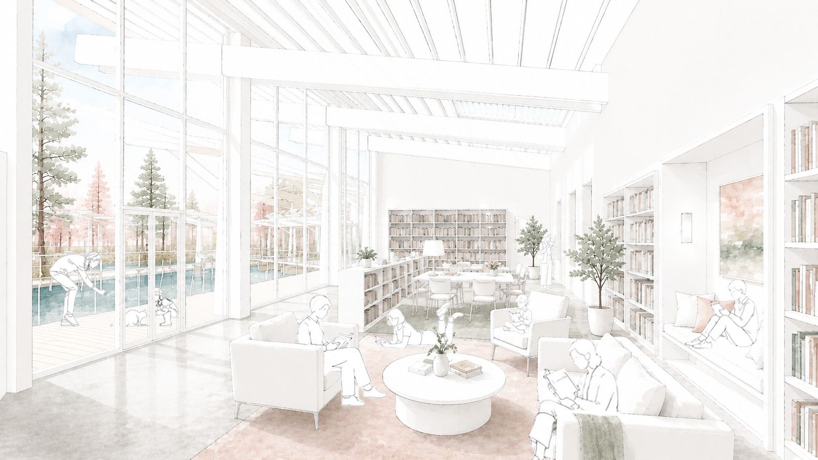
Library and lounge interior
Design for Resources
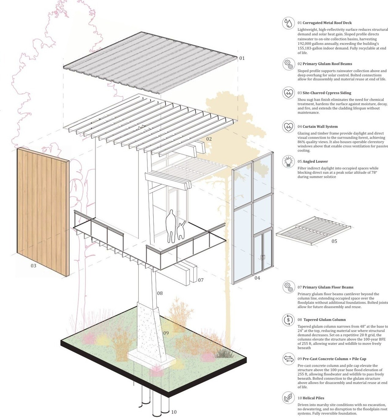
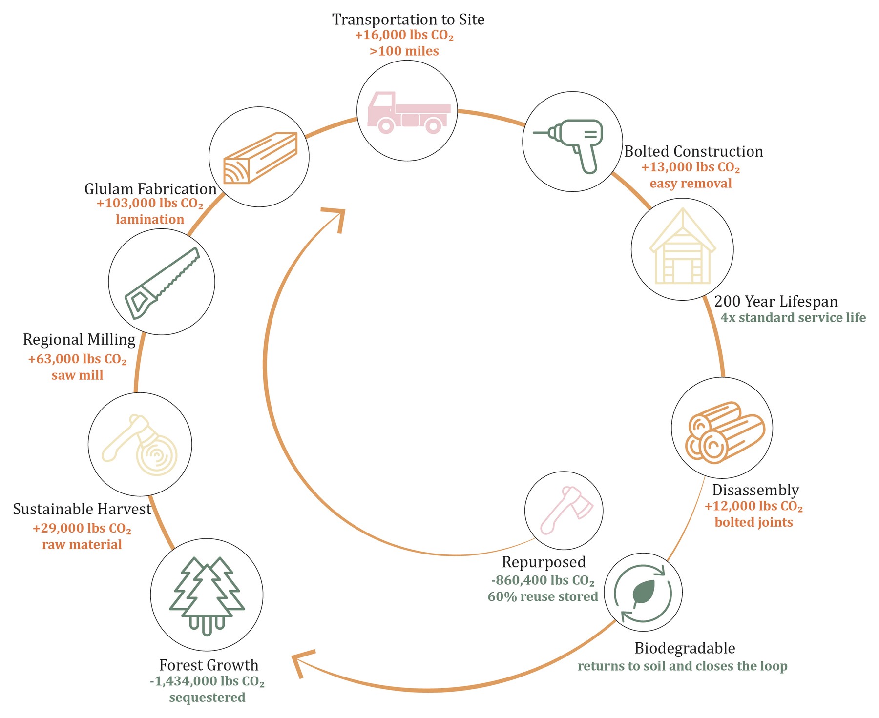
The project explores material availability within 100 miles of the site, favoring wood for both human experience and carbon performance. Mass timber cantilever structures create minimal disturbance — no excavation, no dewatering, no disruption to root systems or the floodplain below. Bolted joints allow disassembly and reuse, and the structure sequesters carbon for the full duration of its 200-year lifespan.
Metric: 707 m³ softwood; net carbon storage −1,434,000 lbs CO₂ over 200-year lifespan.
Exploded Assembly Axonometric
Timber Lifecycle
Design for Change
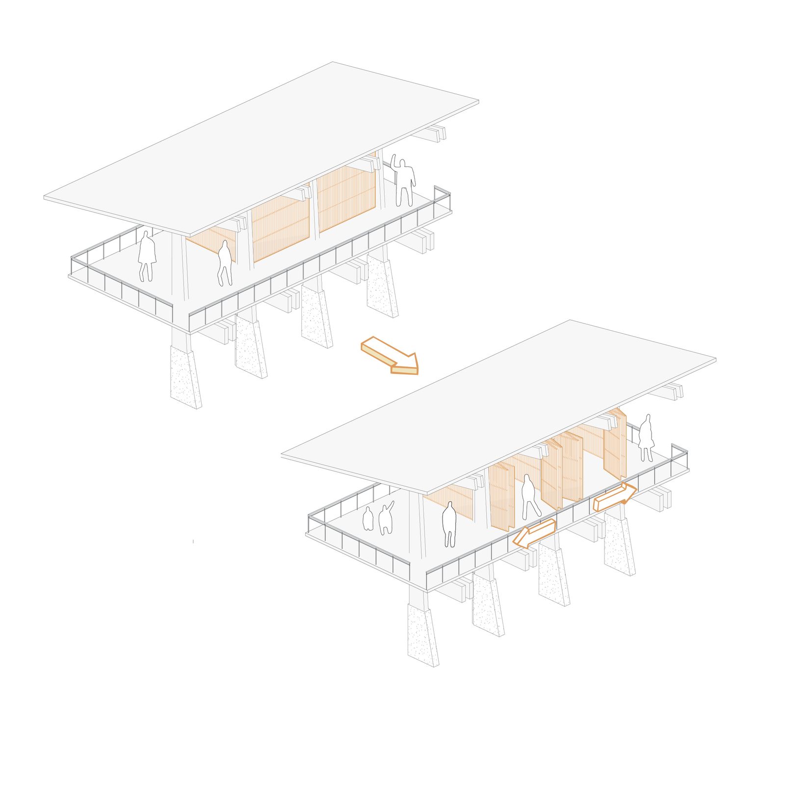
The South Edisto floods seasonally, and climate projections anticipate increased precipitation and storm intensity through 2080. The finished floor sits 12' above the base flood elevation without altering the site. Operable partitions let spaces shift between classroom and exterior space as program needs evolve, and bolted glulam connections allow the mass timber structure to be disassembled and reused well beyond the program it currently serves.
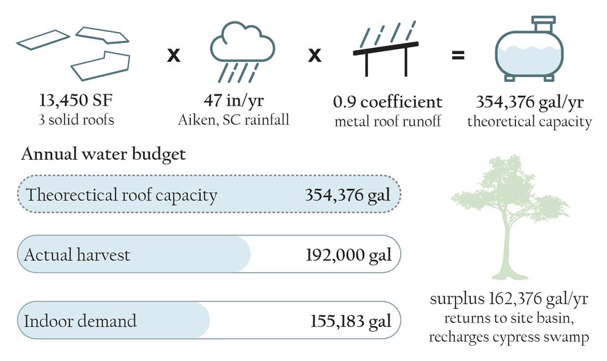
The South Edisto floods seasonally, sustaining the cypress swamp and its ecosystems. The sloped metal roofs are the collection system: 13,450 SF of roof surface feeds two on-site cisterns. No potable water is used for irrigation, and the elevated structure lets natural flooding continue beneath the building undisturbed.
Metric: 192,000 gals of water collected; 0% potable water reliance; 83% stormwater managed onsite.
Water Collection and Use
Design for Energy
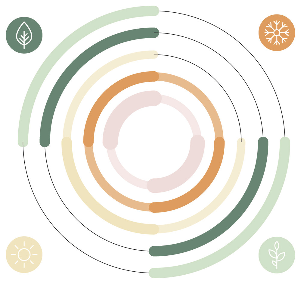
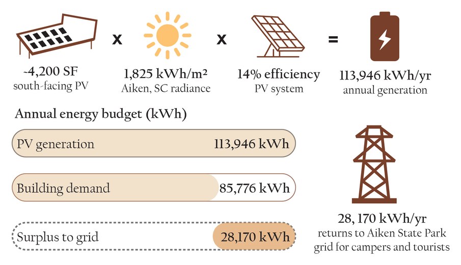
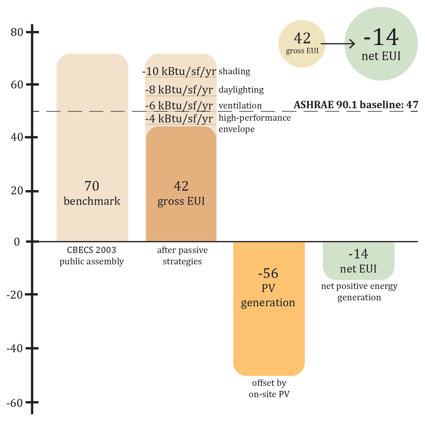
The project incorporates passive strategies toward light, air, and thermal comfort before any mechanical system. Deep roof overhangs and angled louvers reduce solar heat gain at 33 degrees latitude, while operable clerestories and cross ventilation move air through the section without conditioning it. What remains after passive strategies is a net EUI of -14 kBtu/sf/yr — roughly 4,200 SF of south-facing photovoltaics generate more energy than the building demands, returning the surplus to the Aiken State Park grid.
Metric: Net EUI −14 kBtu/sf/yr; 133% renewable energy coverage; LPD 0.62 W/sf.
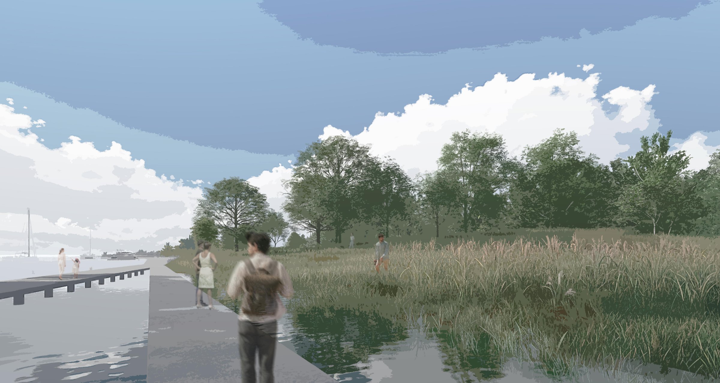
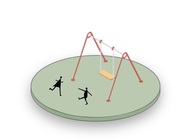
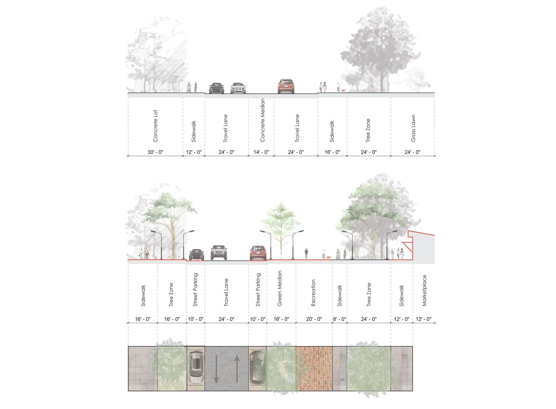
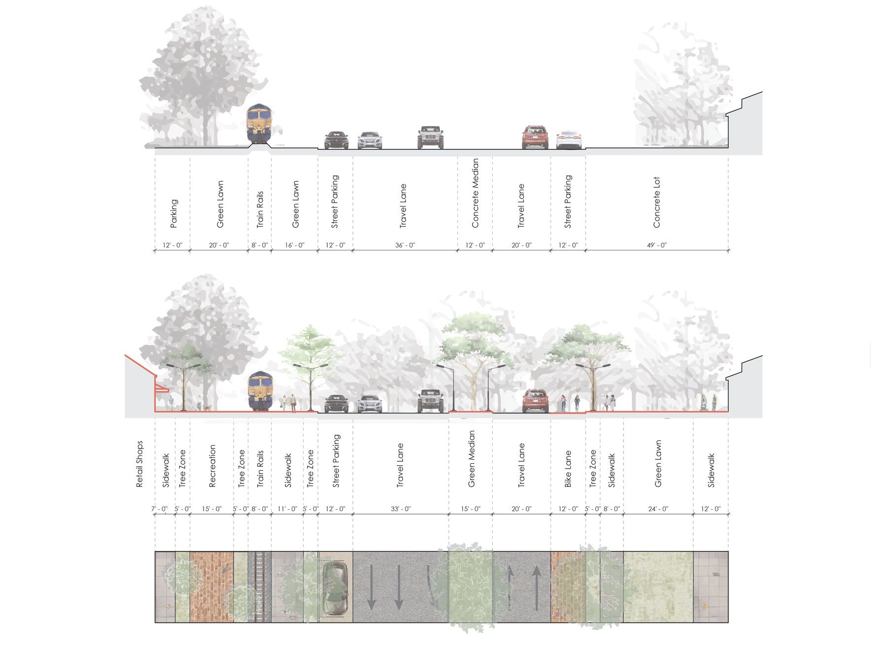
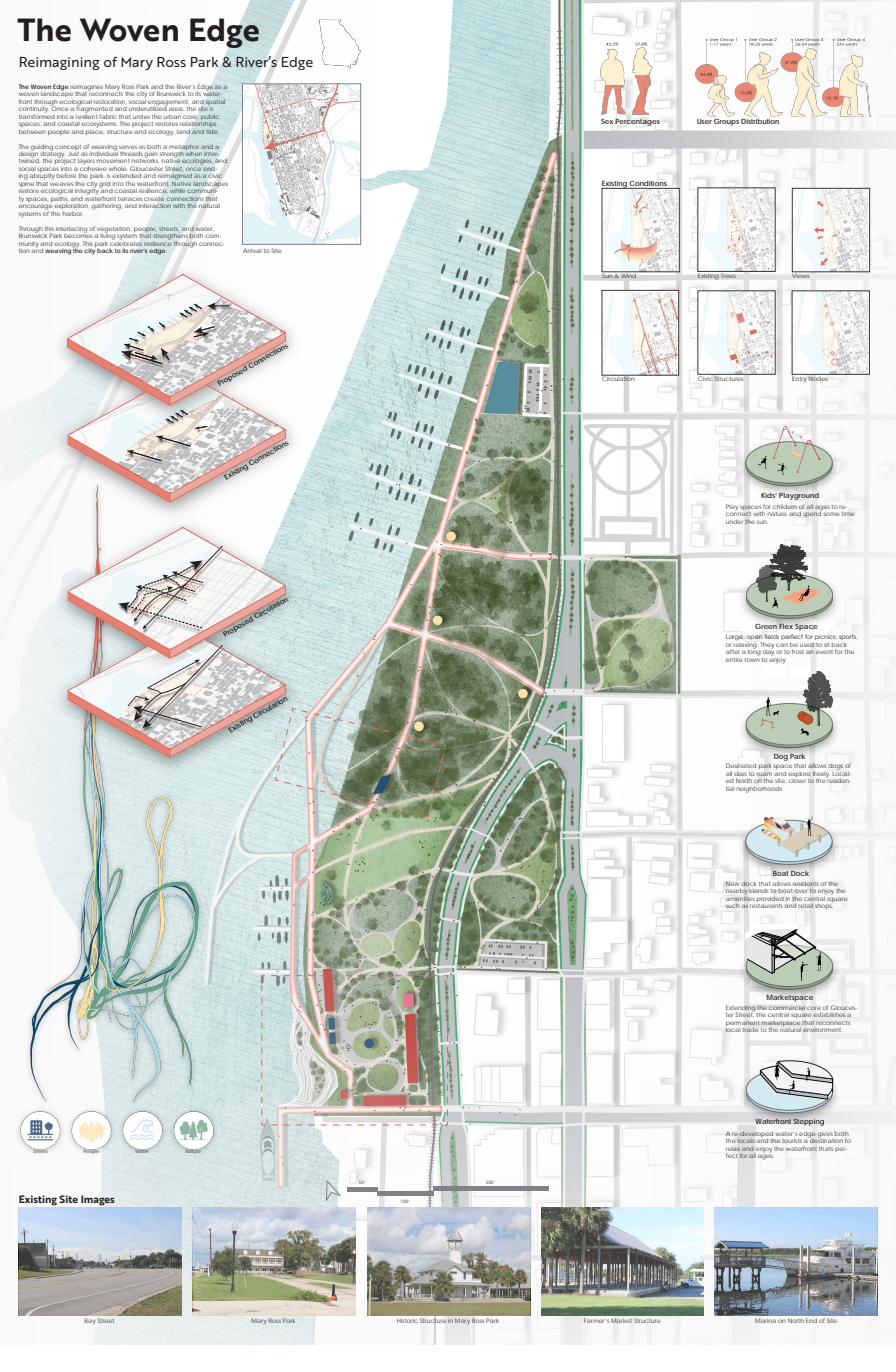
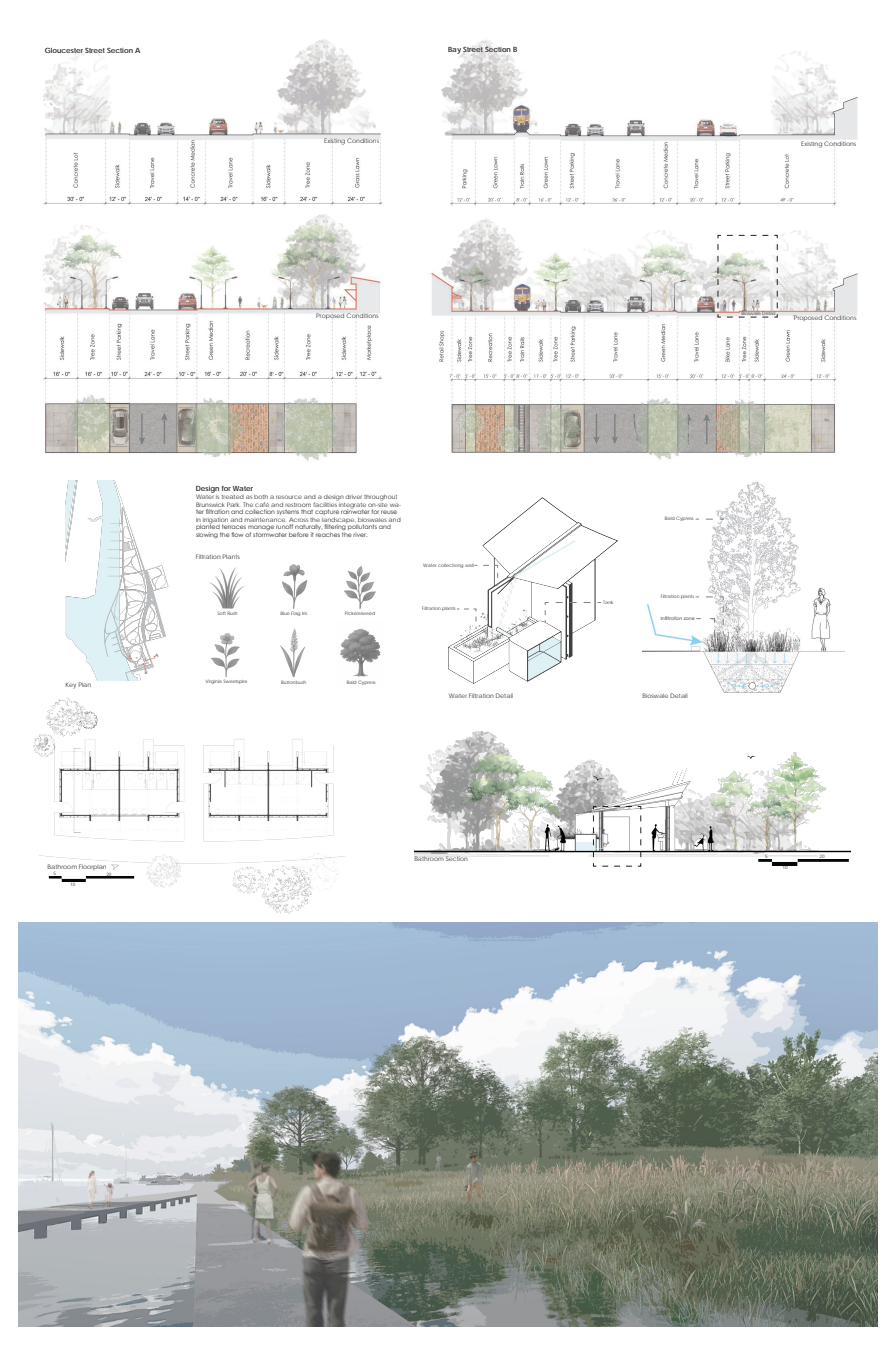
The Woven Edge reimagines Mary Ross Park and the River’s Edge as a woven landscape that reconnects the city of Brunswick to its waterfront through ecological restoration, social engagement, and spatial continuity. The guiding concept of weaving serves as both a metaphor and a design strategy. Gloucester Street, once ending abruptly before the park, is extended and reimagined as a civic spine that weaves the city grid into the waterfront.
Accepted for display at the ACSA 2026 Intersections Research Conference: Urban Design Matters
Site Context
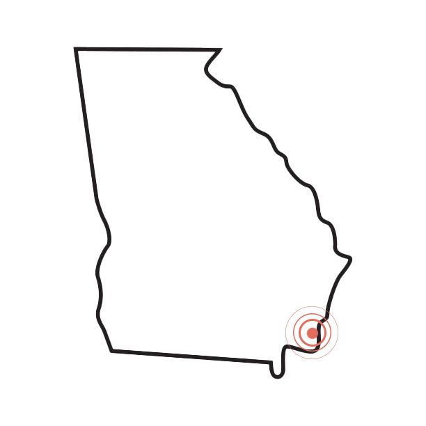
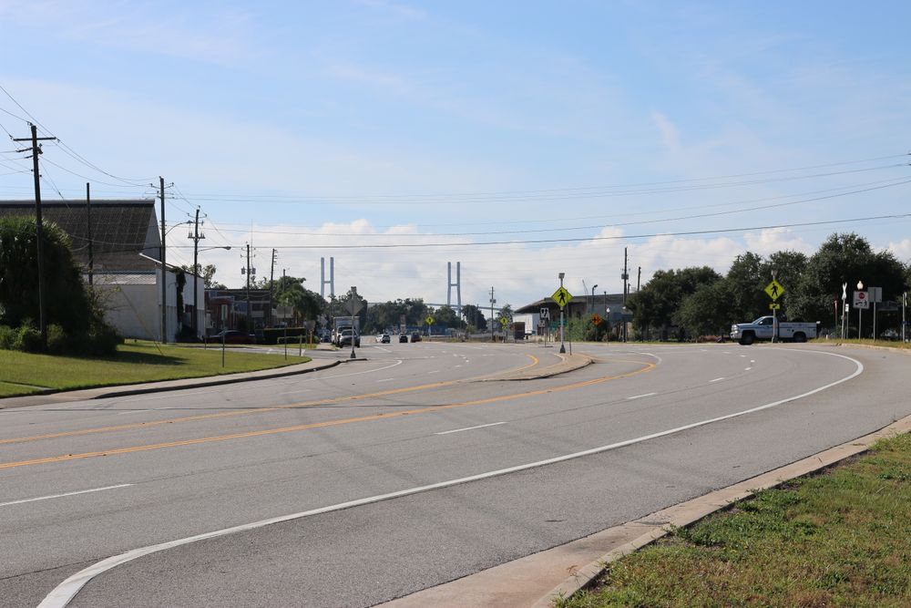
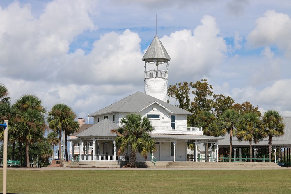
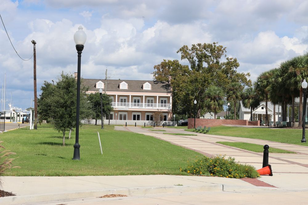
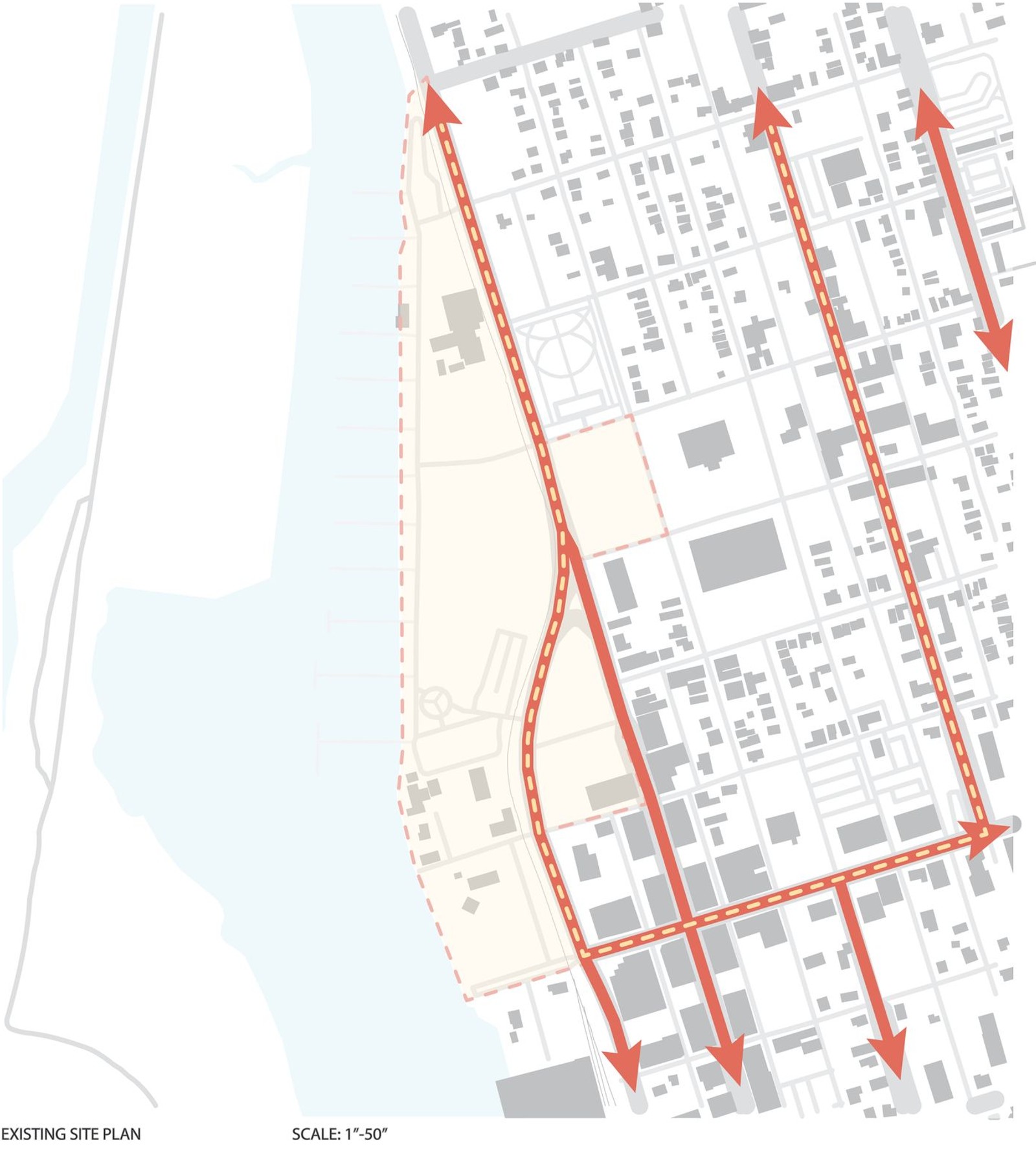
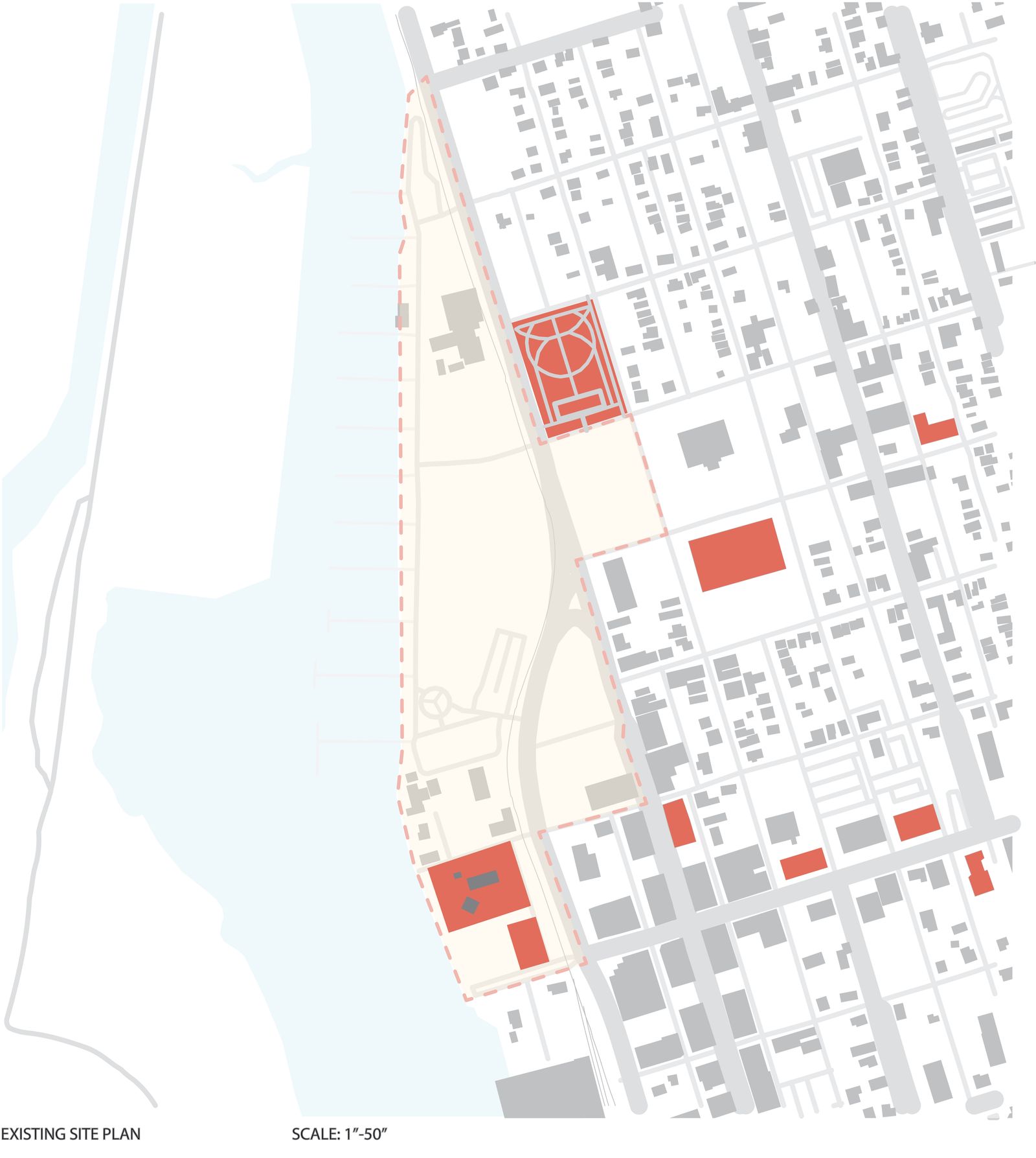
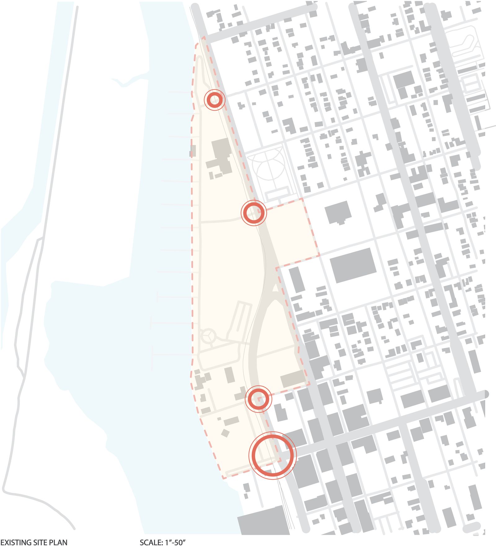
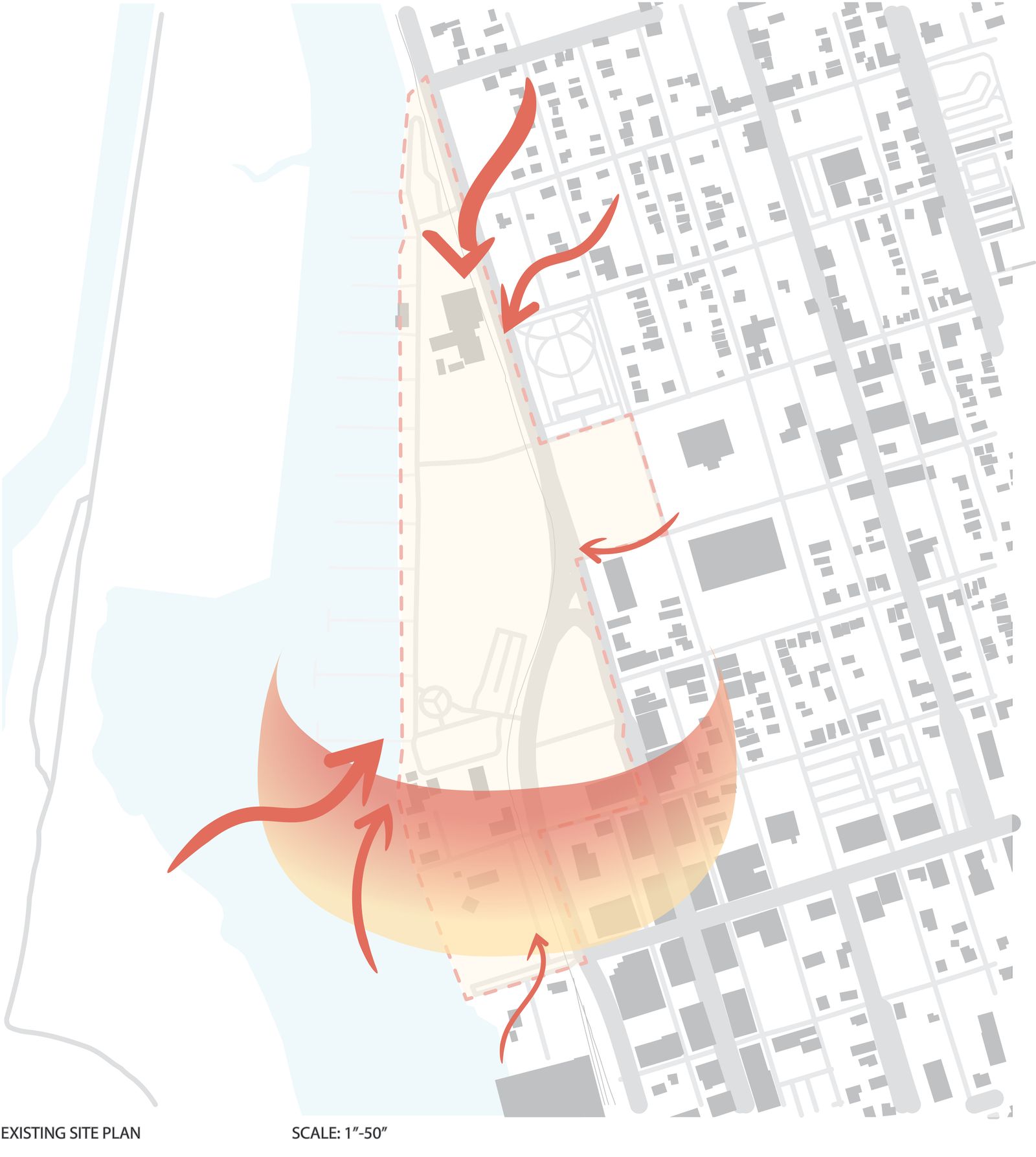
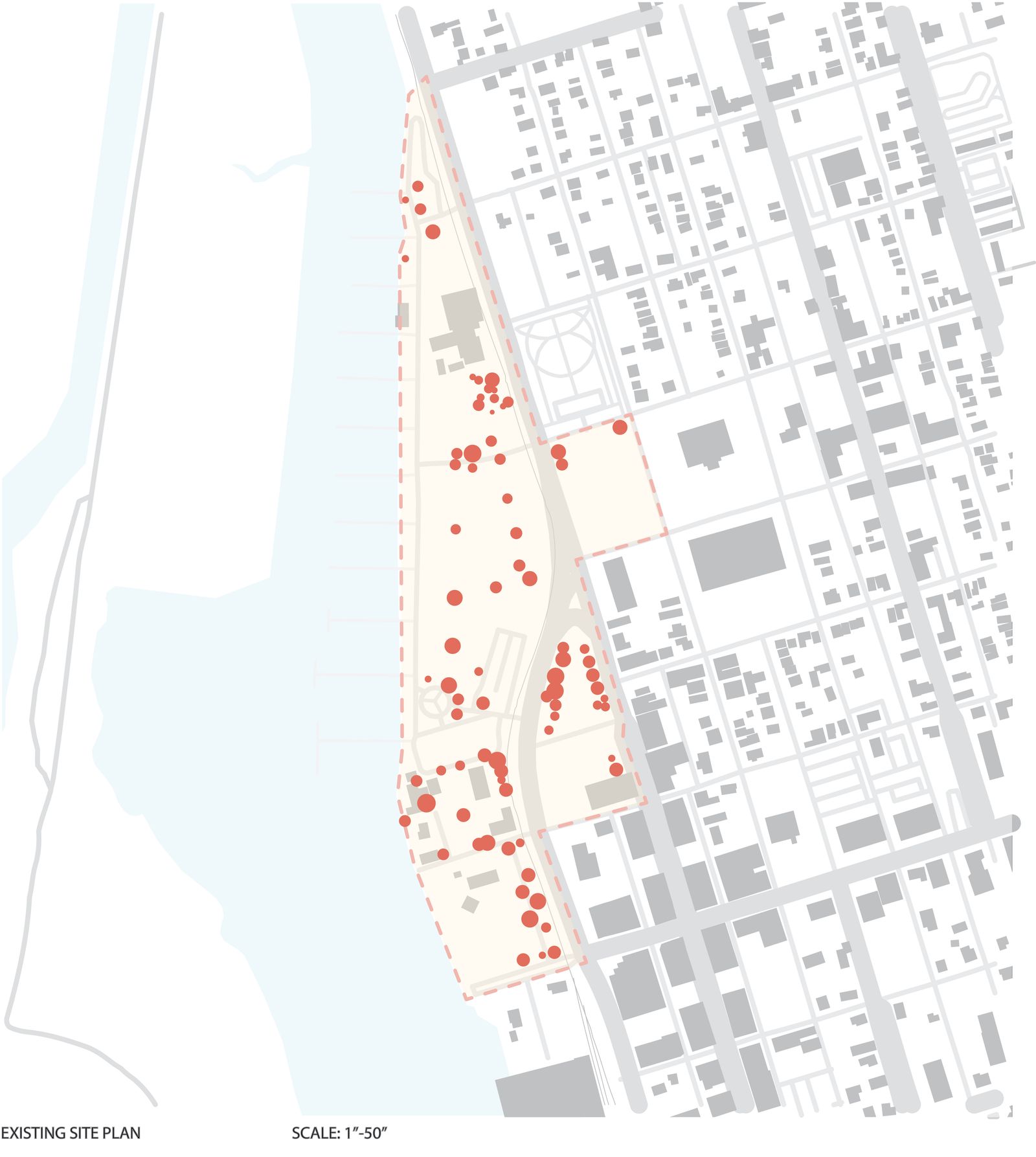
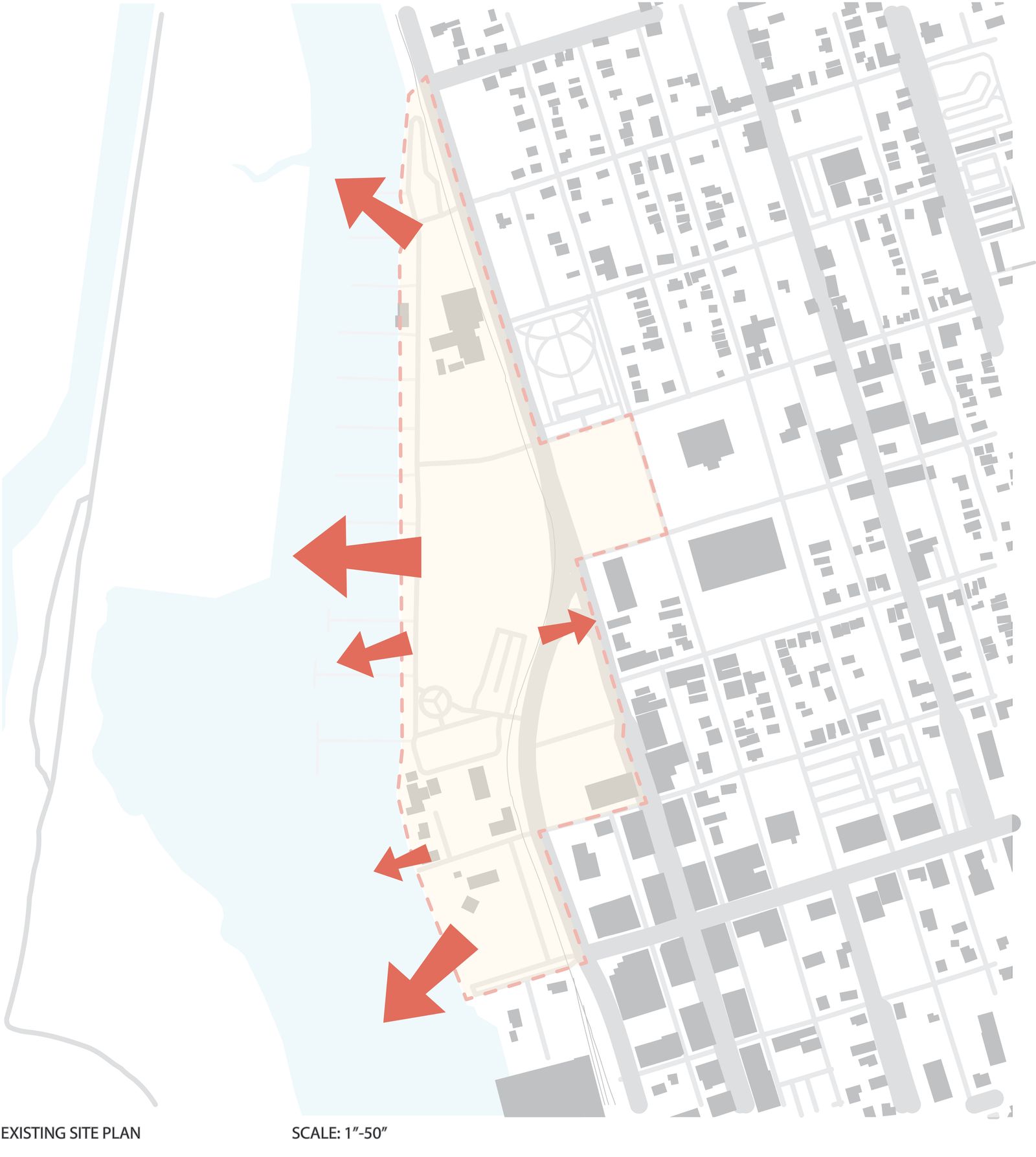
Mary Ross Park sits along the Brunswick waterfront in coastal Georgia. The site analysis examined circulation, civic structures, entry nodes, sun and wind, views, and existing tree canopy.
Existing Market Structure
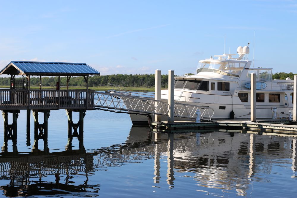
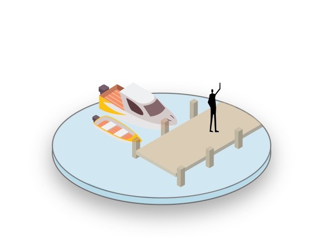
Marina & Boat Dock
Gloucester Street
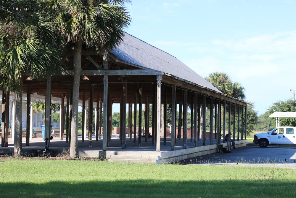
Historic Pavilion
Mary Ross Park
Circulation Diagram
Civic Spaces
Entry Nodes
Sun and Wind Analysis
Existing Vegetation
Viewpoints
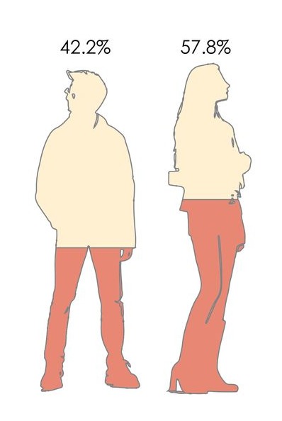
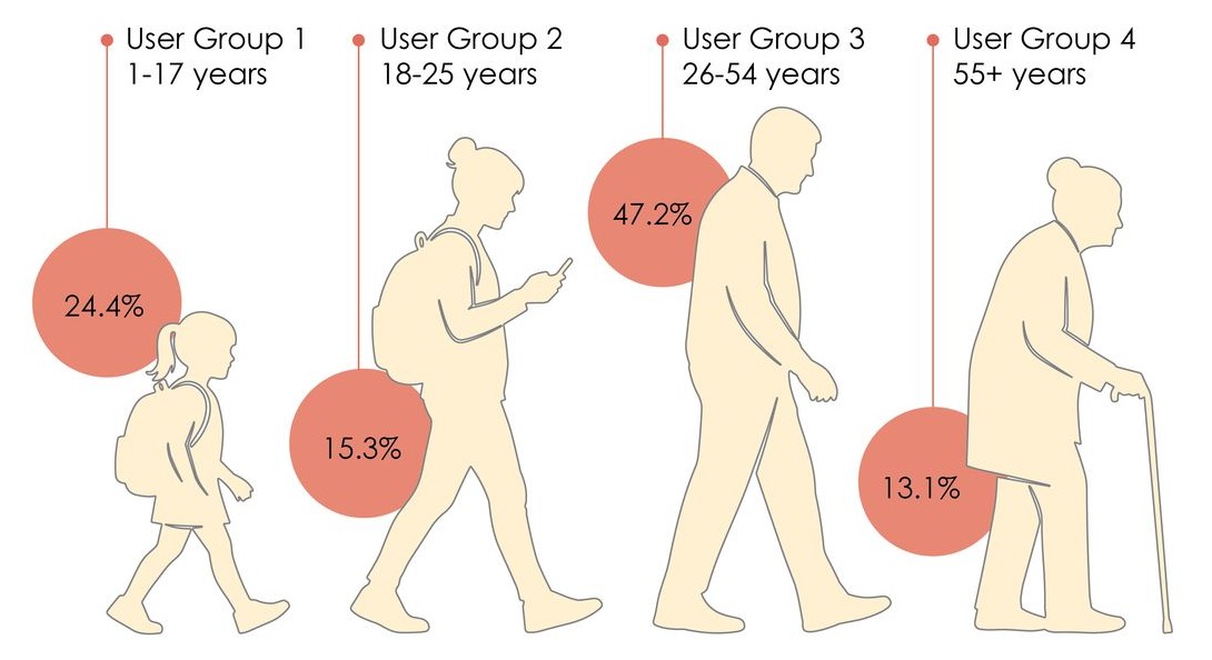
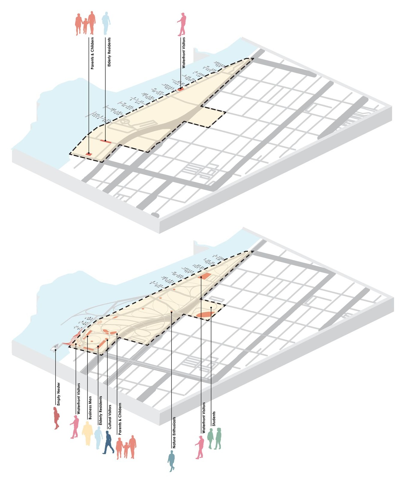
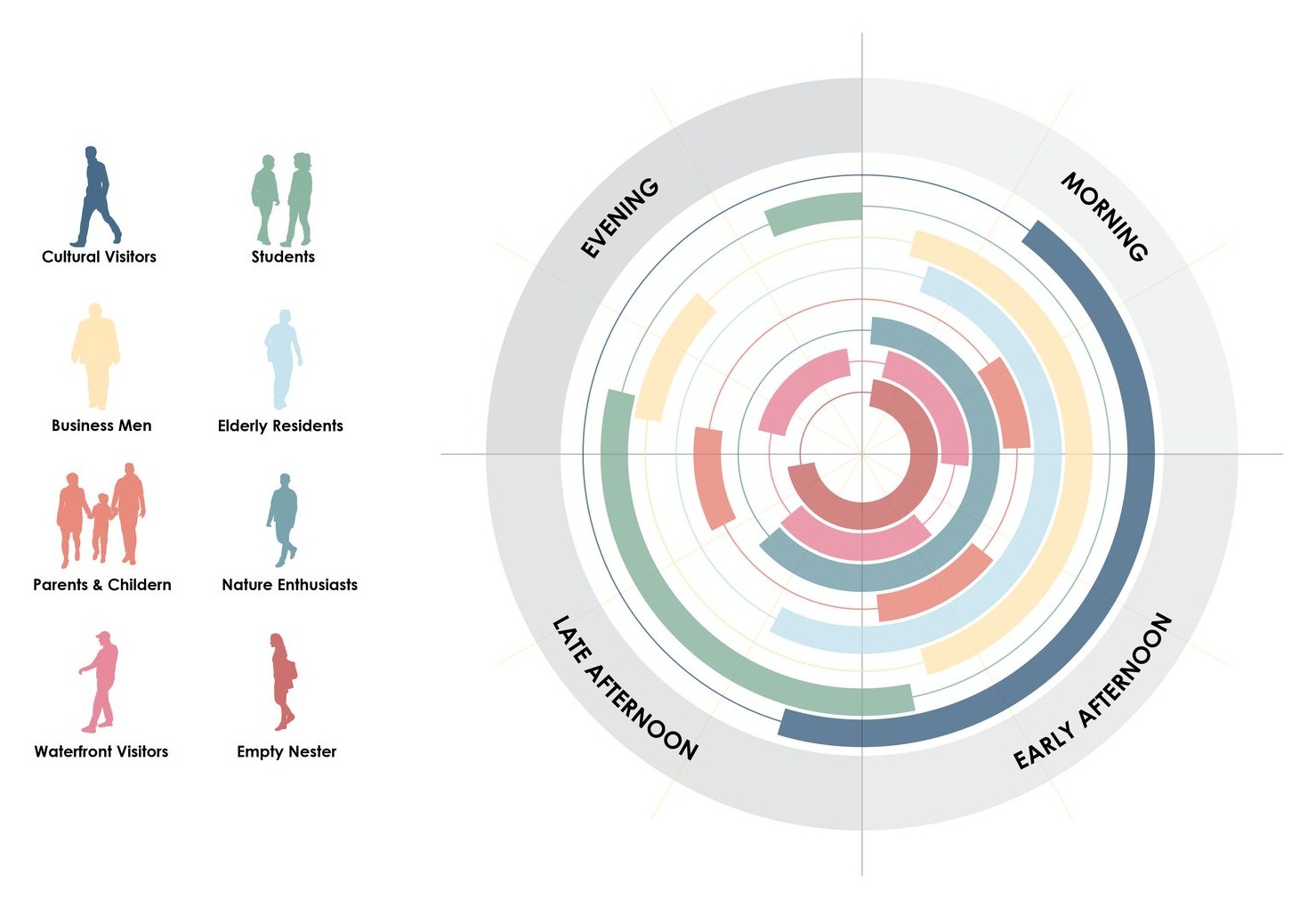
Gender and Age Distribution
Stitching City to Shore
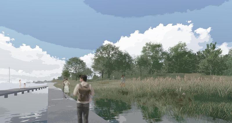
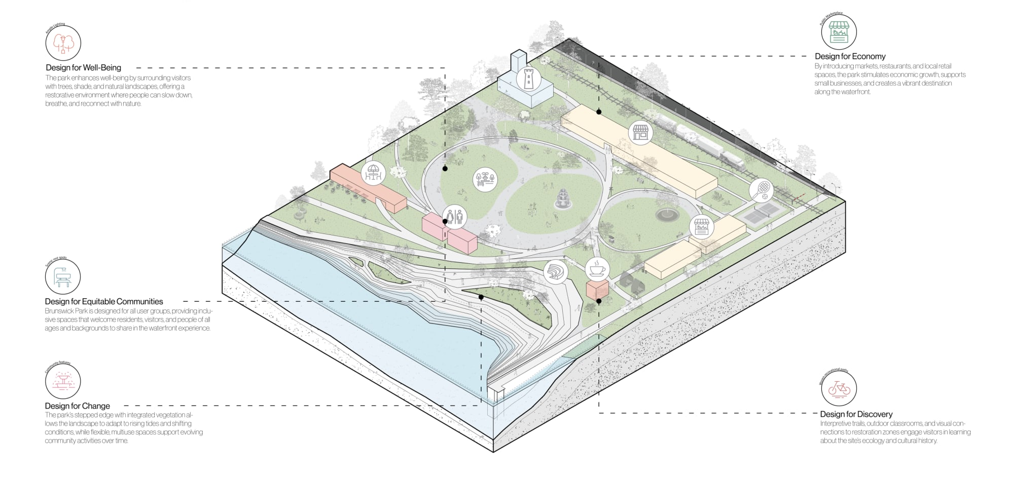
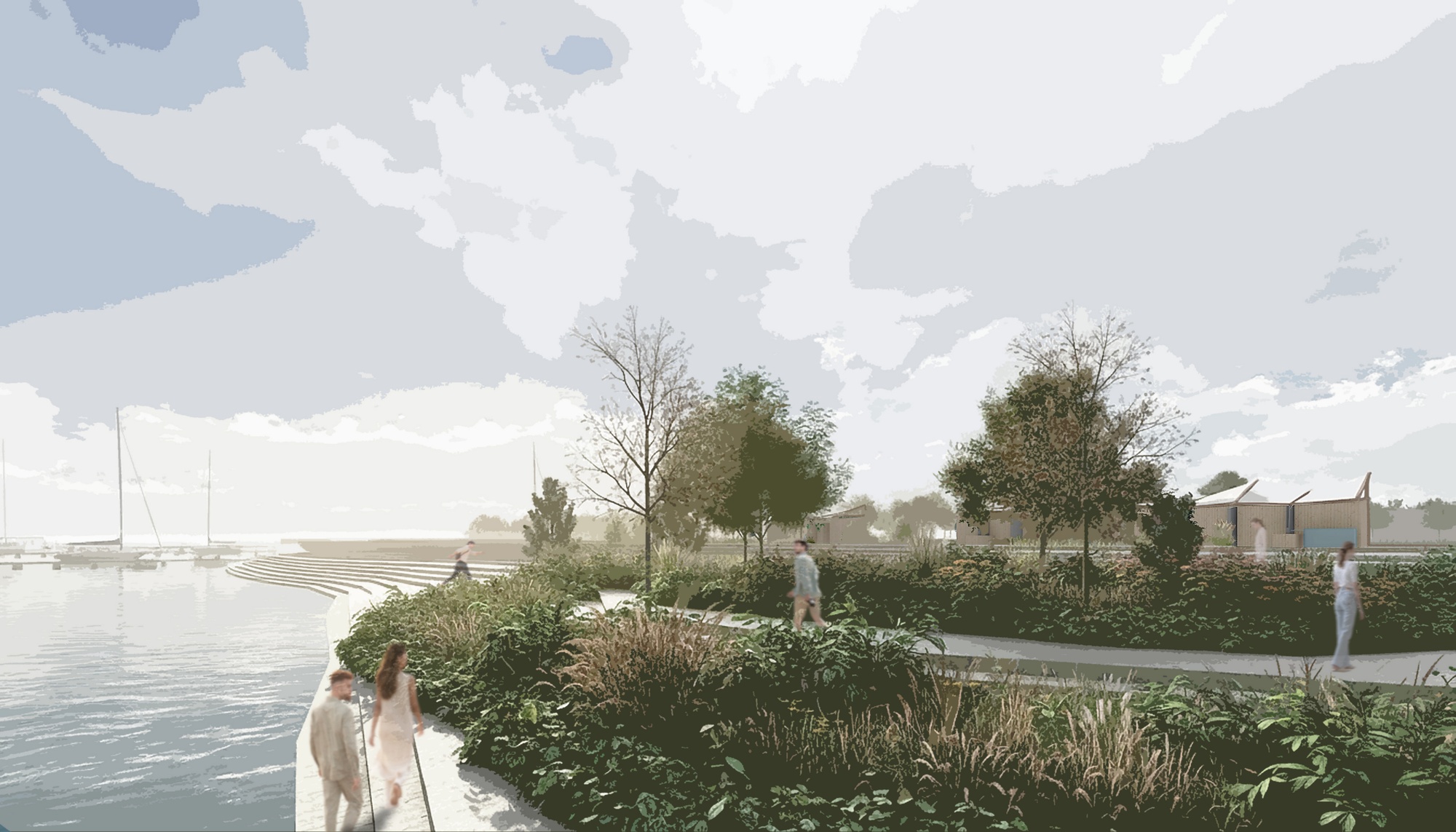
The proposed plan extends the historic Gloucester Street into the park as a civic spine, weaving the city grid into a continuous waterfront landscape. A promenade lined with trees traces the river’s edge while organic paths thread through restored lawns, tree canopies, and gathering nodes. At the southern end, a civic plaza draws together a market hall, café, and pavilions around a boat dock that reaches into the water. Along the western shore, naturalized marsh and bioswales restore the edge and manage stormwater, stitching ecology back into the urban waterfront.
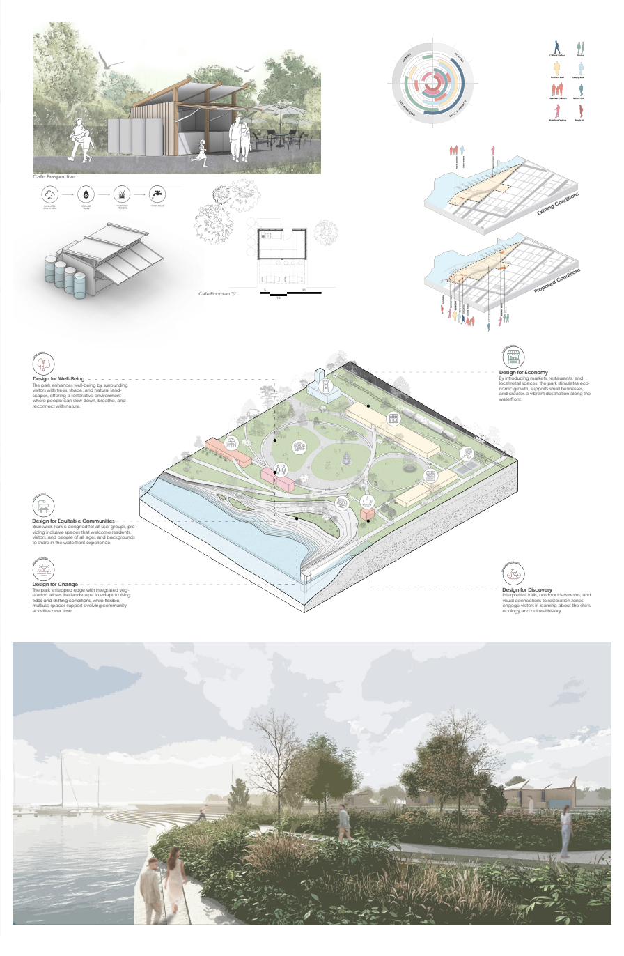
Design for Discovery
Interpretive trails, outdoor classrooms, and visual connections to restoration zones engage visitors in learning about the site’s ecology and cultural history.
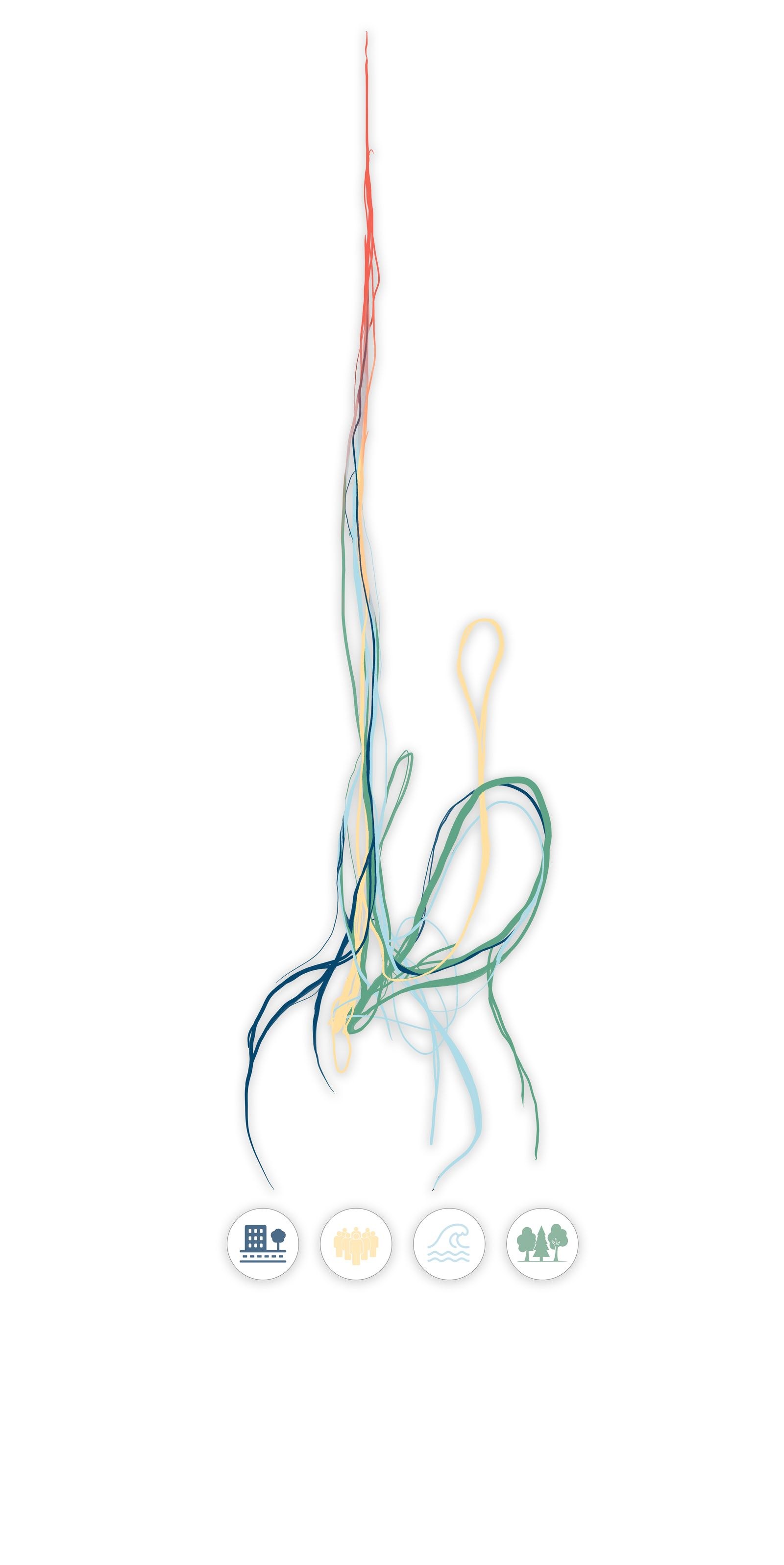
Four threads — streets, people, water, and nature — are interlaced to create a cohesive waterfront landscape.
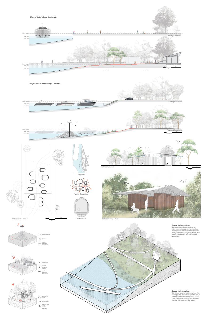
Design for Integration
Brunswick already holds all four threads: streets, people, water, and nature. Yet they sit apart, the shore treated as a barrier instead of a connection to the city. Design for Integration draws them into one interdependent system. Gloucester Street, one of the city’s main streets, is pulled all the way to the water, blending land into shore and stitching the two back together. Restored ecology does more than heal the site. It opens the waterfront as a place that welcomes everyone who lives here and everyone who visits. The city, the park, and the river read as a single continuous landscape rather than separate layers.
Design for Economy
Before, this stretch of Mary Ross Park sat underused and cut off from daily life. A market hall, café, and local retail now bring everyday commerce to the water’s edge, extending the core of Gloucester Street all the way to the shore. This gives the waterfront a working purpose again, one that serves both commerce and leisure. Built around small and independent businesses rather than a single attraction, the plaza stays active throughout the day and becomes an economic anchor for Brunswick.
Design for Equitable Communities
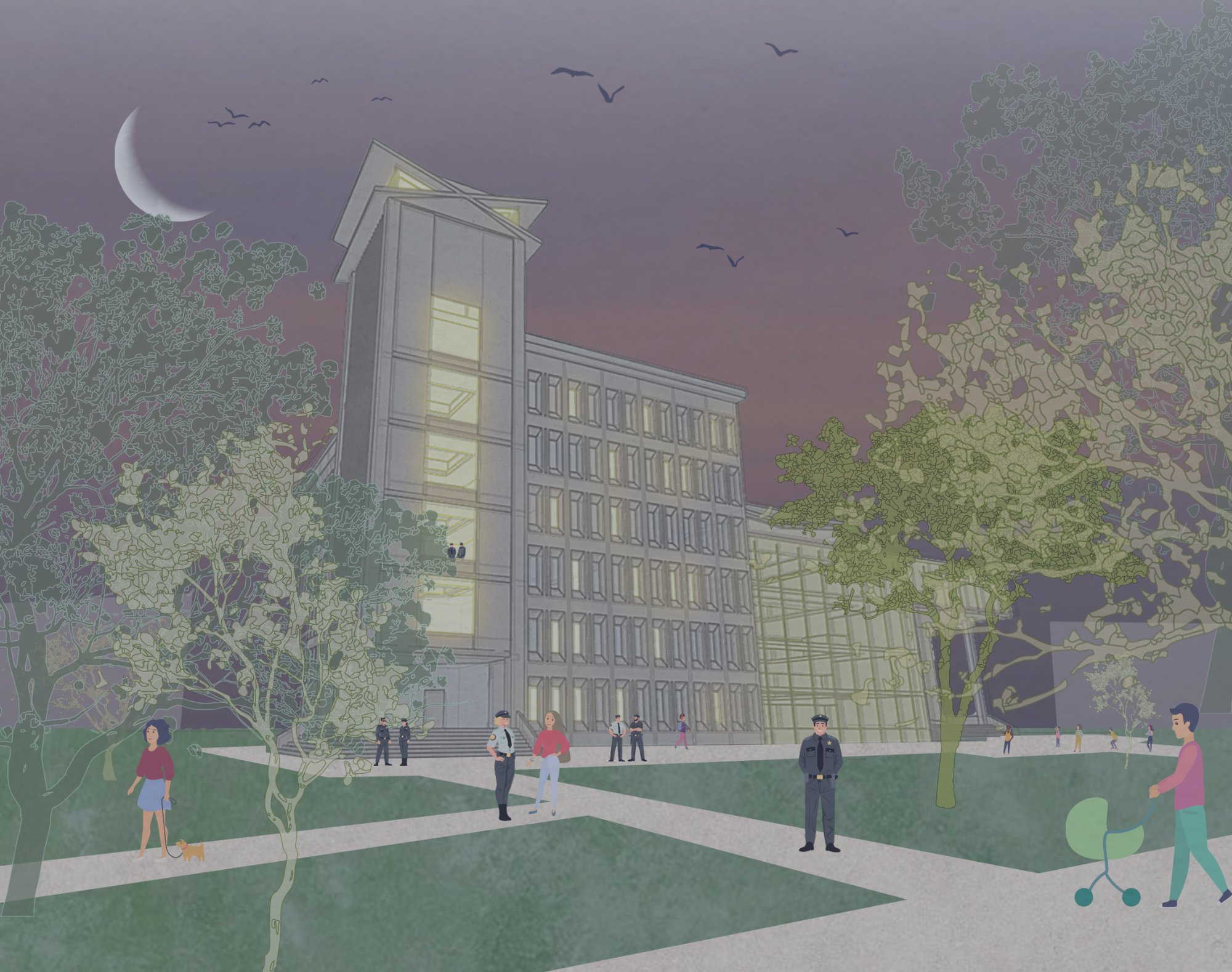
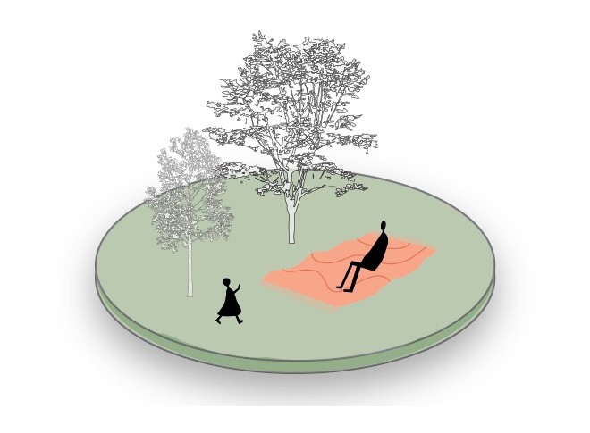
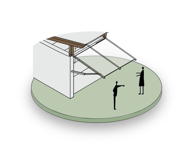
Once, the park served only a narrow slice of the city, an occasional elderly resident or waterfront visitor moving through a largely empty space. Its new range of program opens the waterfront to the whole community, drawing families, workers, shoppers, and neighbors to the same edge at every hour of the day. This steady, varied presence is what makes the park feel safe: a place kept alive by the people who use it rather than one left vacant. The result is a shared waterfront that belongs to everyone.
Design for Well-Being
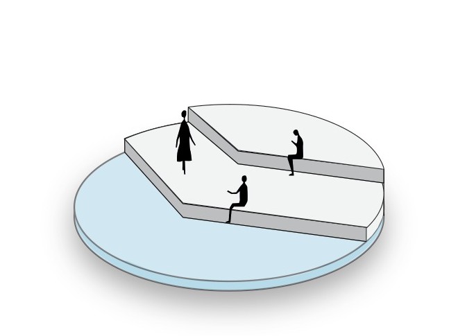
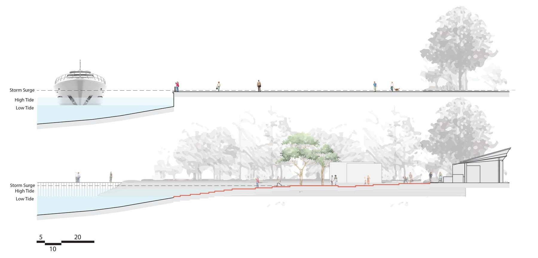
The park is designed to restore, drawing on the same moves that shape the rest of the plan. The promenade and its paths invite walking and daily movement, while the restored marsh, tree canopy, and shade give relief from the coastal heat and a calm setting to rest in. At the shoreline, the stepped water edge slows people down and offers a place to sit close to the river, and gathering spaces throughout the park support the connection that comes from sharing a place. Whether a visit is active or quiet, time spent here is meant to restore both body and mind.
Gloucester Street Section A
Existing ConditionsProposed Conditions
Bay Street Section B
Existing ConditionsProposed Conditions
Design for Water
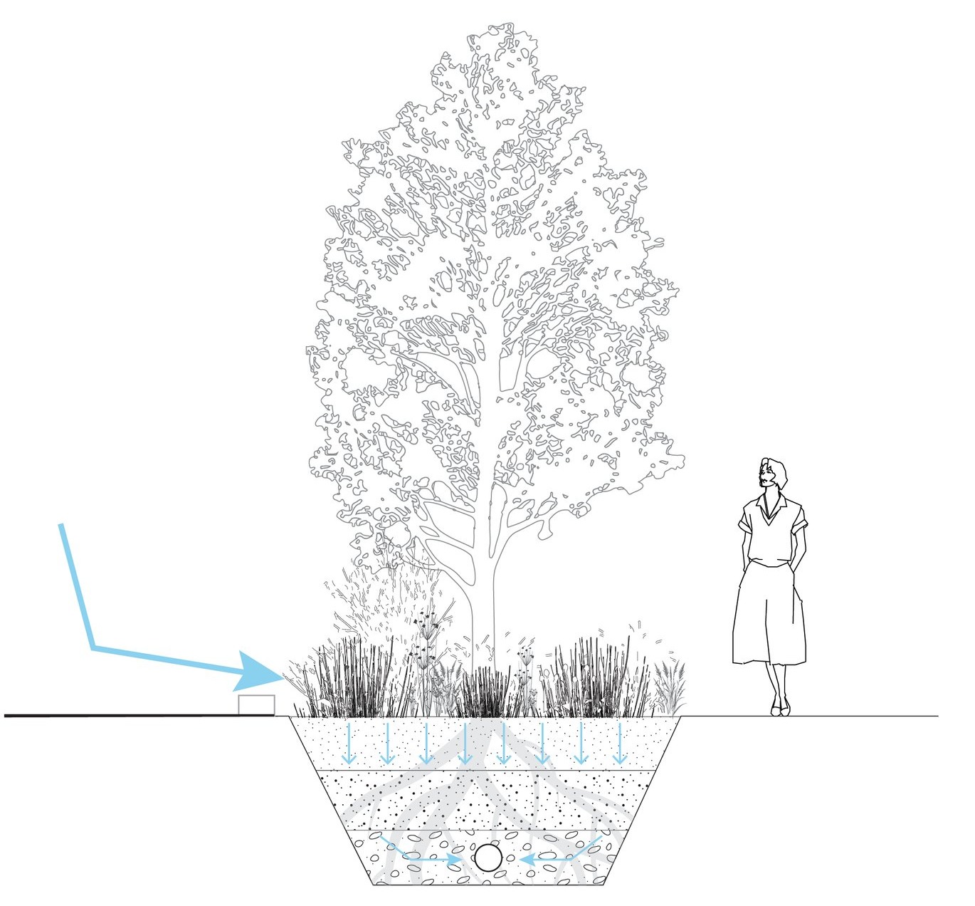
Water is treated as both a resource and a design driver throughout Brunswick Park. The café and restroom facilities integrate on-site water filtration and collection systems that capture rainwater for reuse in irrigation and maintenance. Across the landscape, bioswales and planted terraces manage runoff naturally, filtering pollutants and slowing the flow of stormwater before it reaches the river.
Bioswale Section
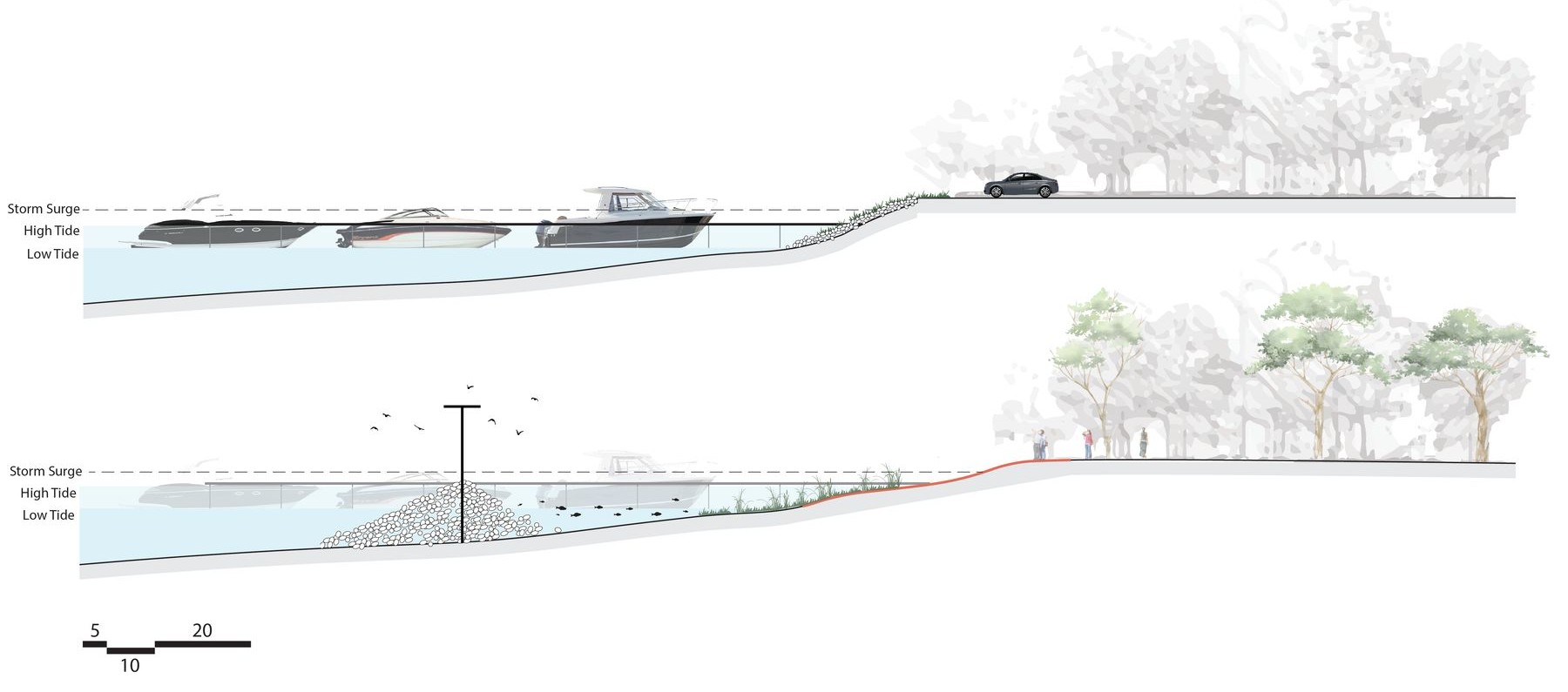
Marina Water’s Edge Sections A
Existing ConditionsProposed Conditions
Mary Ross Park Water’s Edge Section B
Existing ConditionsProposed Conditions
Design for Ecosystems
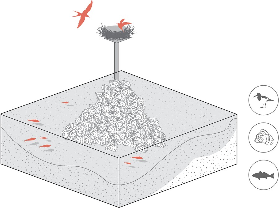
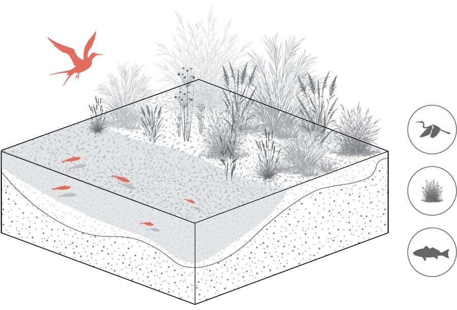
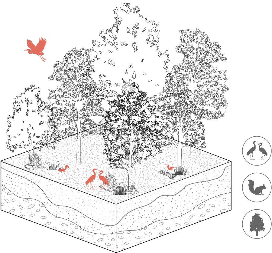
Rather than a single hardened edge, the waterfront is rebuilt as a layered set of coastal habitats. Three ecosystems return along the shore: an oyster reef and tidal flat that filter water and shelter fish, a marsh that buffers storm surge and draws wading birds, and a maritime forest that anchors the upland with shade and canopy. Each layer supports its own community of native species, from shorebirds and oysters to herons, squirrels, and fish, so the park functions as habitat as much as public space. Restoring these systems repairs an ecology the site had lost and lets the whole waterfront work as a living, connected landscape.
Oyster Reef and Tidal Flat
Marsh
Maritime Forest
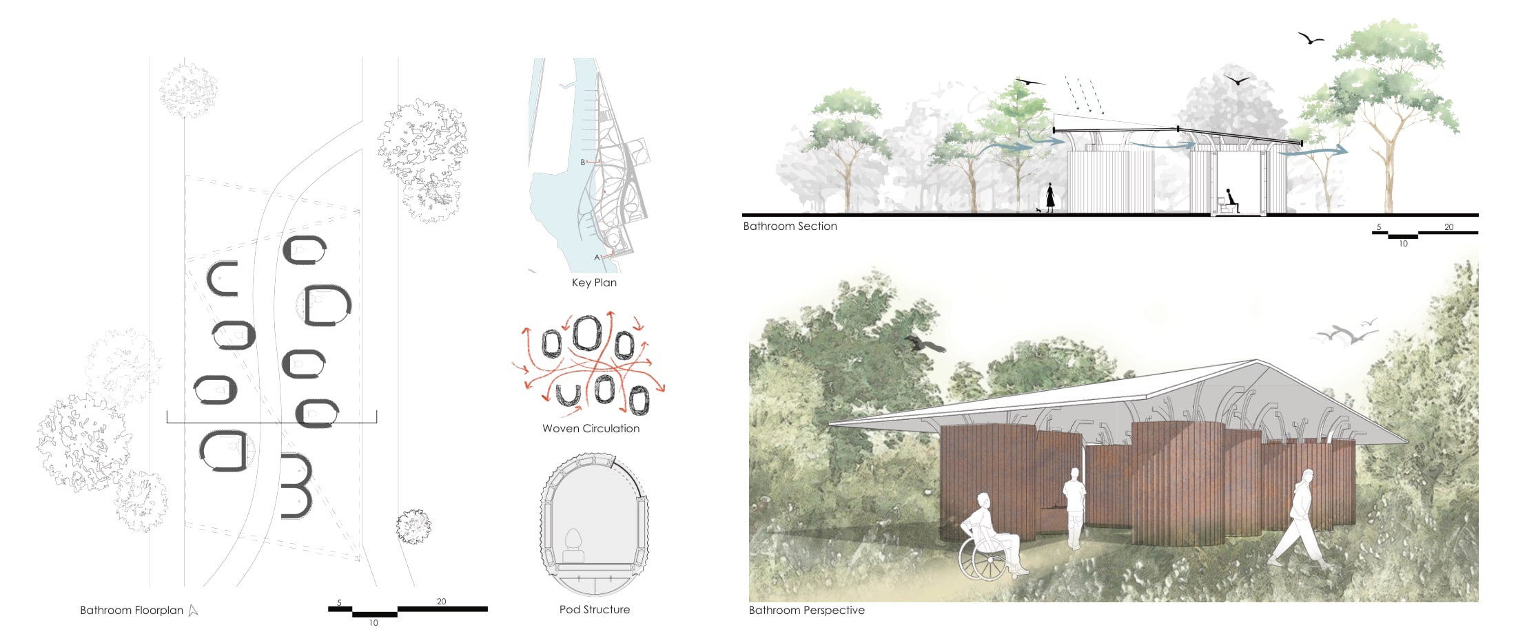
Bathroom Charette
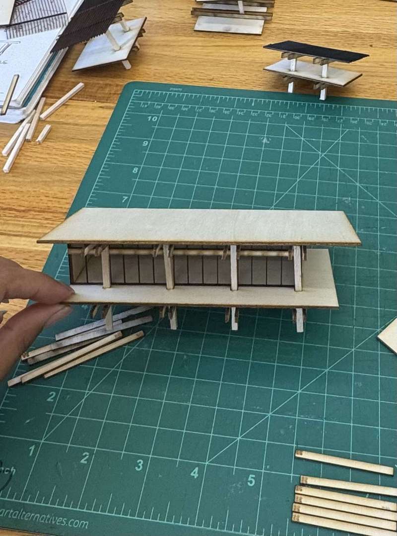
The restroom pods came out of a weeklong charette exploring public restroom design for the park. The scheme takes its cues from the surrounding trees: slatted walls read as tree trunks, and a thin roof plane floats above like a canopy. Each stall is its own separate pod, so that even in such an open, transparent layout every visitor feels safe to enter.
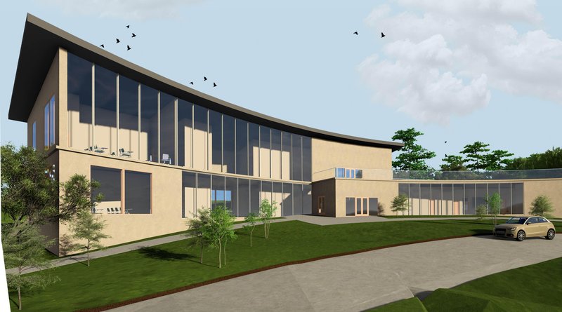
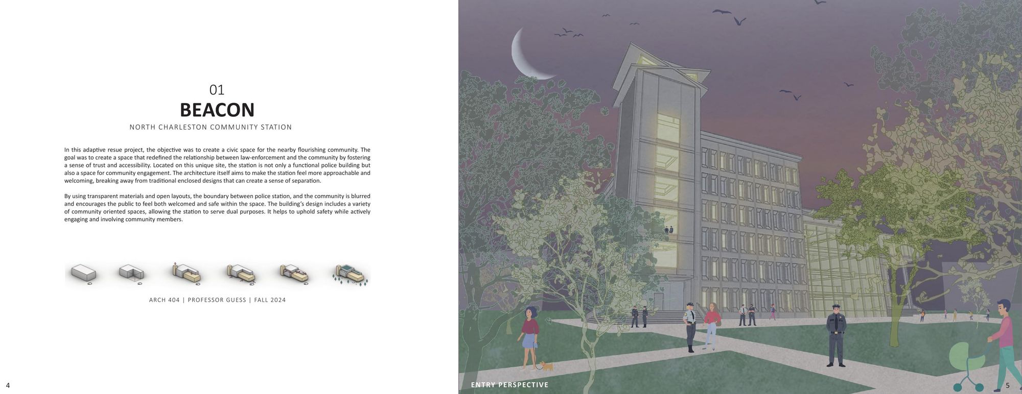
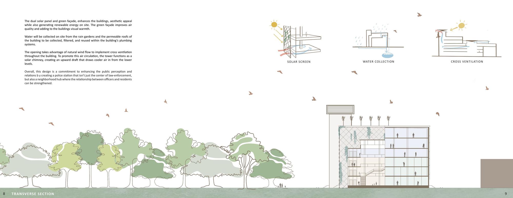
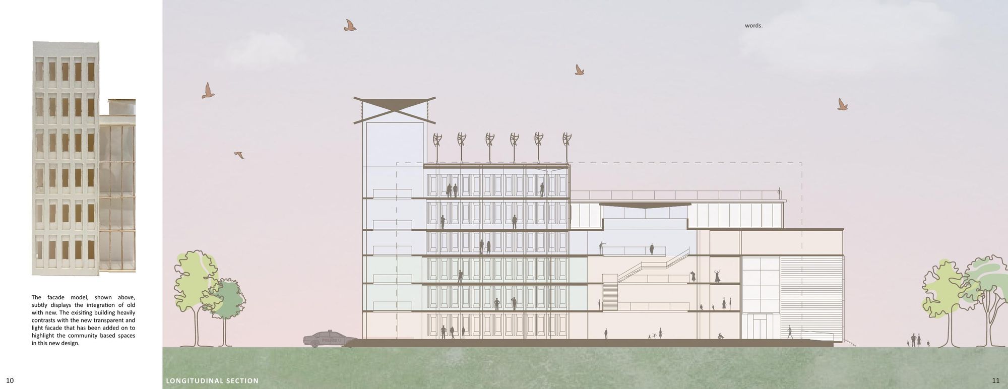
A police station is a building most people approach only when something has gone wrong. Beacon is built to be entered for other reasons. Alongside the operational station it holds meeting rooms and multipurpose spaces used for events, educational programs and everyday gathering, so the building works as a neighborhood hub as much as a police station. Transparent materials and open layouts blur the boundary between the two, breaking from the enclosed civic buildings that put officers on one side of a wall and residents on the other. Wind turbines, a solar panel facade, cross ventilation and a water collection system carry that same openness into how the building runs.
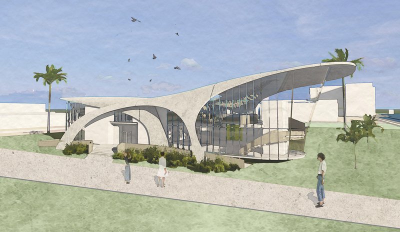
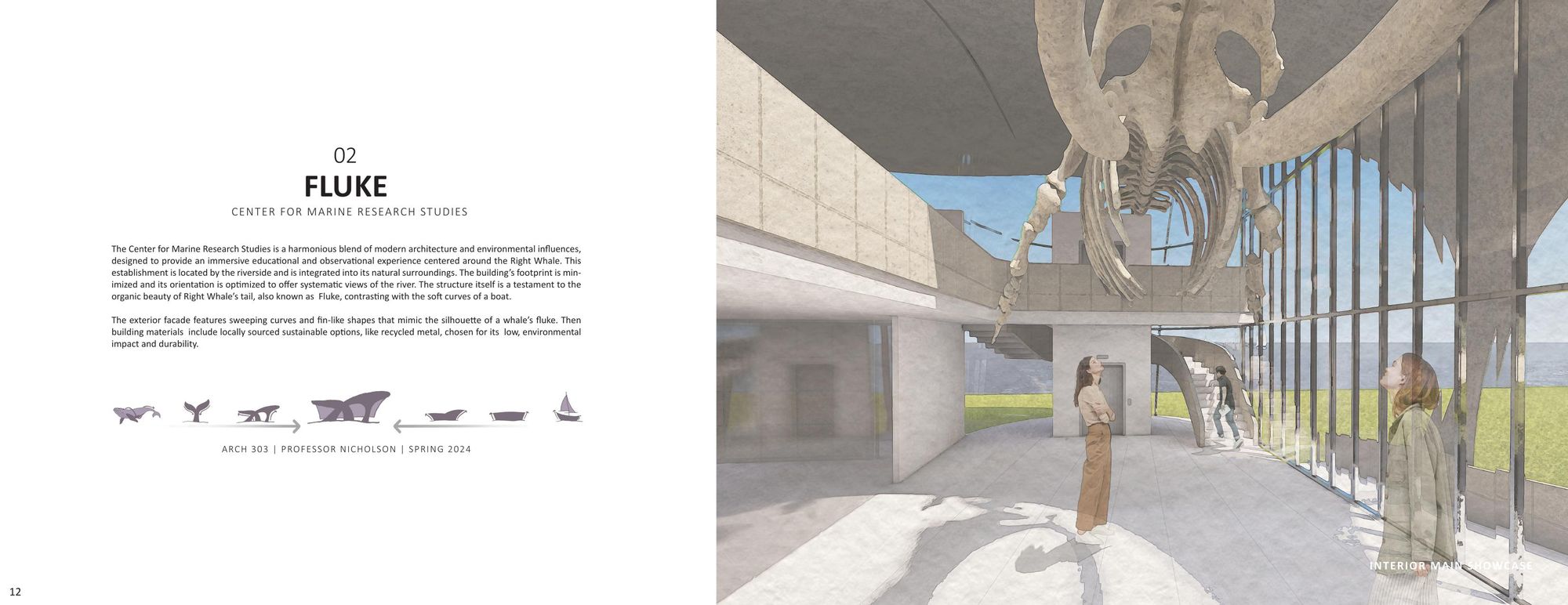
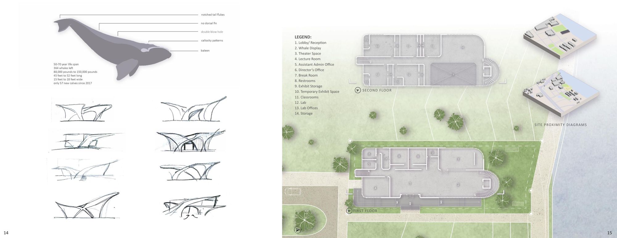
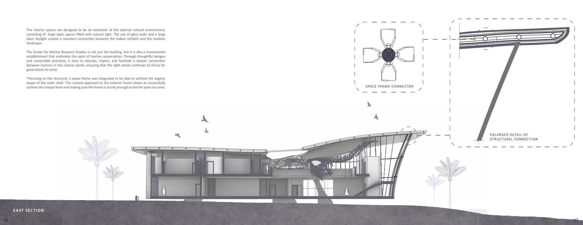
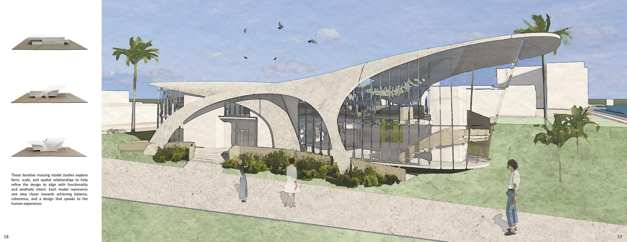
A research and observation center for the North Atlantic right whale, on the river outside Savannah. The building keeps a small footprint and sits low against the bank, so you arrive through the landscape rather than across a parking lot. Its form comes from the whale’s fluke: sweeping curves read as one continuous surface, cut open where the building meets the water. Materials are locally sourced and include recycled metal.
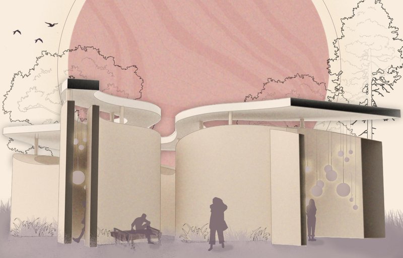
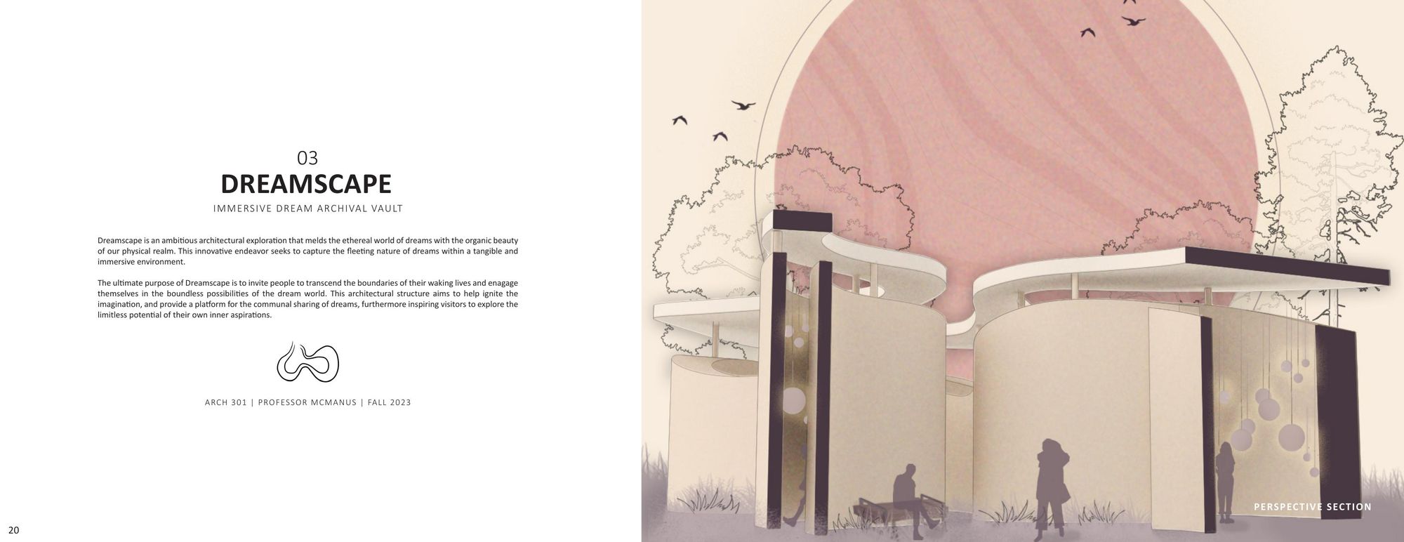
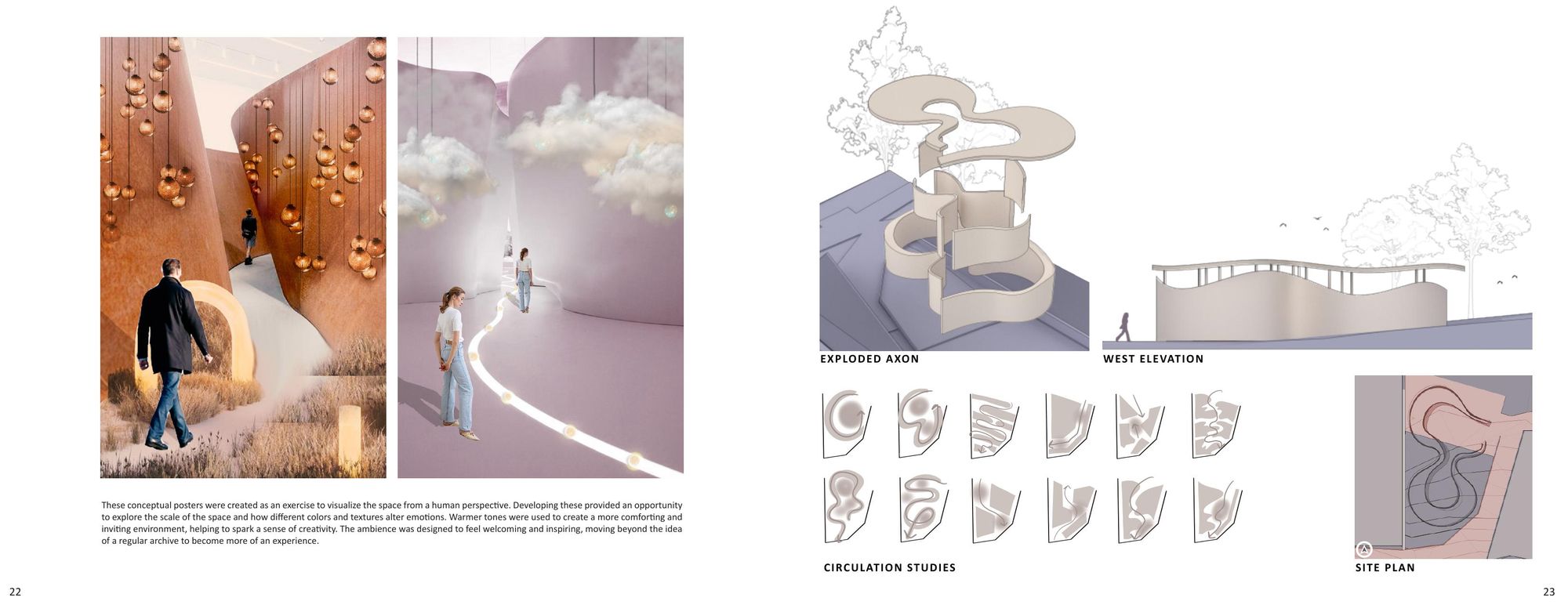
An archive for dreams, designed in Lacoste during my study abroad in Provence. The program is deliberately impossible, which is what made it worth doing: a building to hold the one thing that does not survive being held. The curves of the wall and roof carry that idea. You enter through a compressed opening and come out into an open interior, so the sequence works the way a dream does, hard to get into and completely free once you are there.
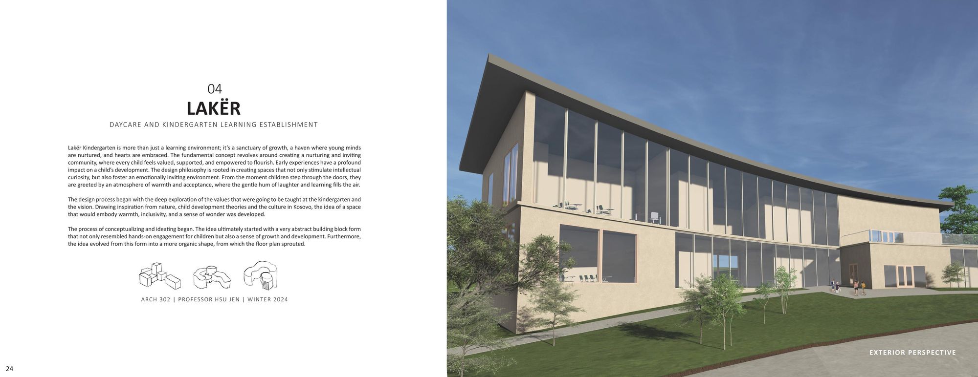
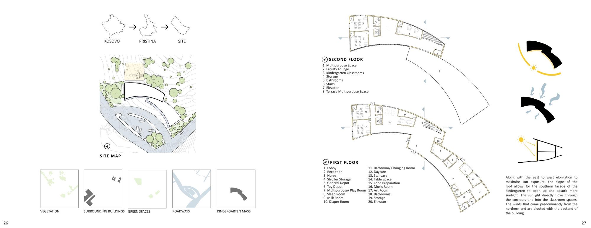
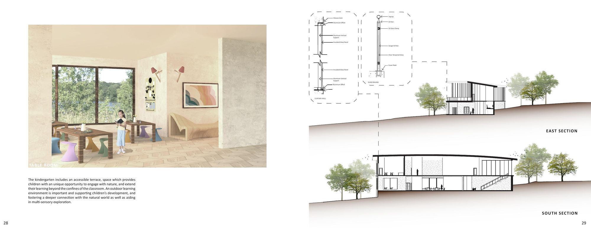
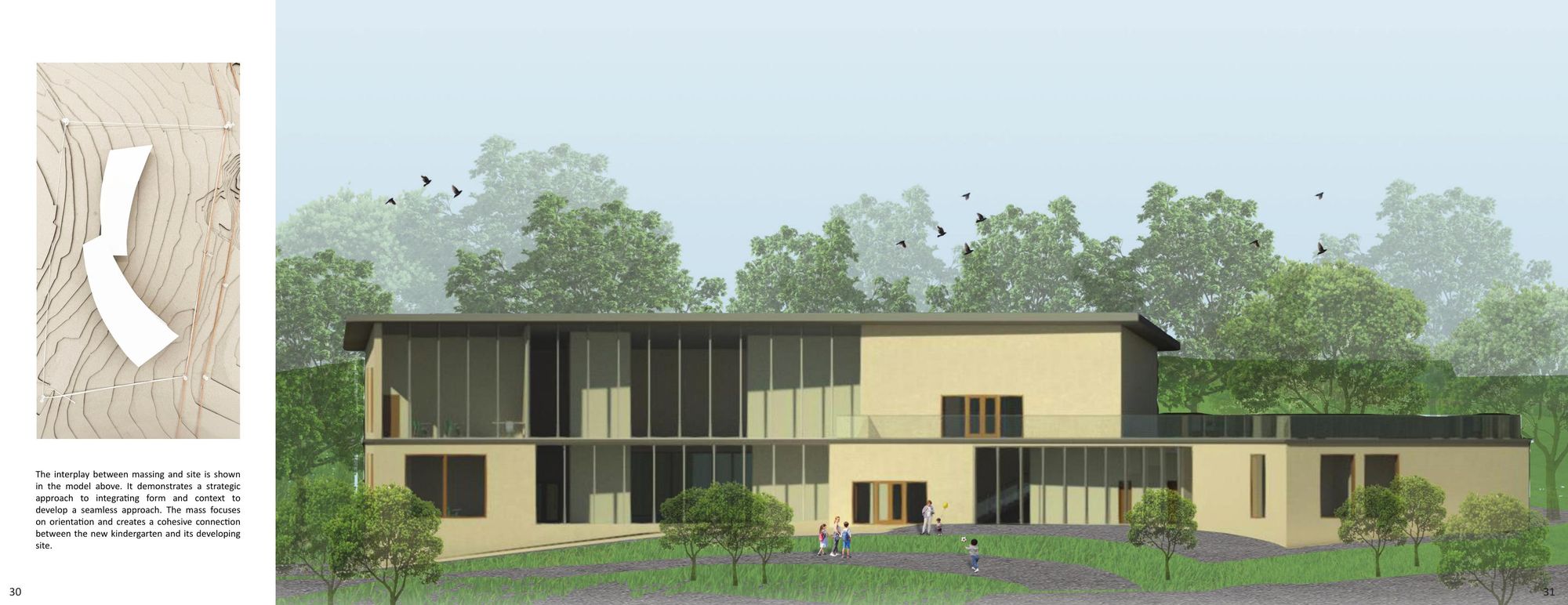
A school for young children in Pristina, drawing on Kosovar building culture and on what child development research says about how children use space. The plan began as a set of abstract blocks and became one curving form, turned so its long face runs east to west and the classrooms take the best daylight.
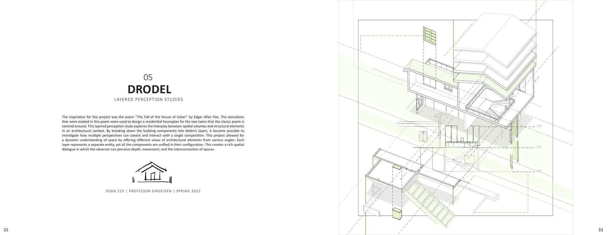
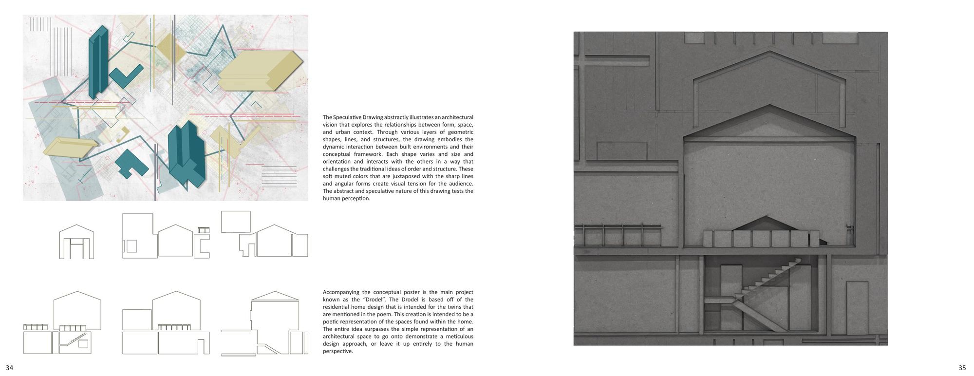
A house for twins, designed from the sensations in Poe’s The Fall of the House of Usher rather than from a program. The study breaks the building into separate layers, each a complete composition on its own, then sets them in register so that moving past them changes what lines up. What I was testing is whether several perspectives can occupy one composition without collapsing into a single reading. Chipboard, laser cut and hand cut.
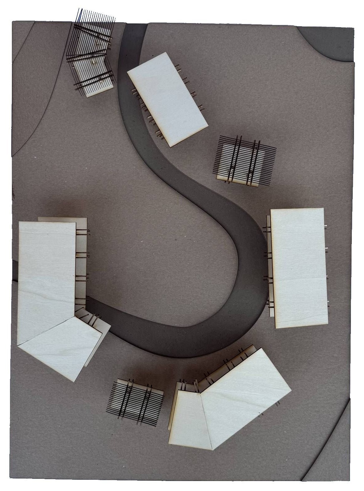
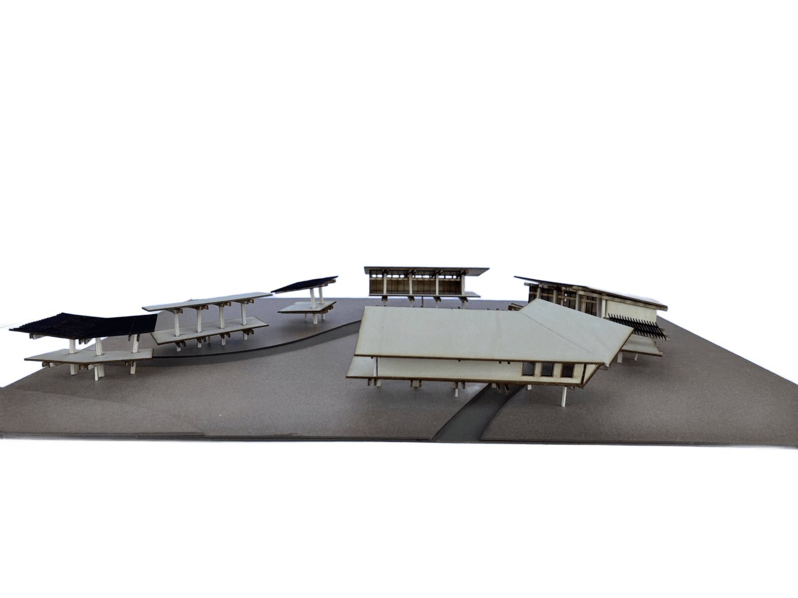
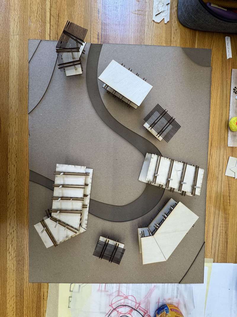
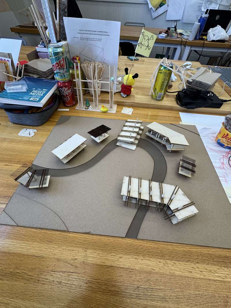
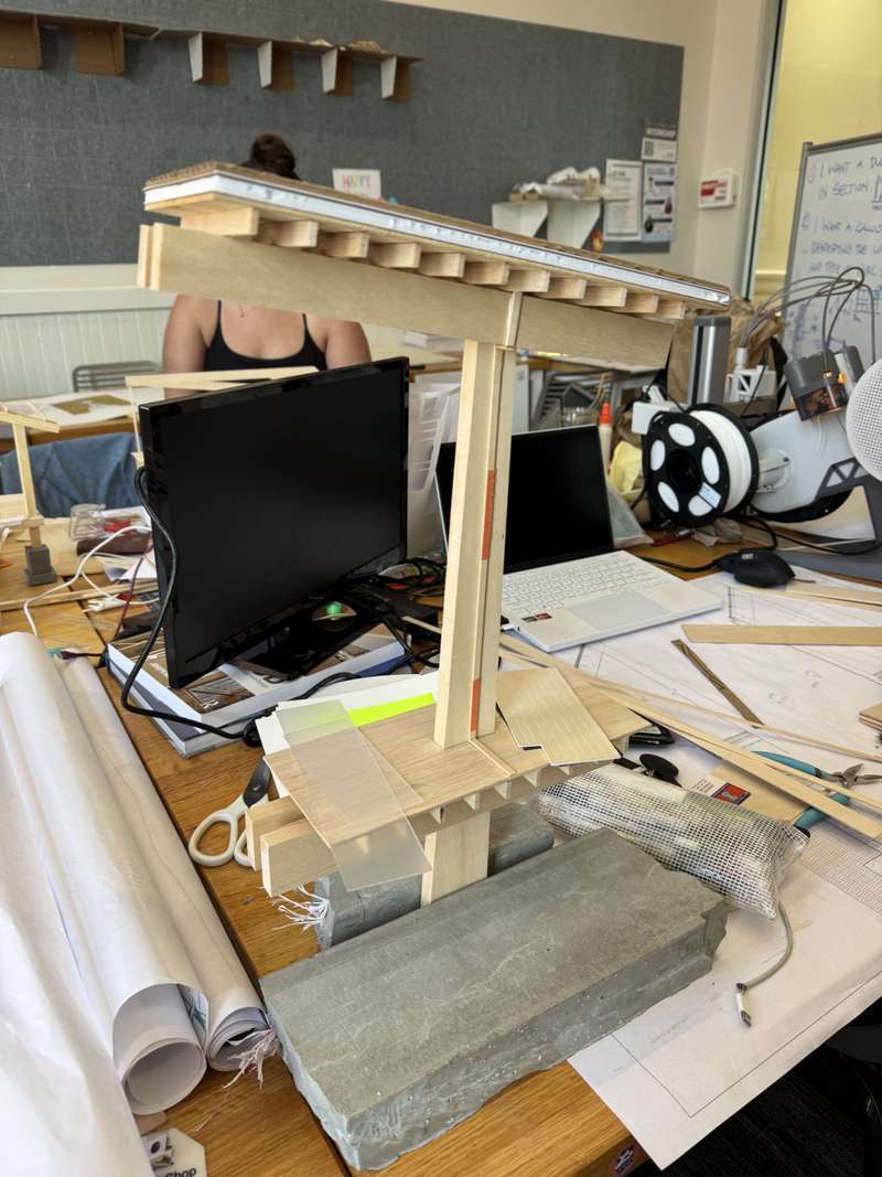
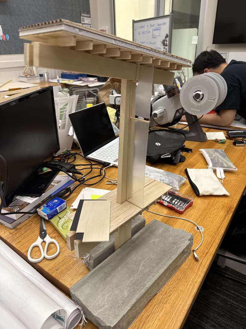
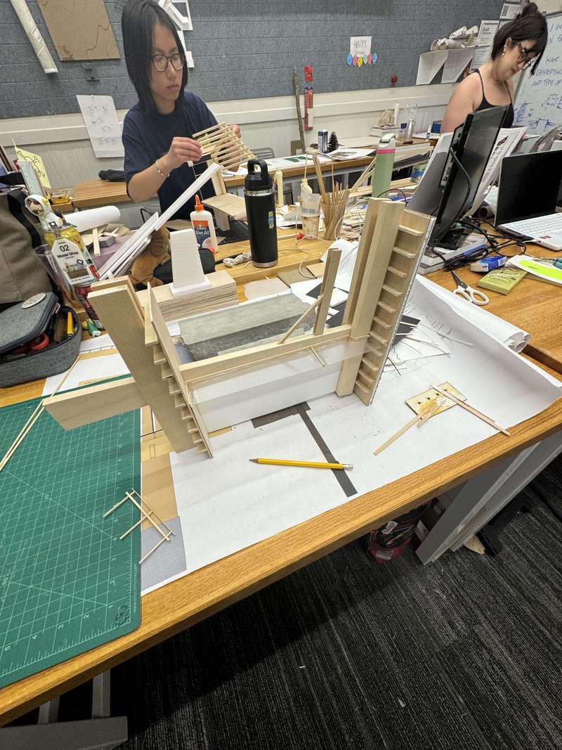
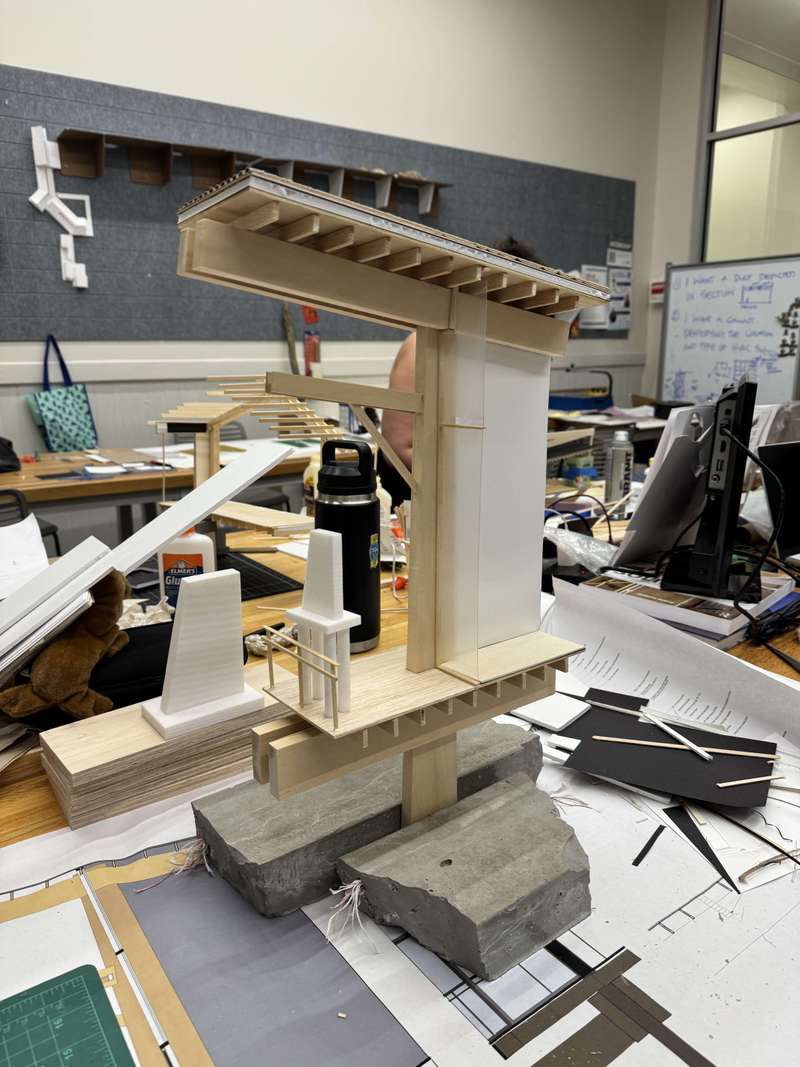
Massing model for Caesura at Aiken State Park, exploring the relationship between building volumes, the curving pathway, and the surrounding landscape.
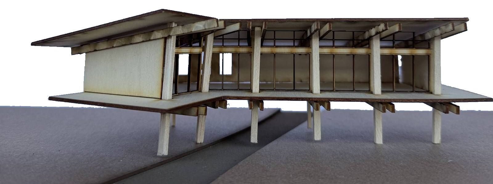
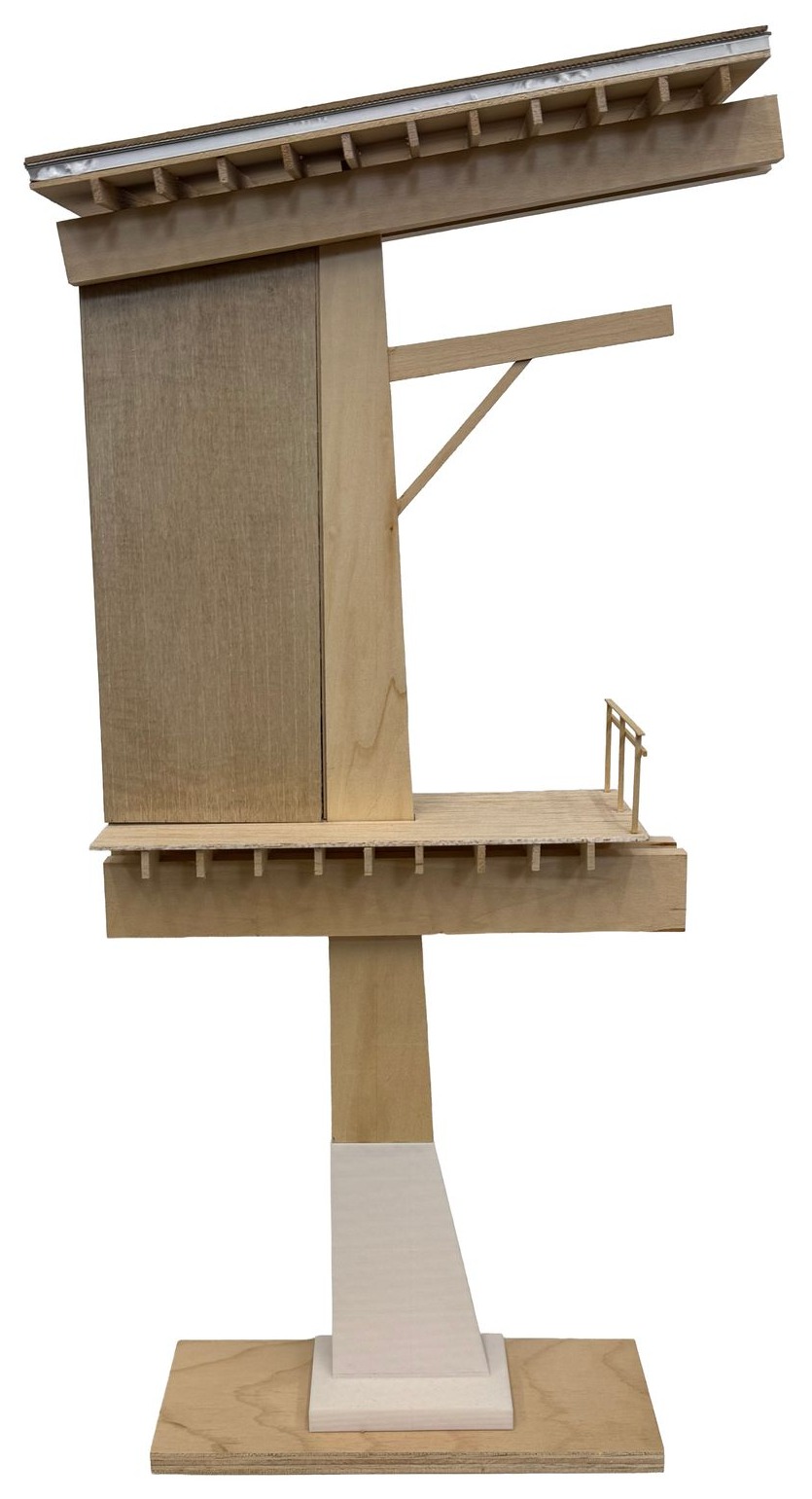
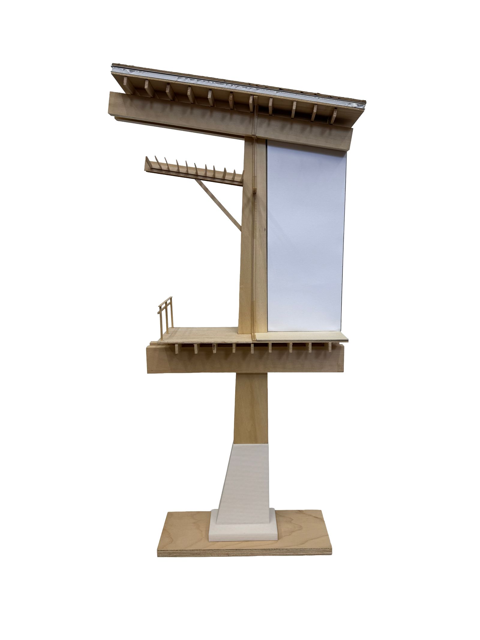
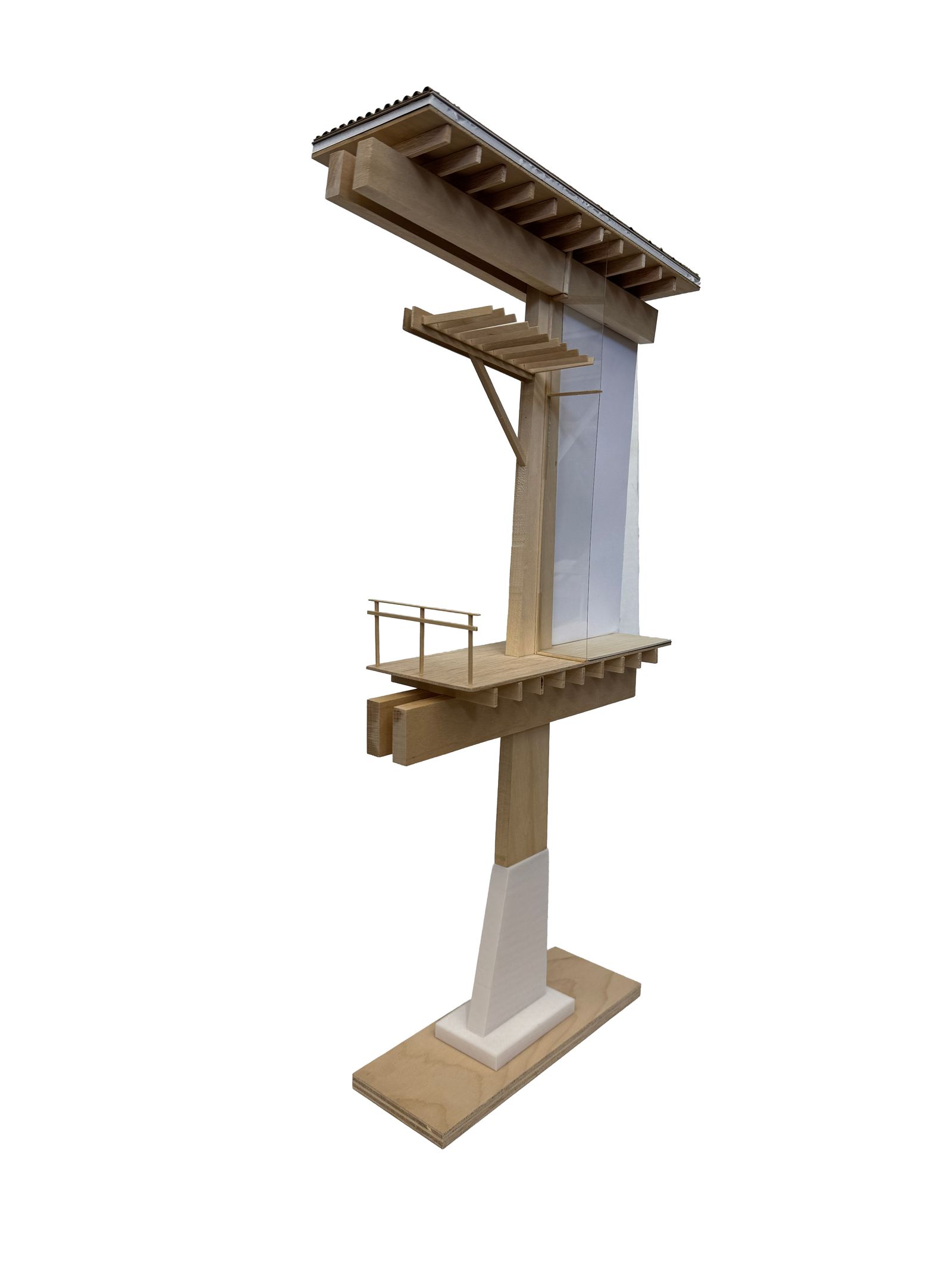
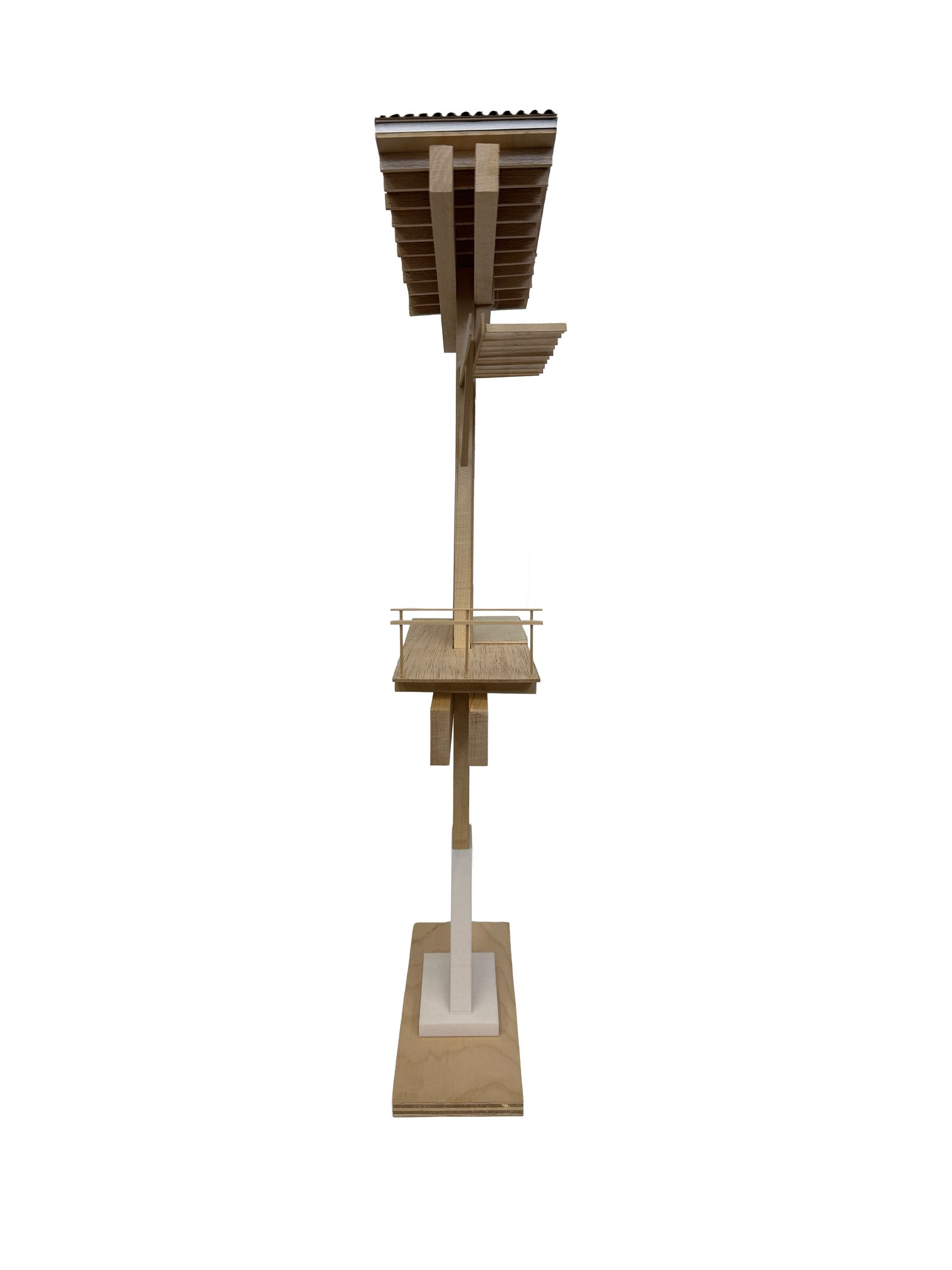
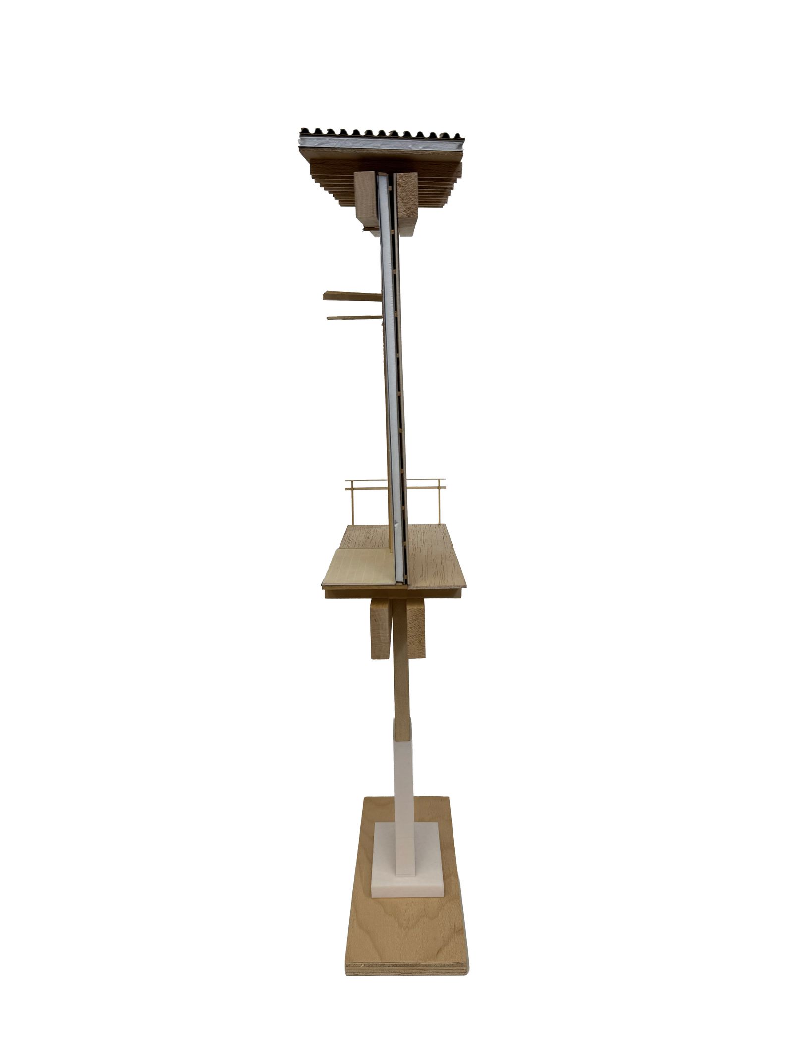
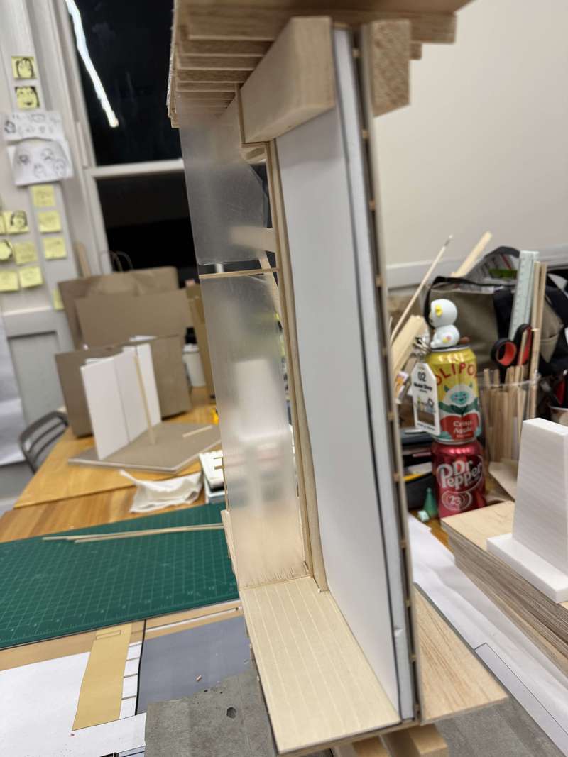
Section model for Caesura at Aiken State Park, revealing the internal spatial relationships, structural system, and connection between interior and landscape.
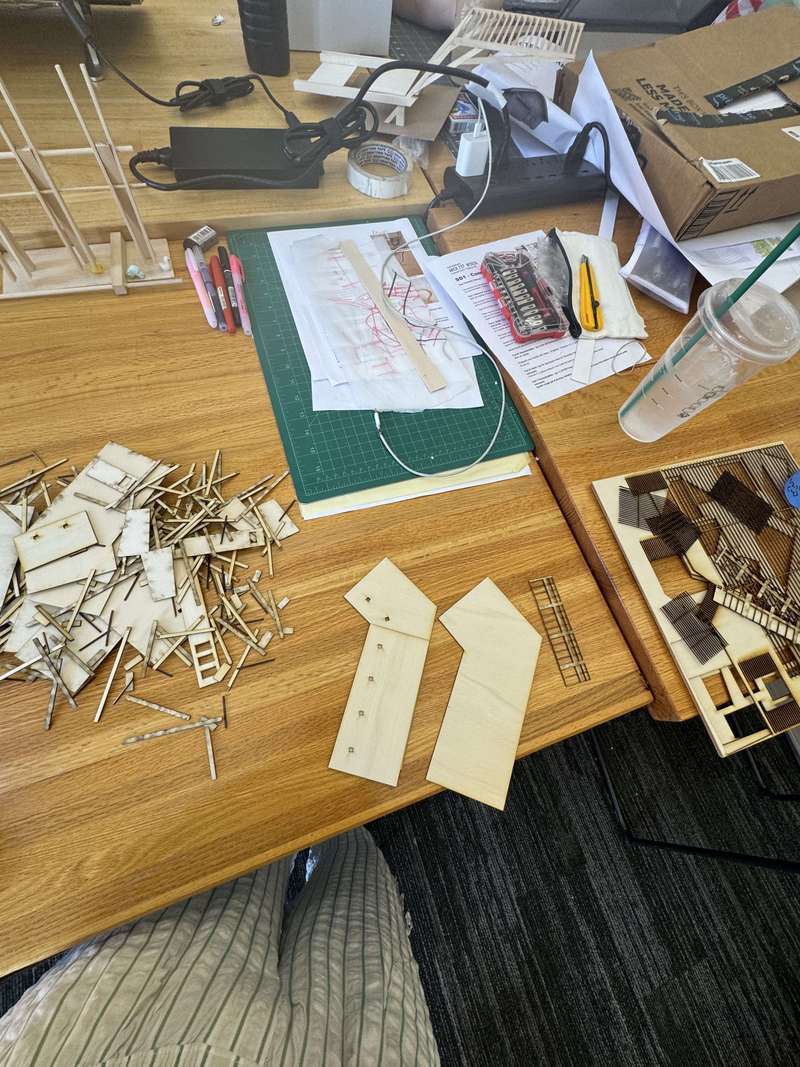
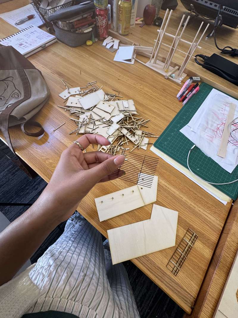
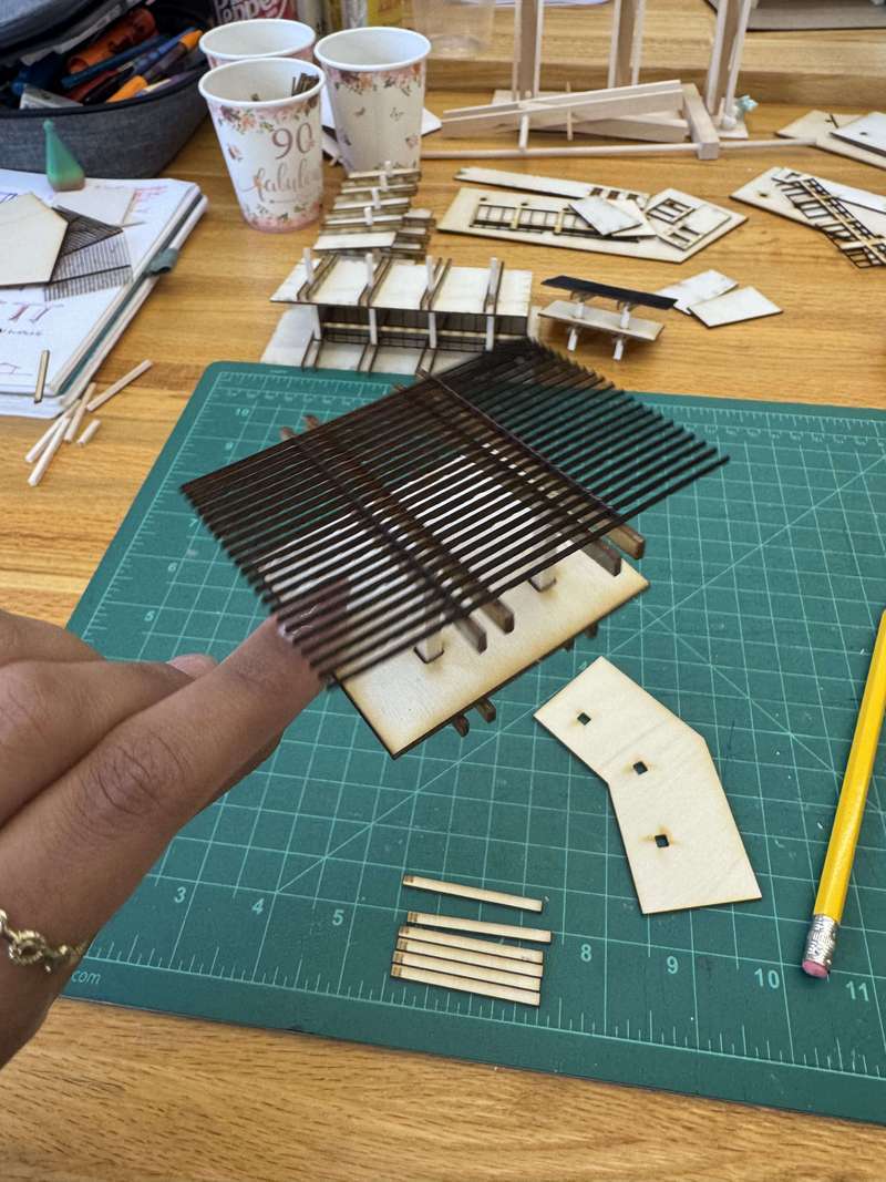
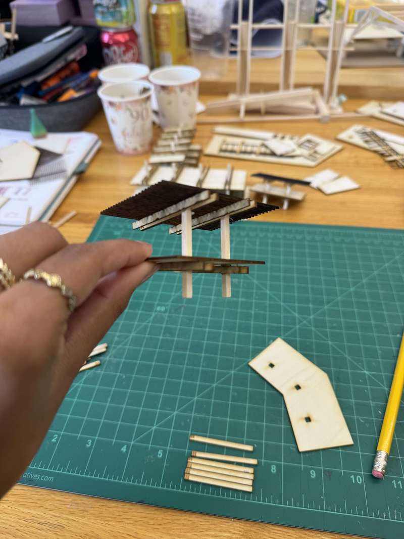
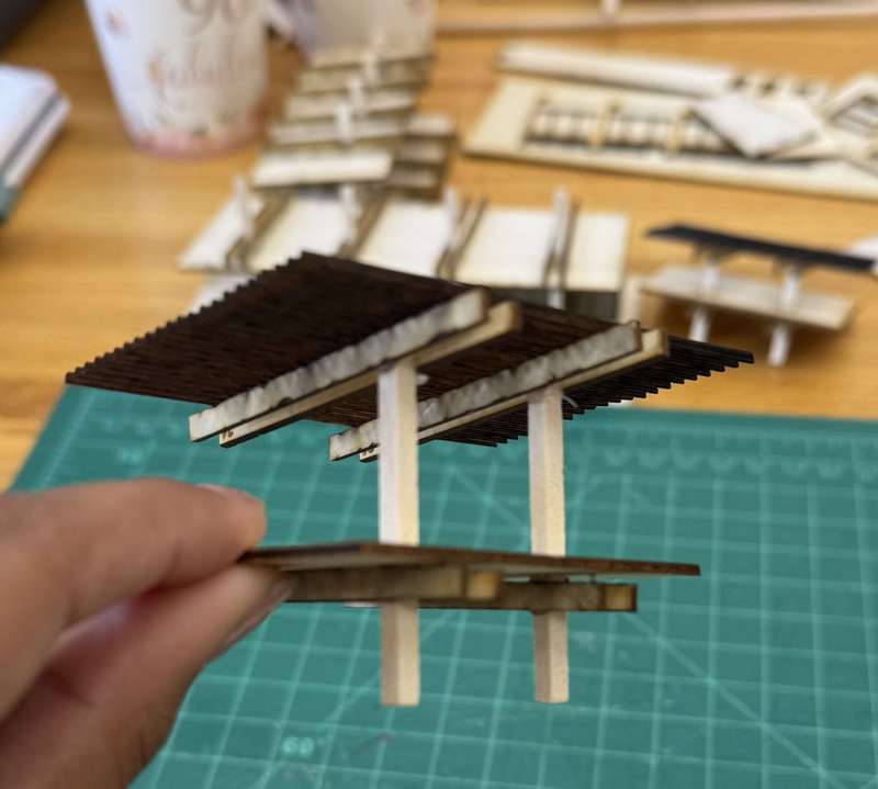
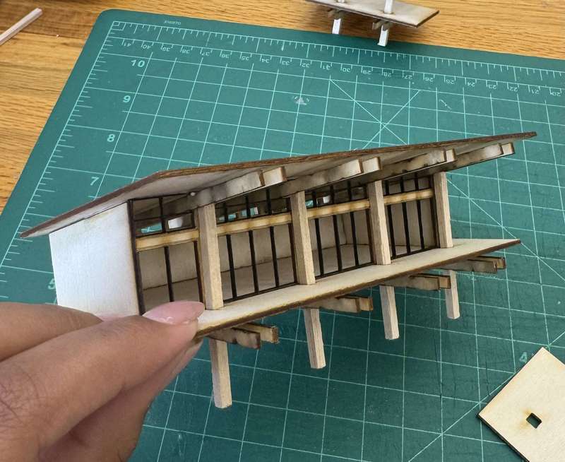
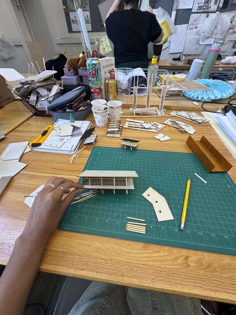
Handcut basswood, chipboard, illustration board, bristol, and 3D printed parts
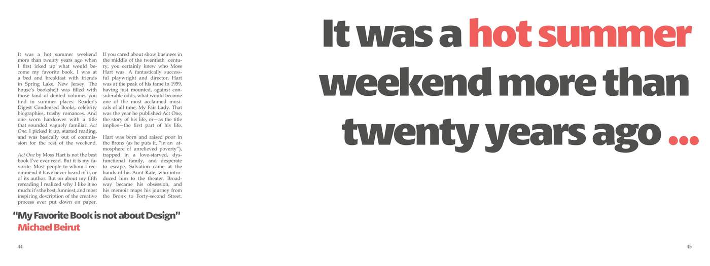
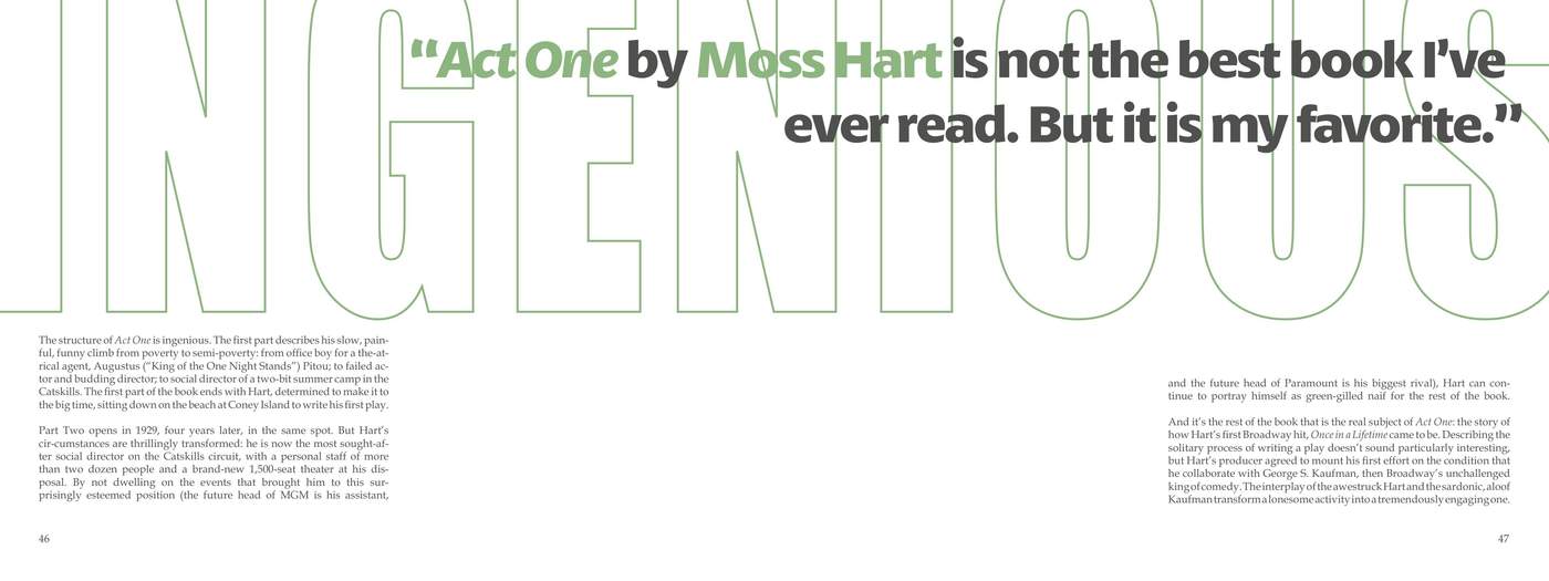
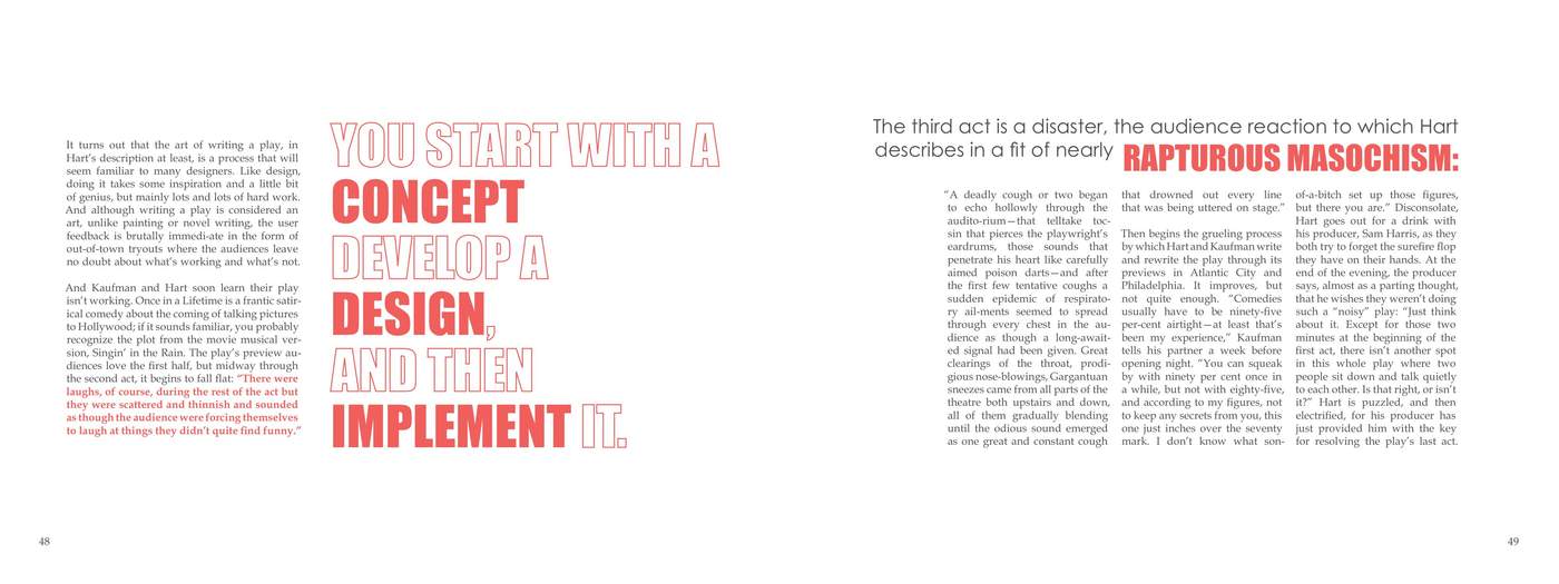
This book merges Bruno Munari’s methodical approach to design with Michael Bierut’s reflective narrative style, challenging readers to see design beyond aesthetics. Through a dynamic typographic landscape, each page serves as a carefully curated composition, utilizing contrast, rhythm, and hierarchy to guide perception and provoke thought.
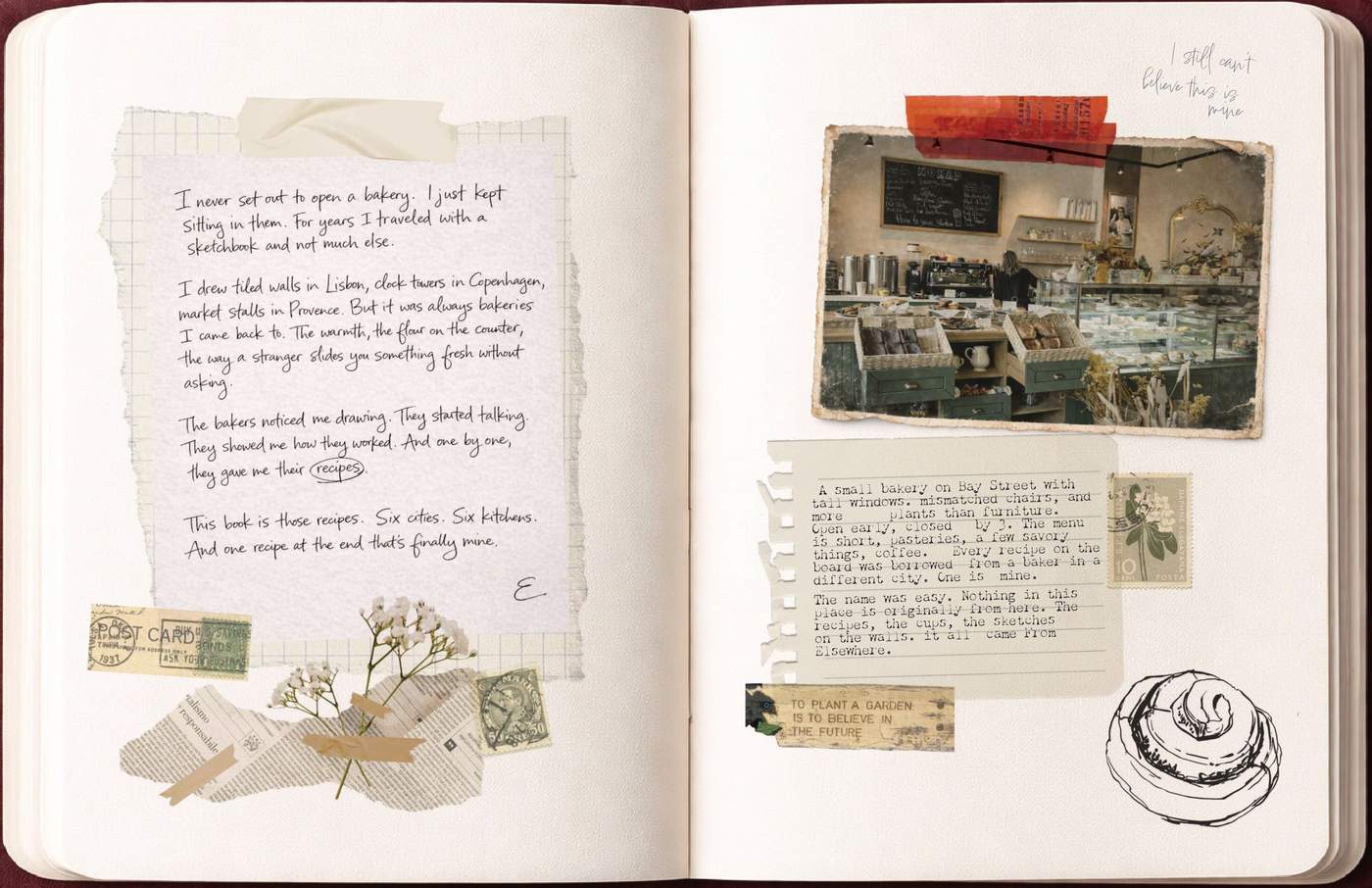
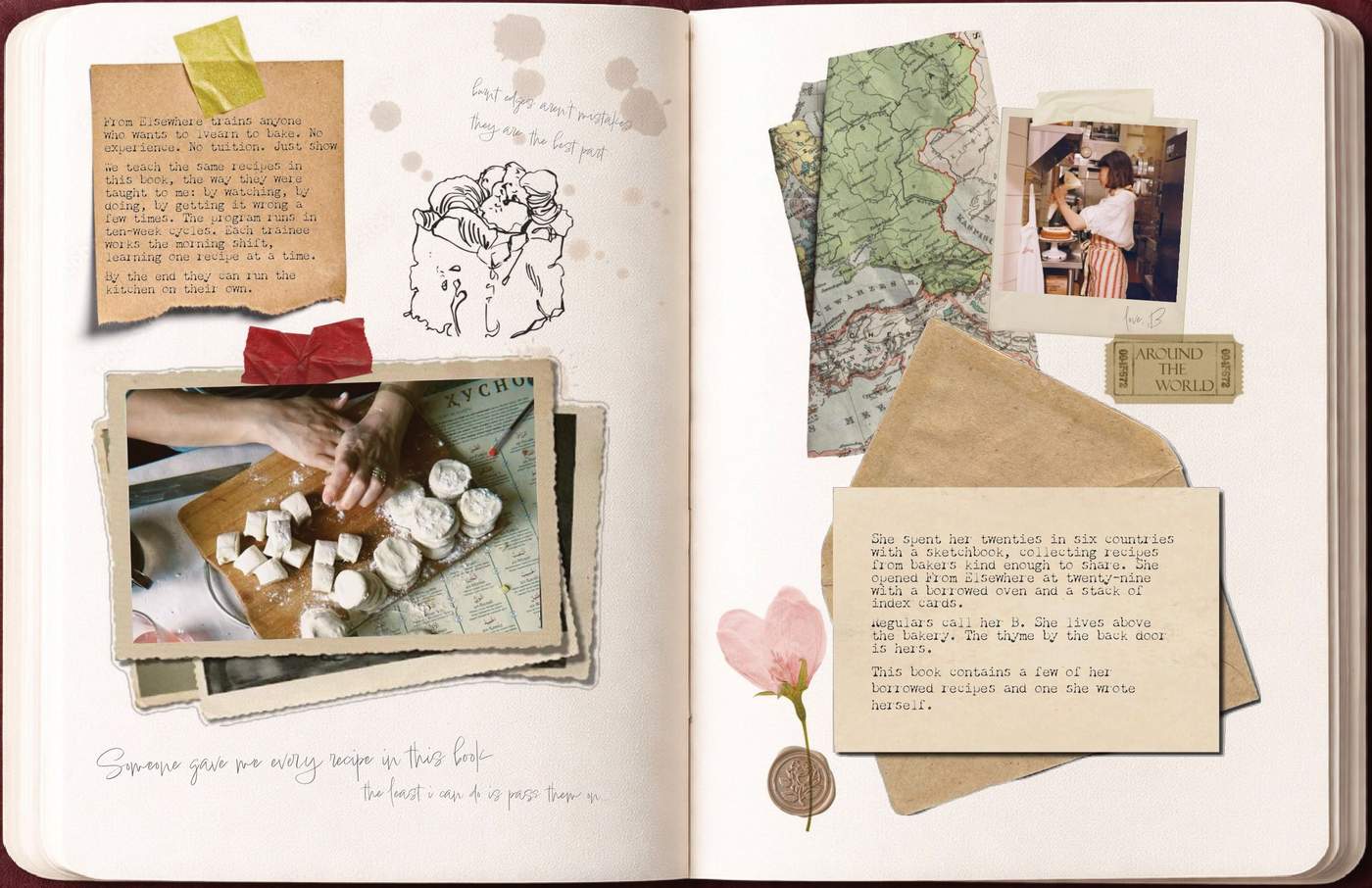
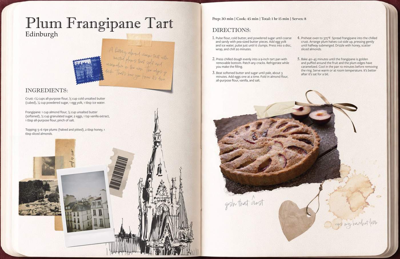
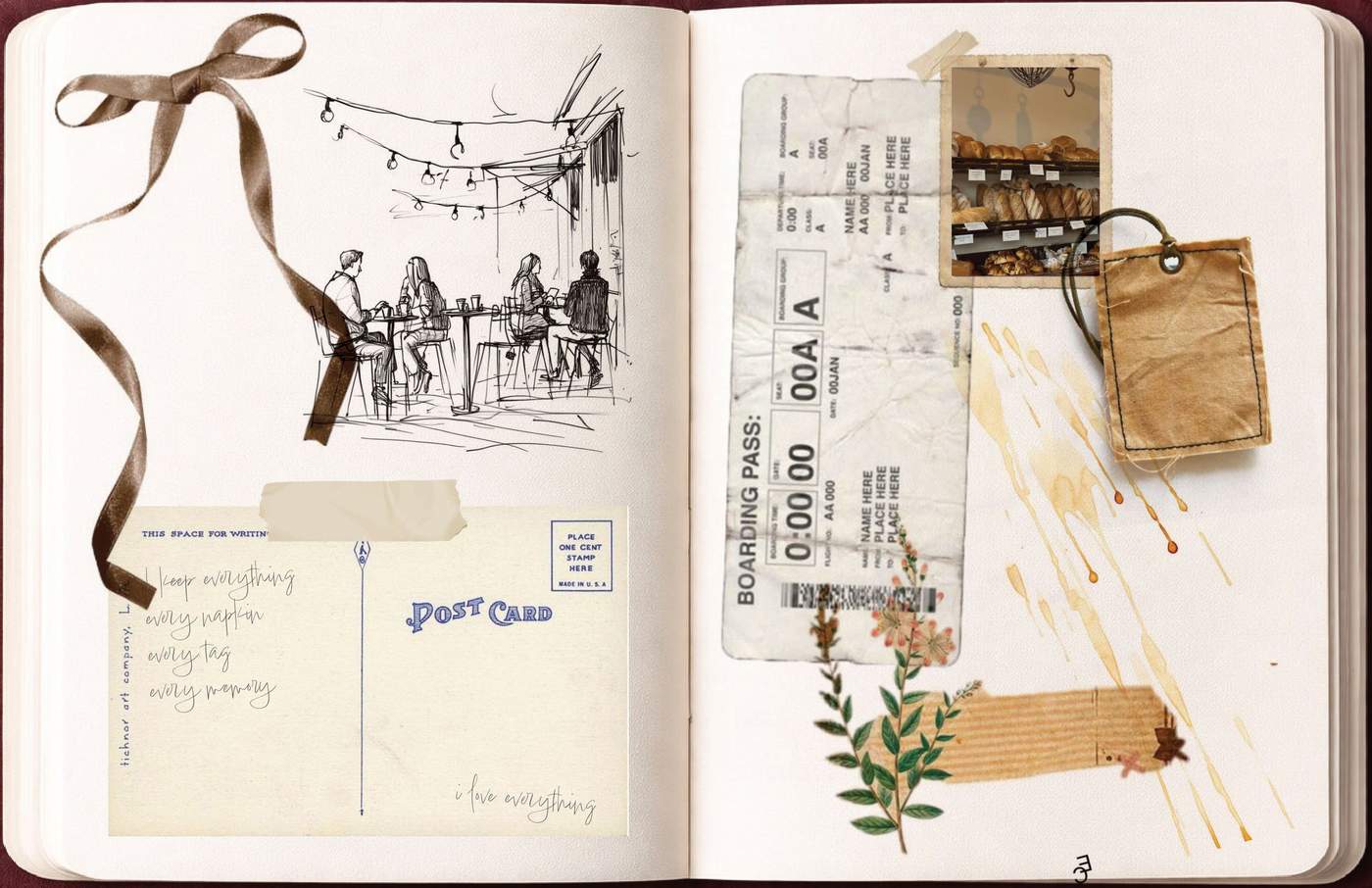
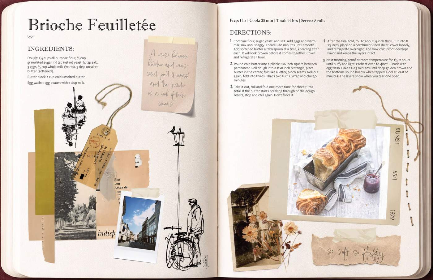
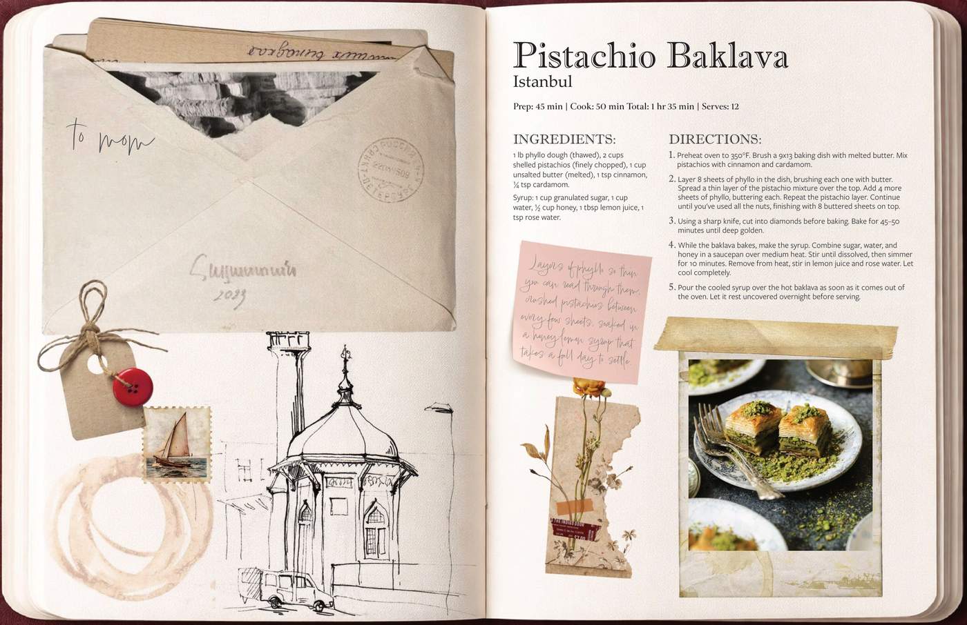
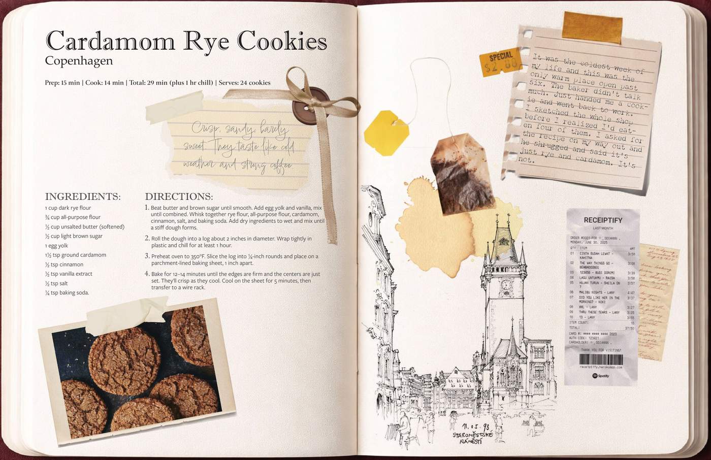
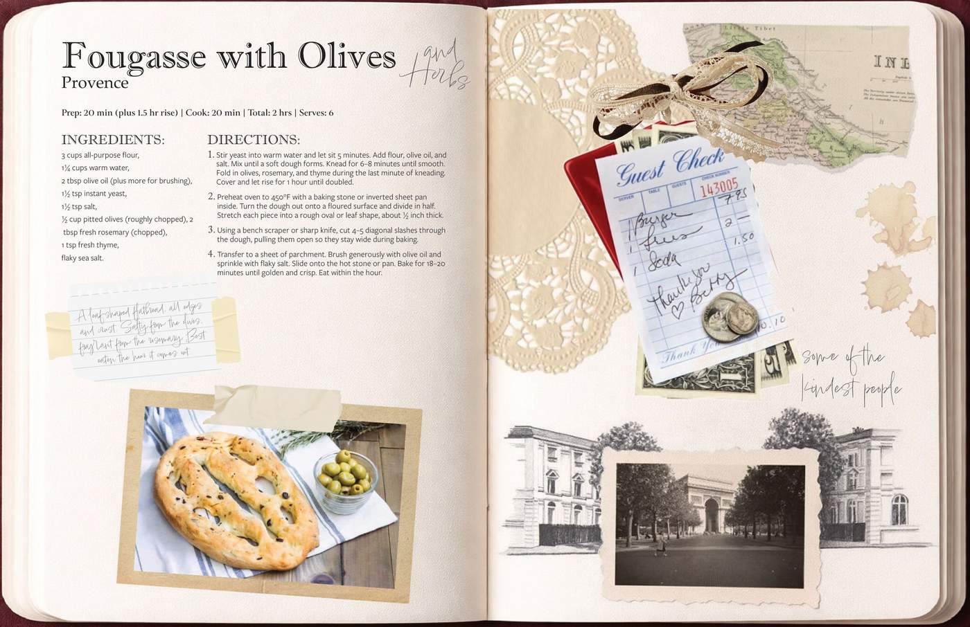
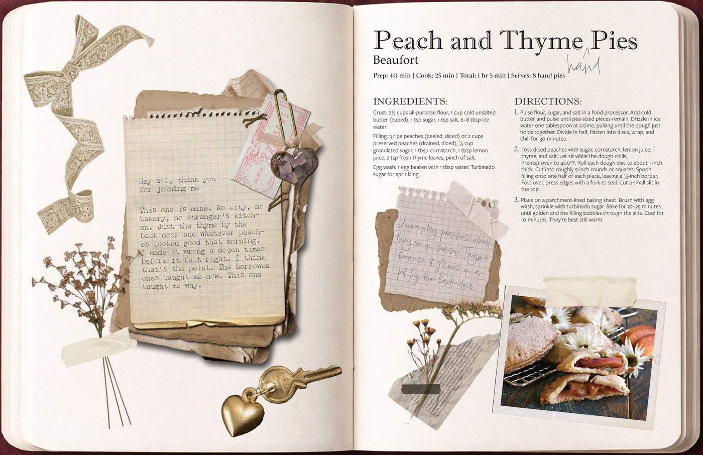
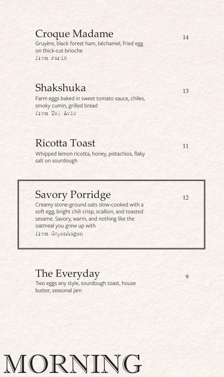
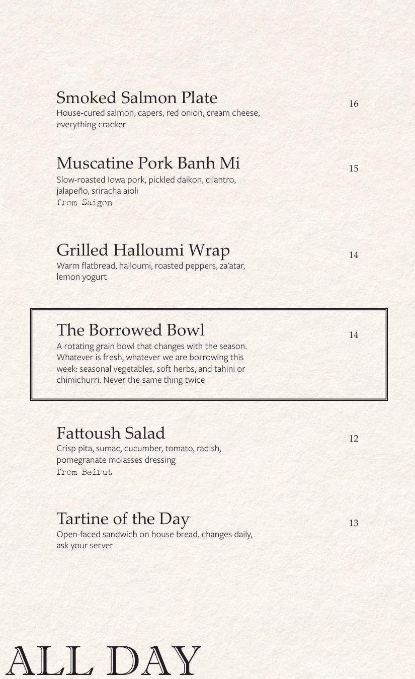
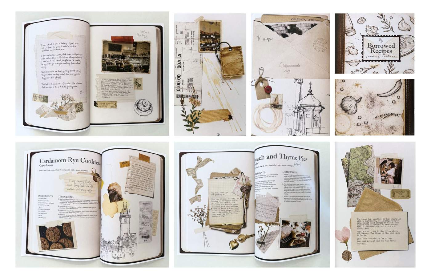
A cookbook built around a story: a baker who collected recipes from the cities she passed through. The name Beaufort, the short menu, the sketchbook format, none of it felt arbitrary. The scrapbook aesthetic demanded restraint; pulling things out was harder than putting them in. The handwriting, the taped photos, the coffee stains, the recipe she kept for herself at the end, it feels like something she carried.
North Charleston, SC | ARCH 404 | Professor Guess | Fall 2024
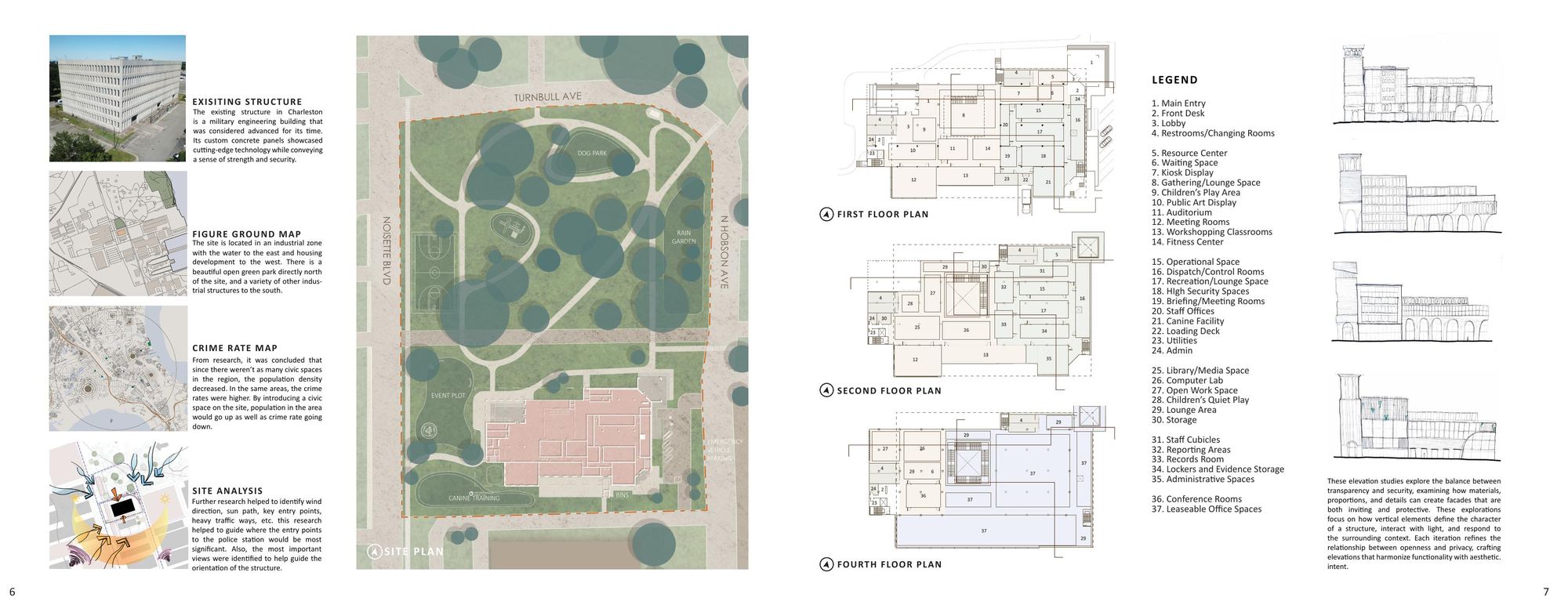
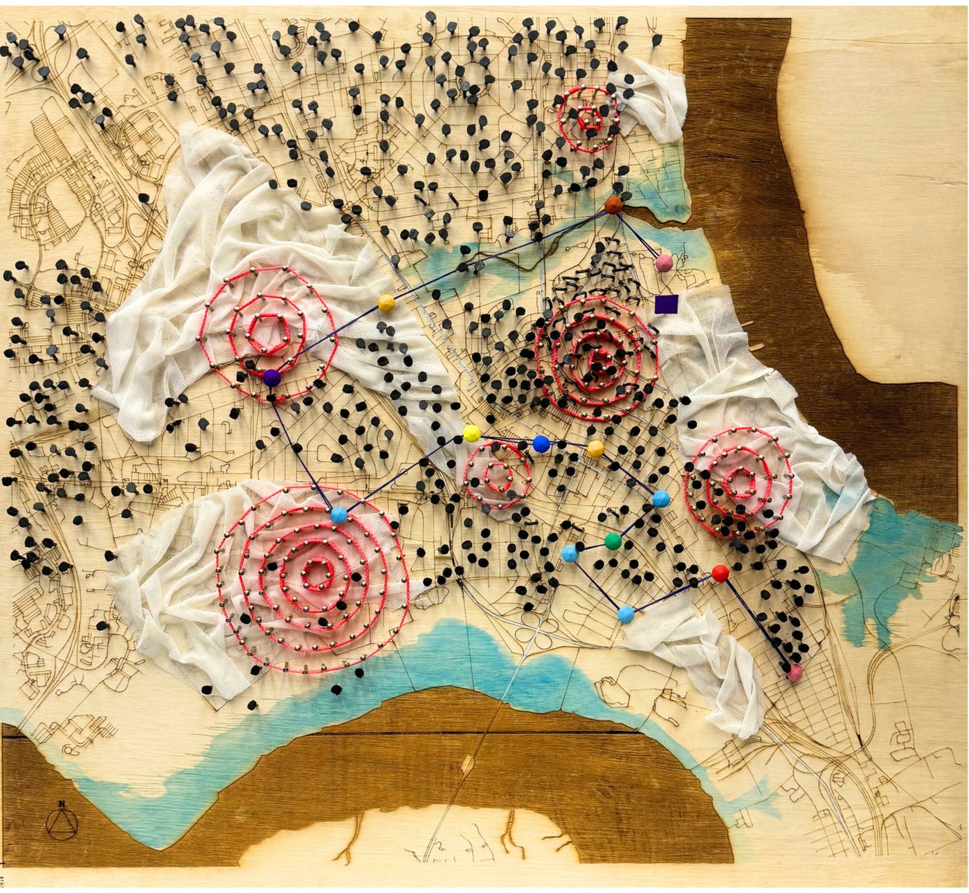
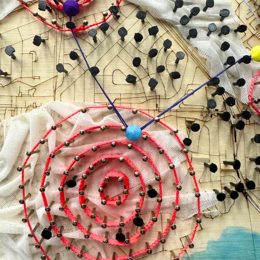
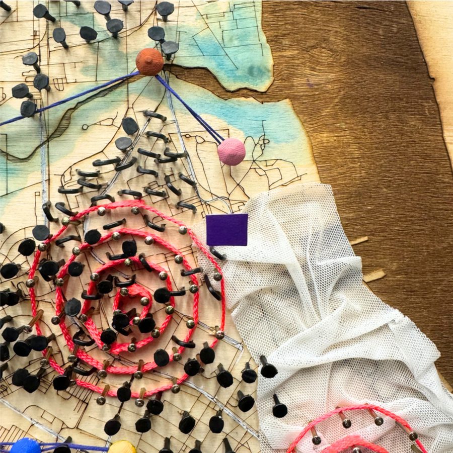
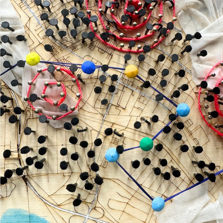
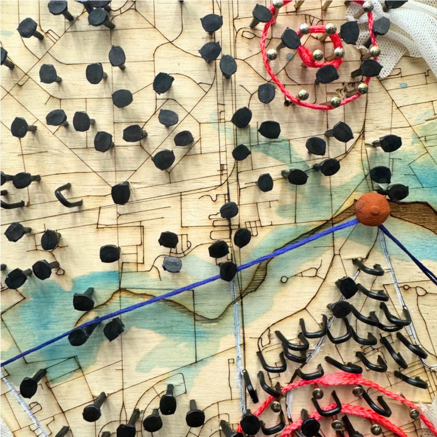
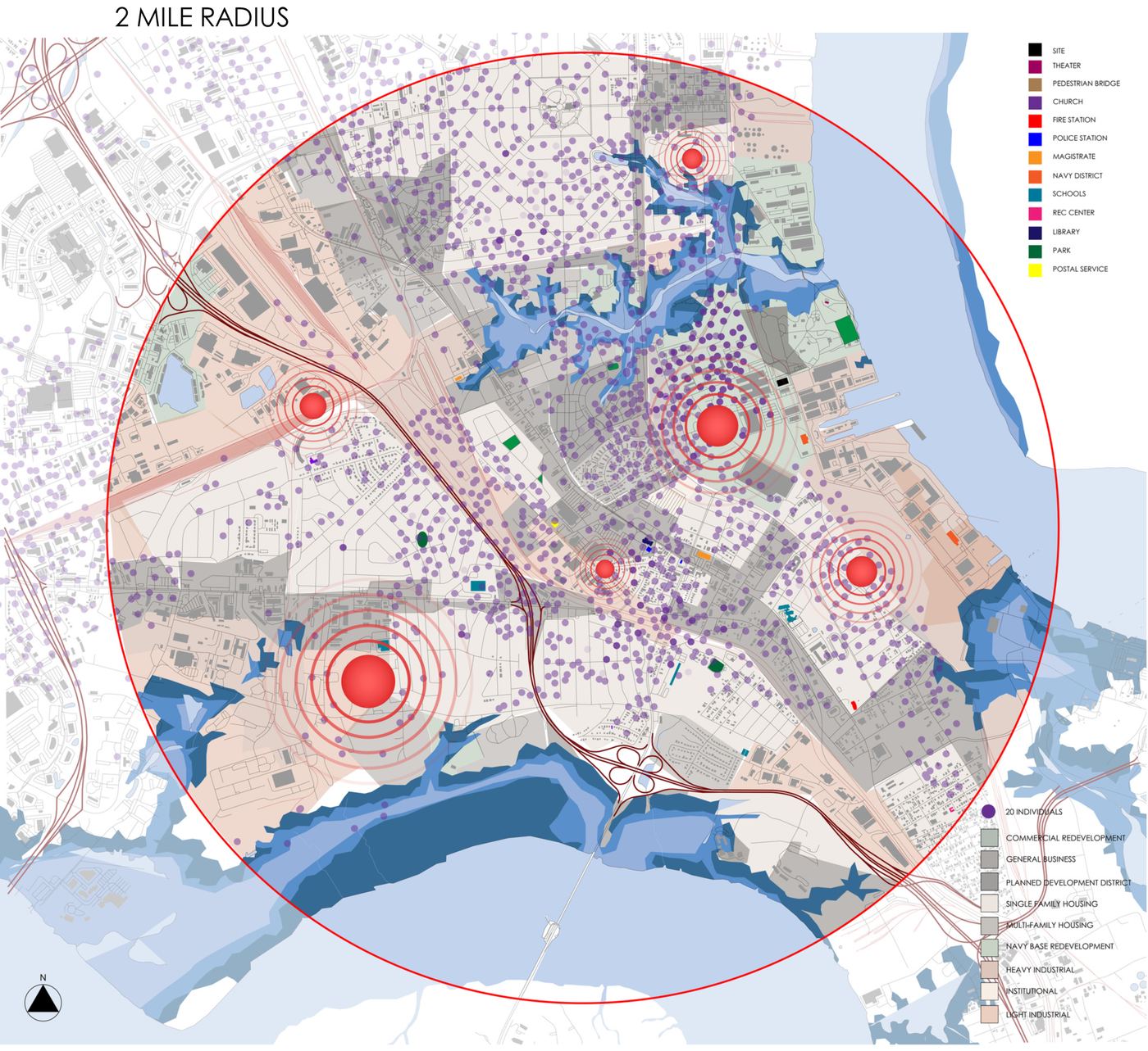
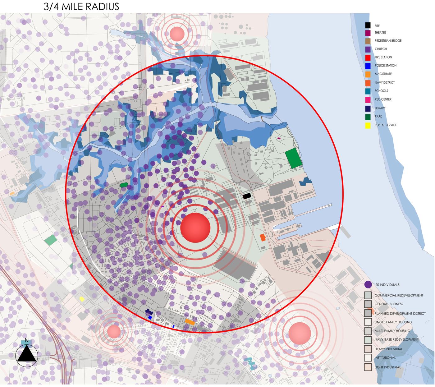
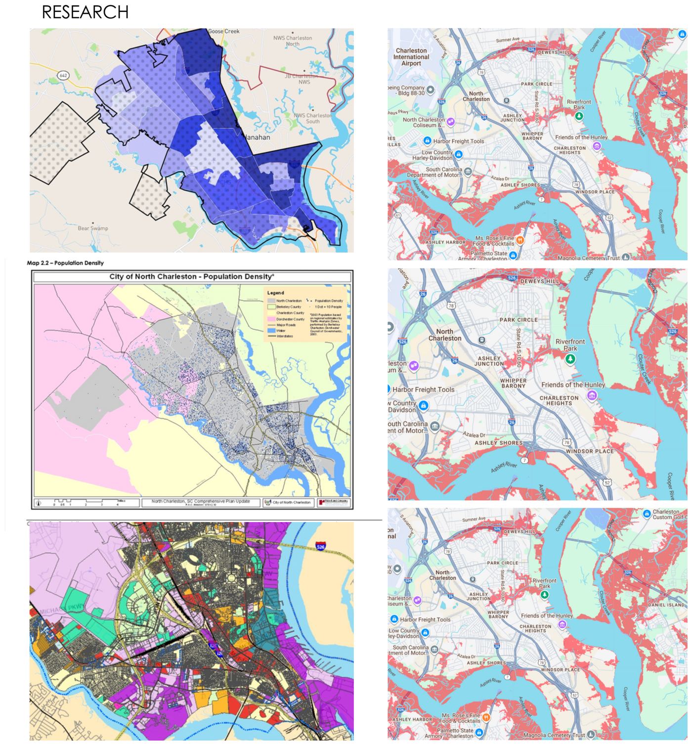
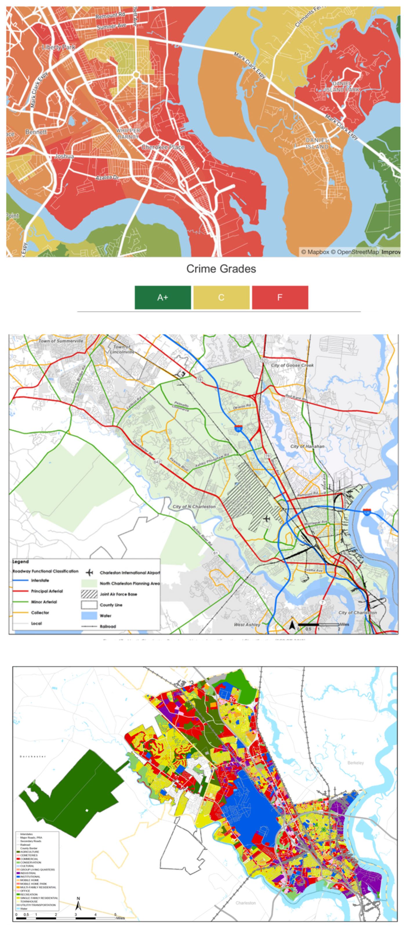
Site analysis is usually a set of maps filed behind the design. Here it came first and decided what the building would be. The study began as a physical map: a routed wood base, fabric laid over it for topography, hundreds of black pins for the existing fabric, and colored pins linked with thread to trace how people actually move between civic anchors. Red spirals mark intensity where those movements concentrate.
Working at two radii, two miles and three quarters of a mile, then layering population density, zoning, flood extent and crime data over the same ground, the gap in the neighborhood became legible: the civic institutions people relied on were the ones they trusted least. That reading is what led to a police station as the program, and to Beacon.
Environmental Control | Professor Guess | Winter 2024
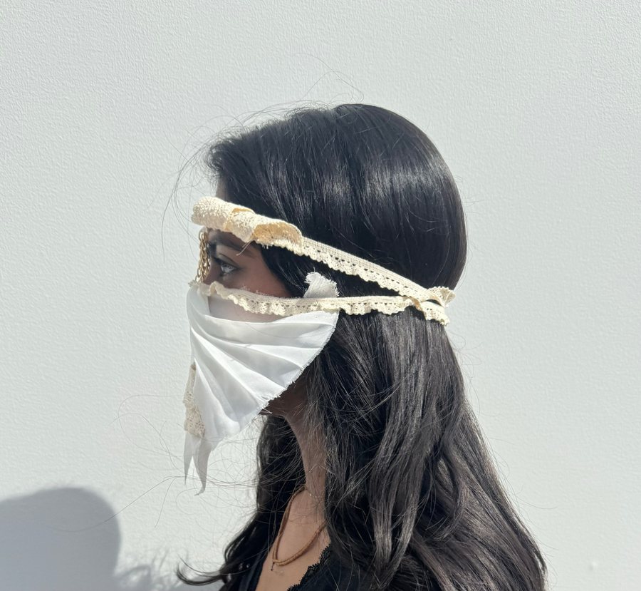
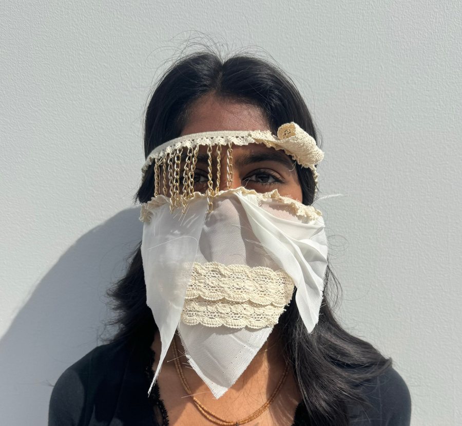
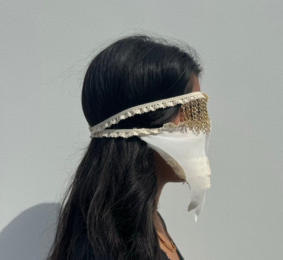
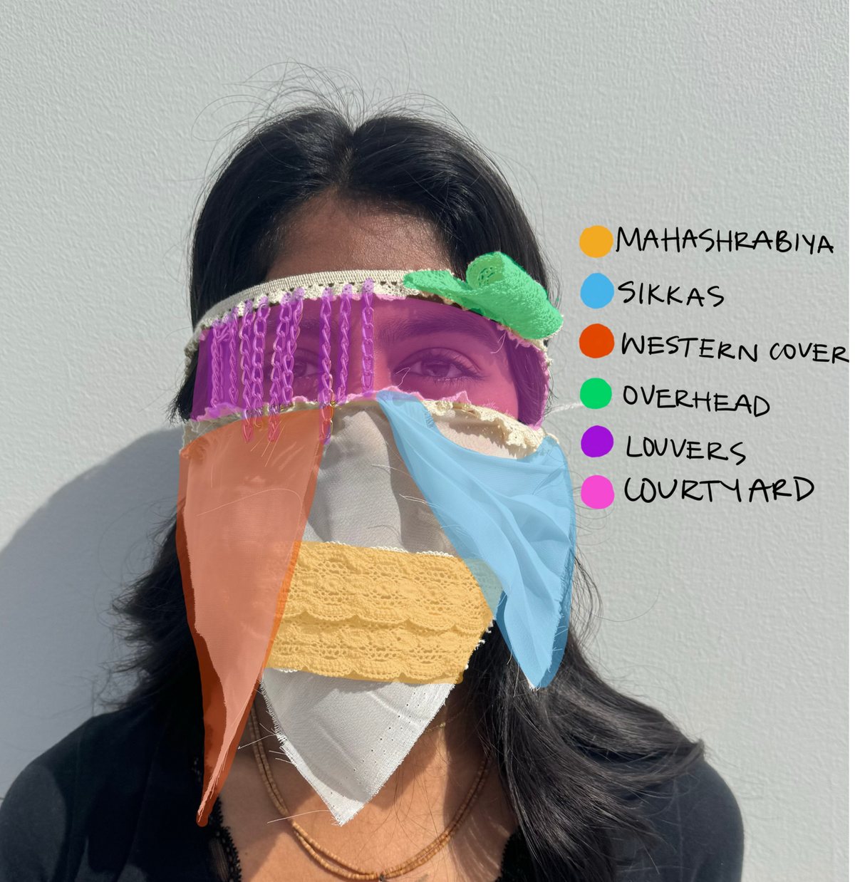
A facade you wear. The brief was to take a climate and build its environmental strategy as a mask, which turns an abstract set of tactics into something that has to fit a face, and something you have to see and breathe through.
I chose Dubai, where the strategies that matter in a hot arid desert climate are shading, daylighting and ventilation. Three traditional elements do that work, and each became part of the mask: mashrabiya lattice screens, which diffuse light and filter dust while letting hot air escape; sikkas, the narrow alleys built close enough to stay shaded and channel wind toward the creek; and central courtyards, turned away from the sun, their overhangs and louvers blocking direct light while the walls hold off dusty winds.
Put together, these are not defenses against the climate so much as ways of using it. That is the argument the mask is making.
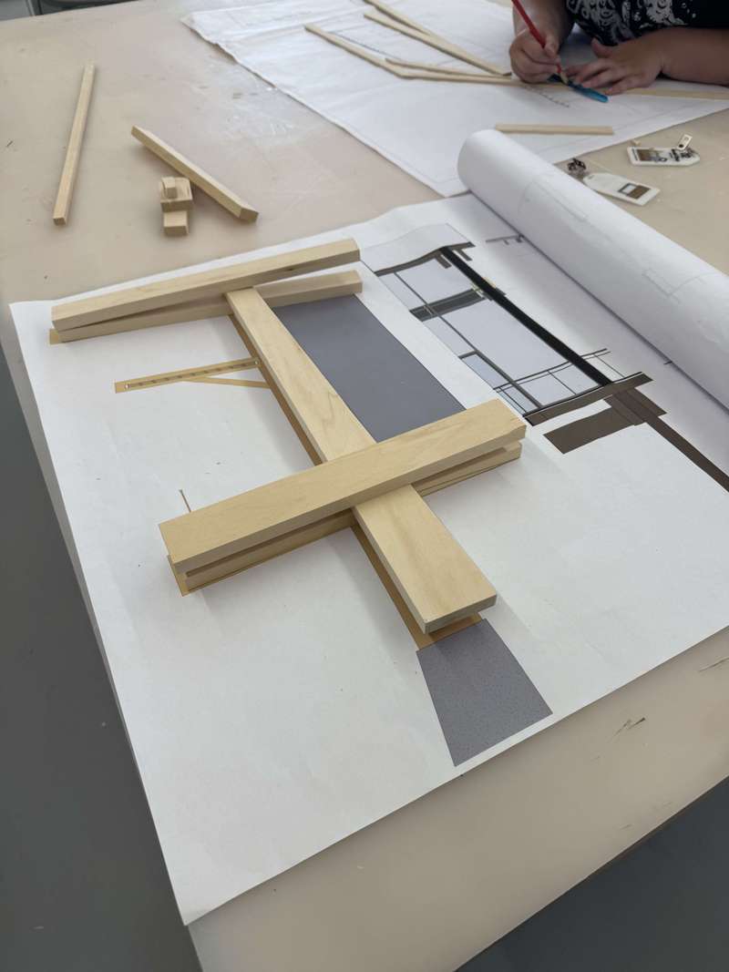
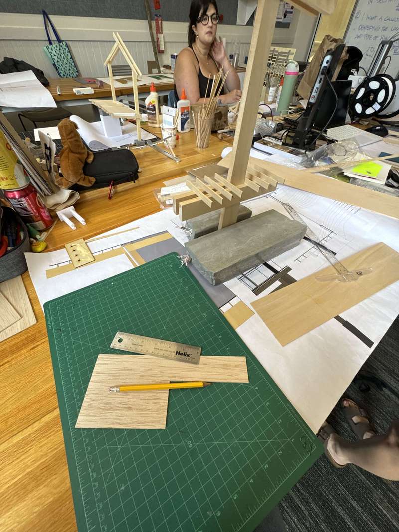
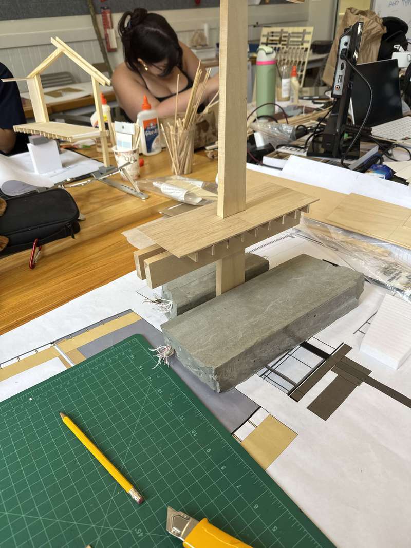
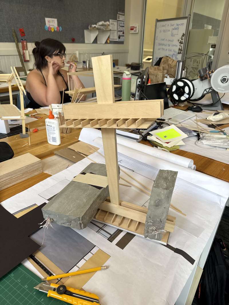
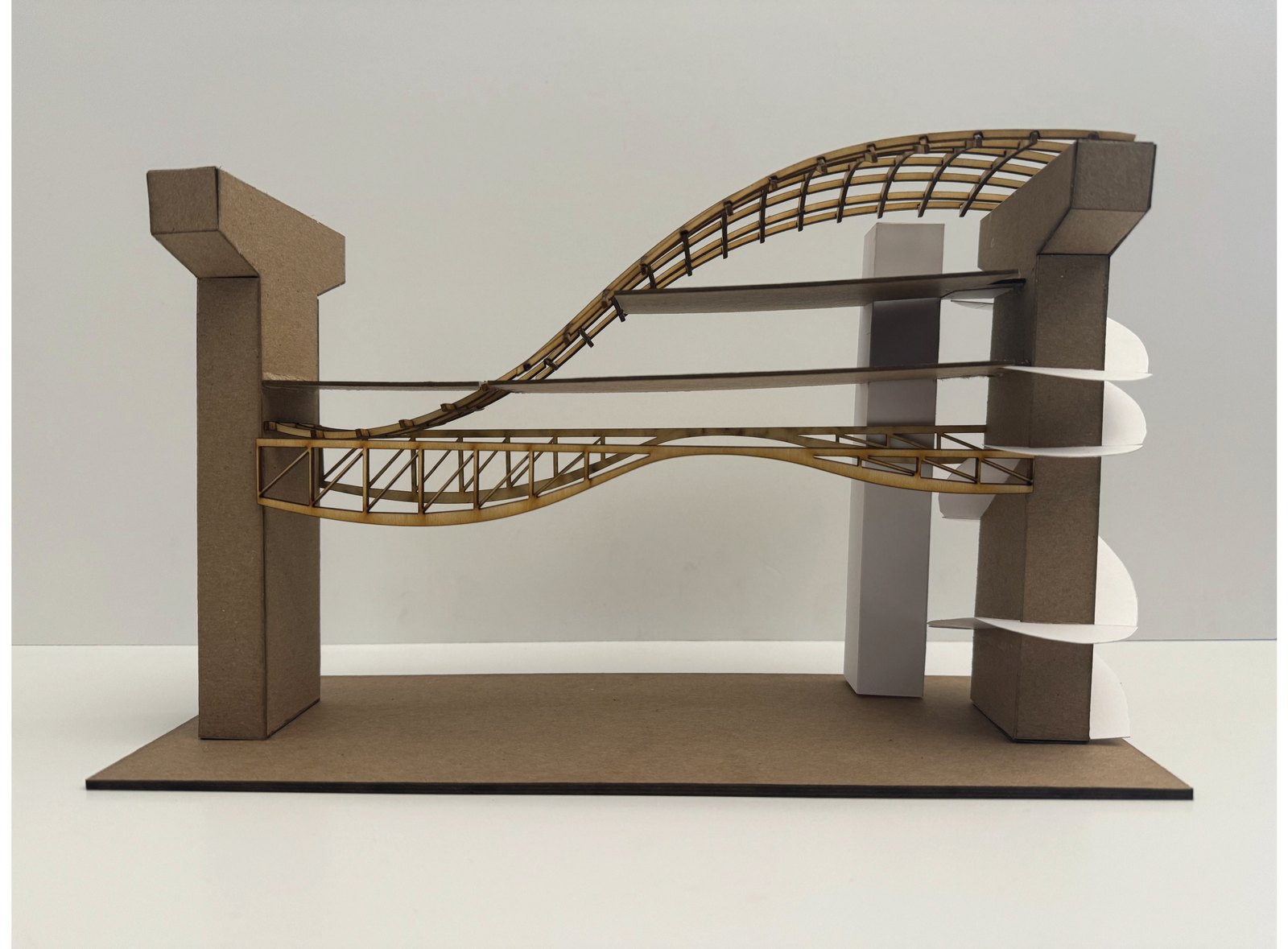
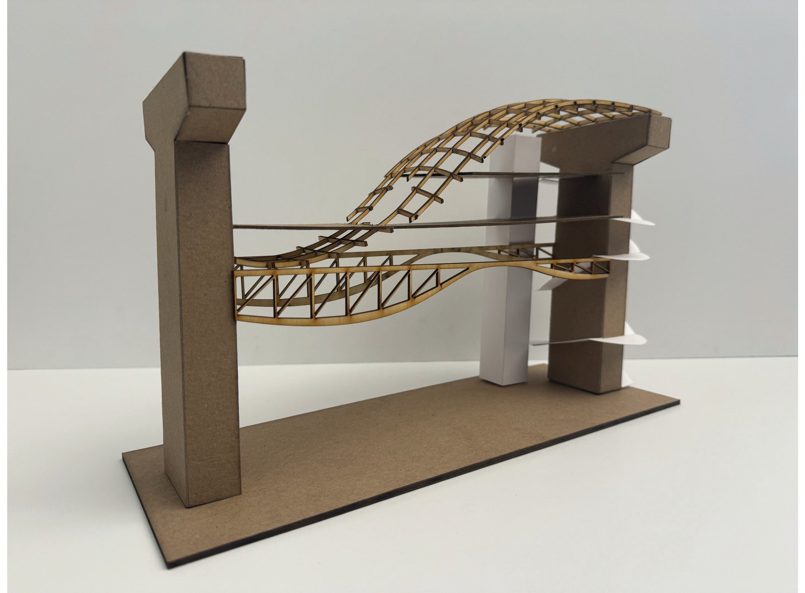
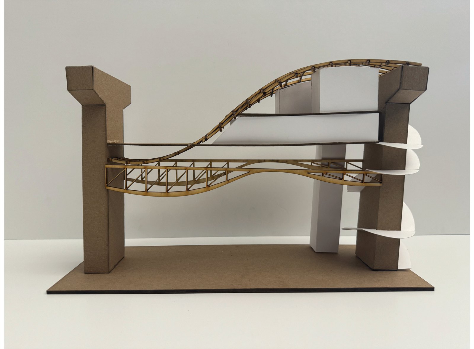
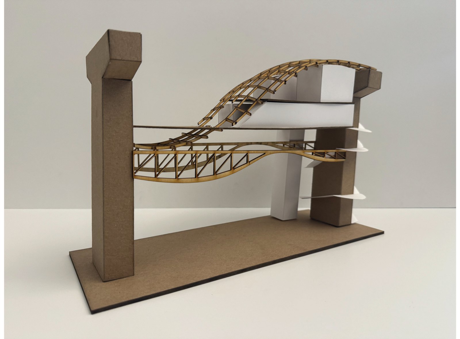
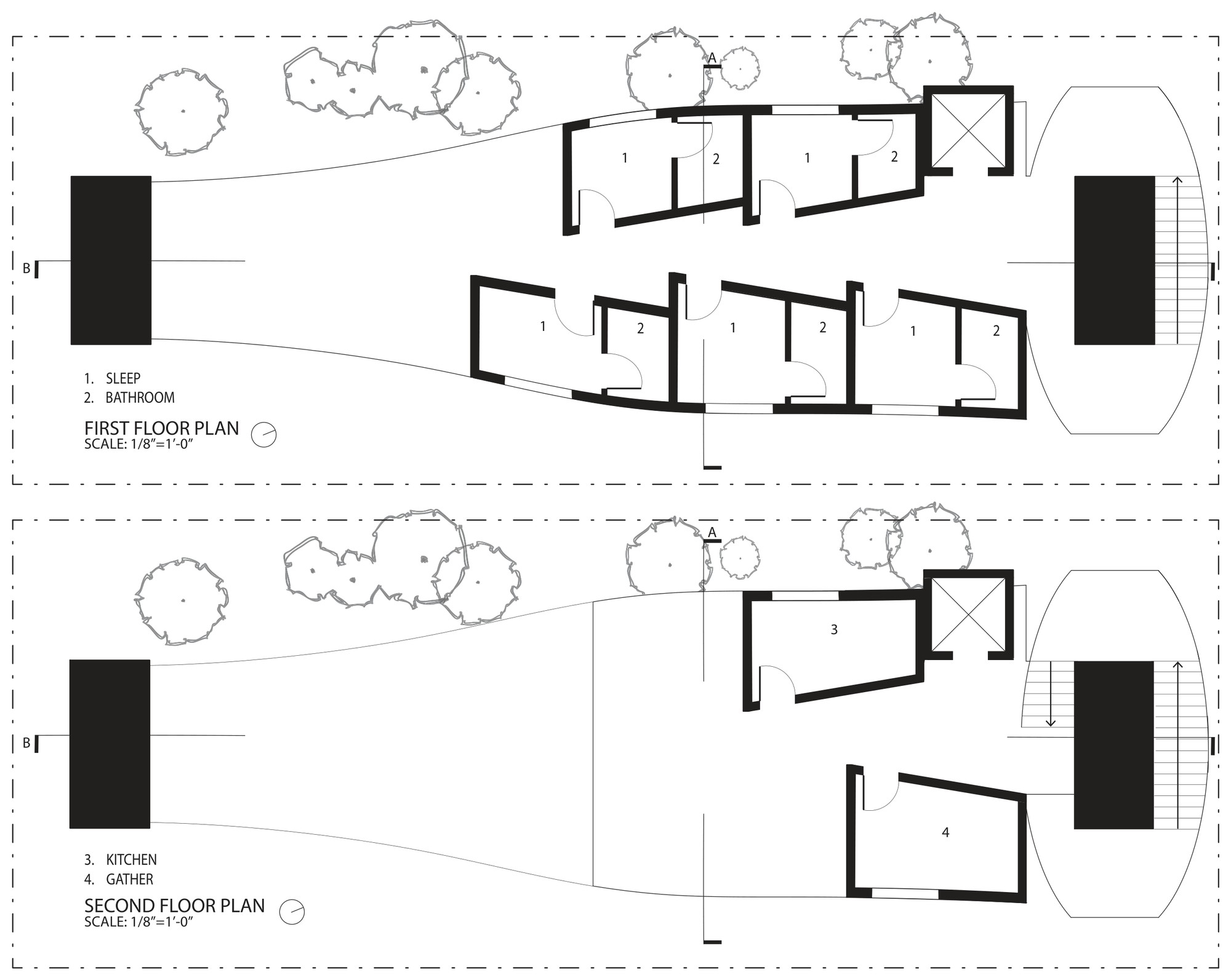
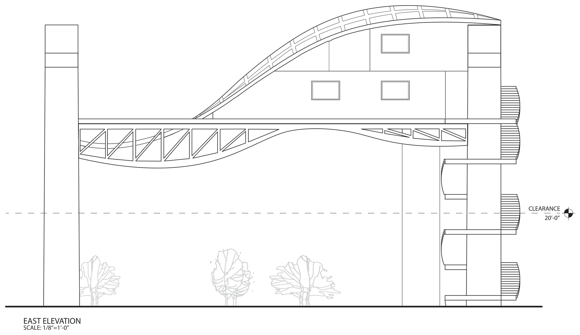
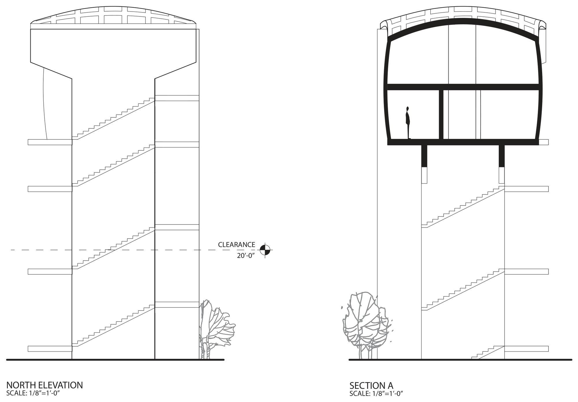
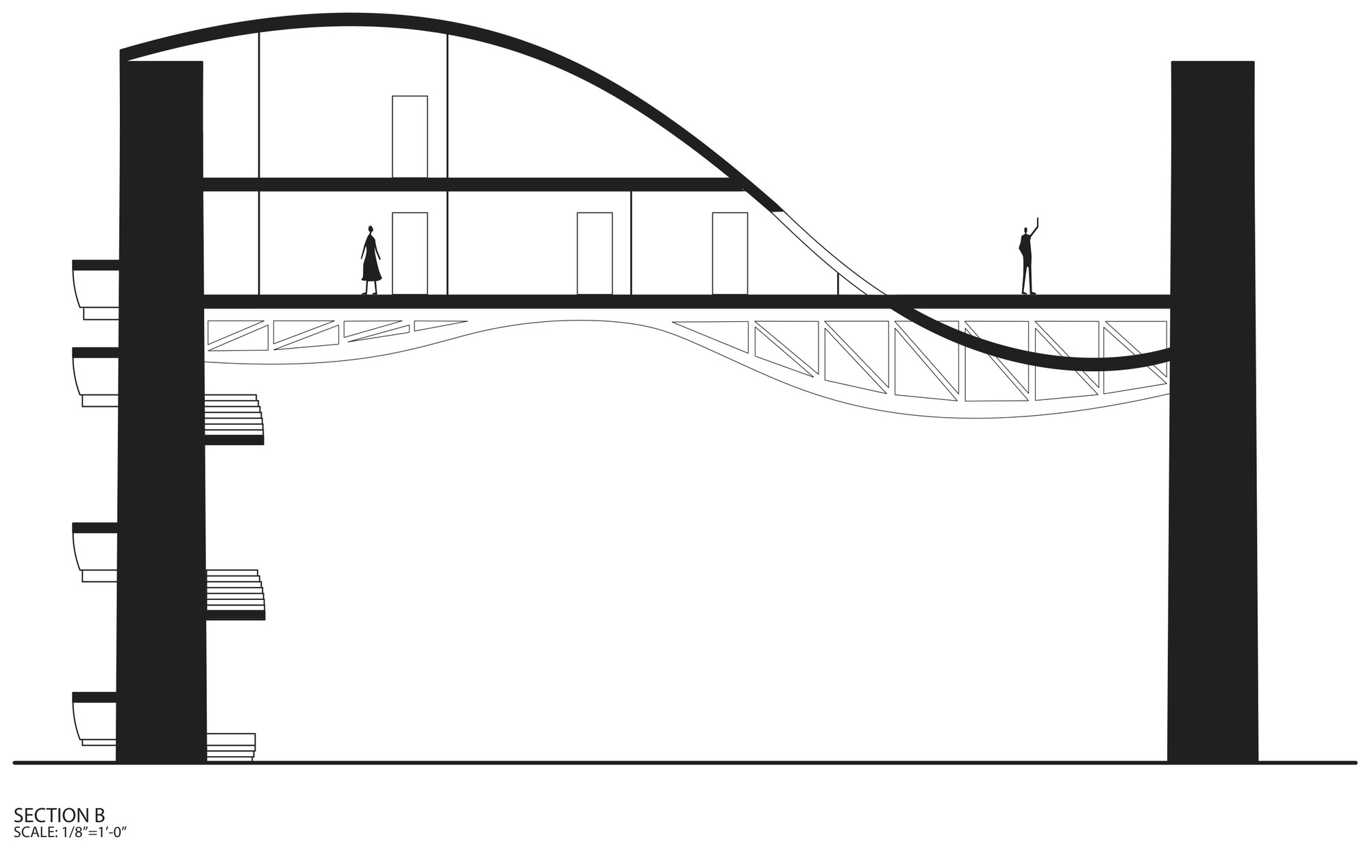
A one week charette for a bridge that is also a house. Two piers anchor a curved timber truss that carries the crossing and the dwelling hung inside it: sleeping and bathing at one end, kitchen and gathering at the other, so crossing the span means passing through someone’s home. The camber of the deck, the upward curve a bridge is built with so it reads level under load, became the organising line for both.
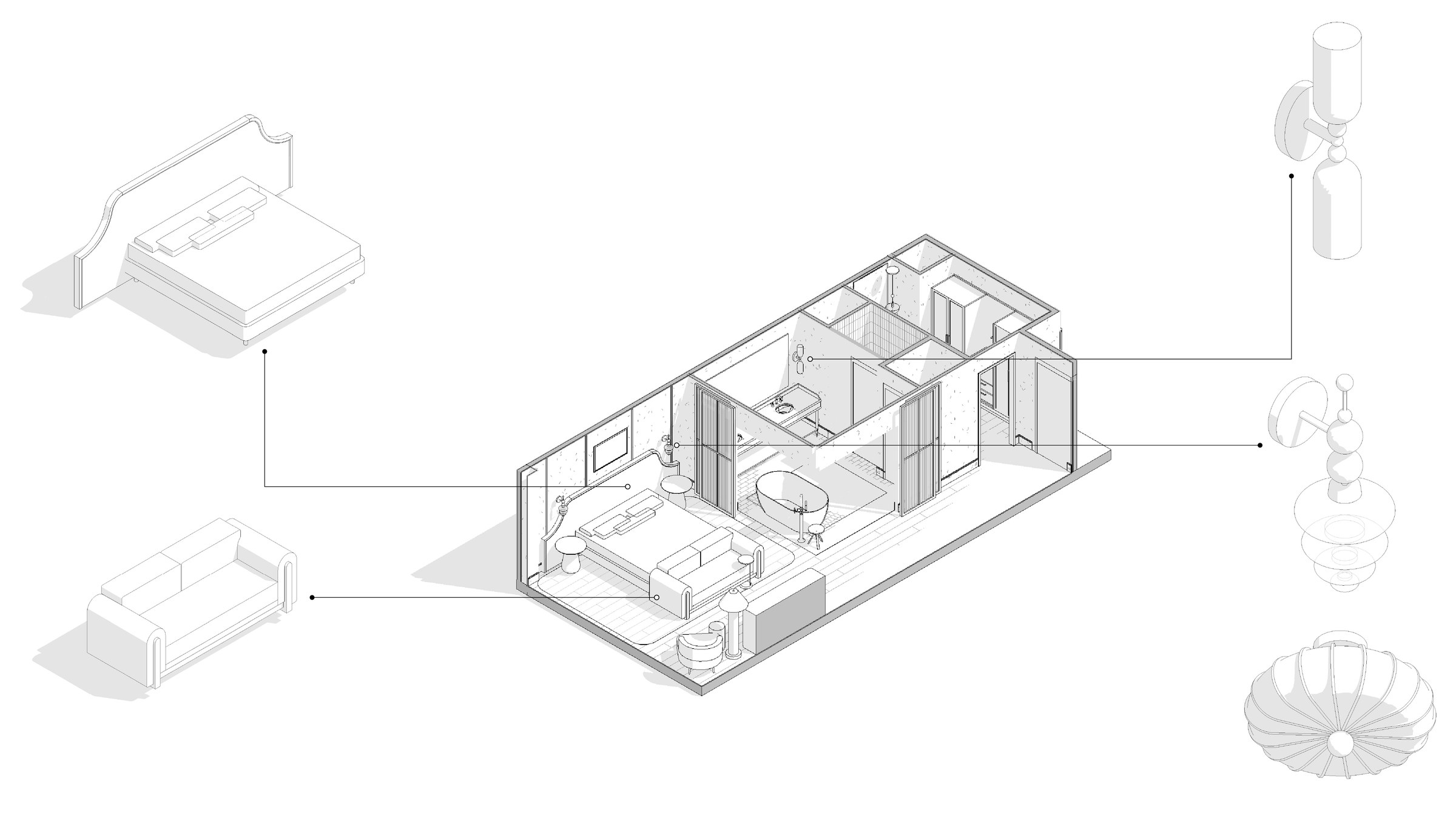
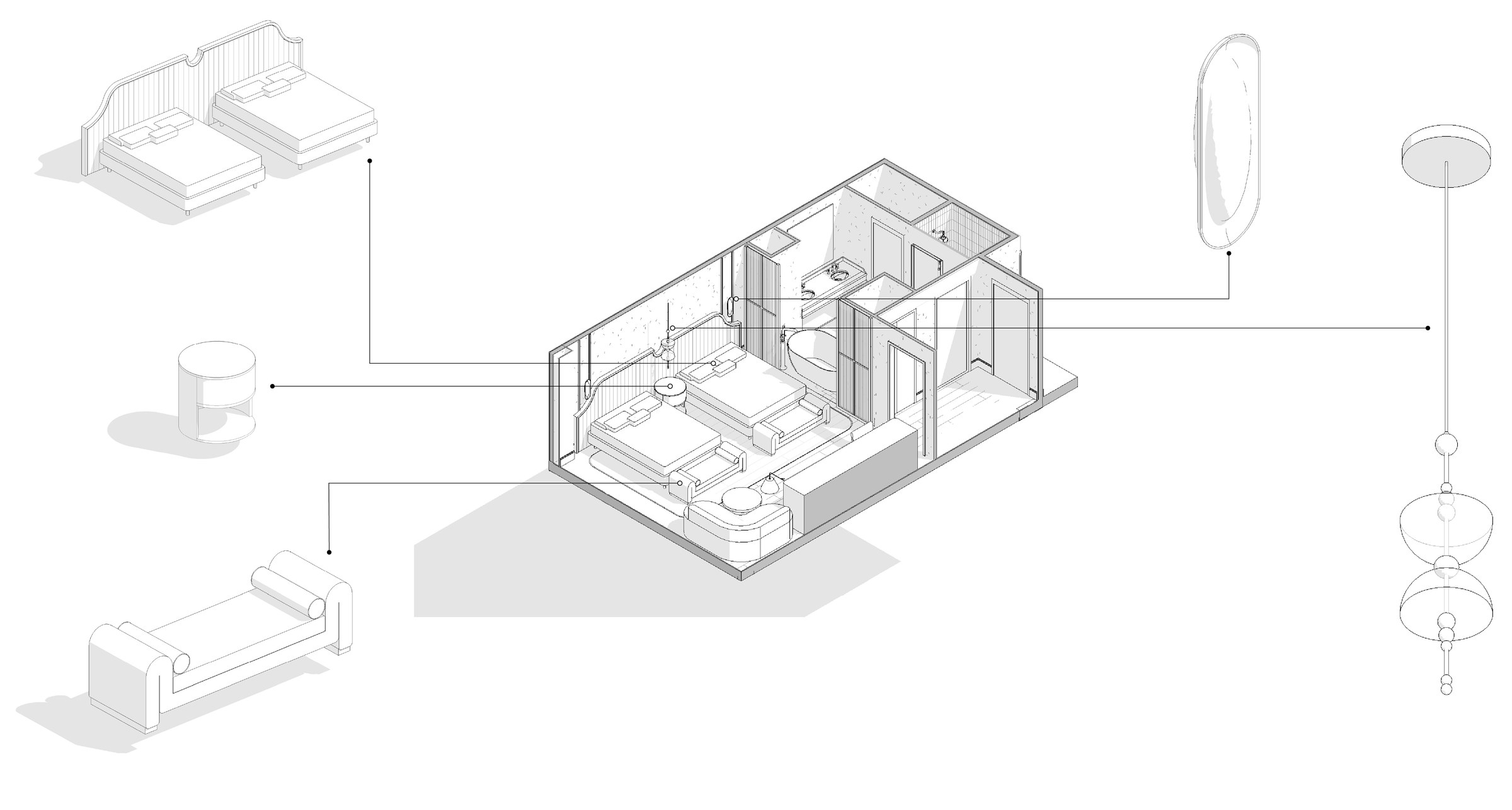
Custom Revit Families — The Johnson Studio at Cooper Carry
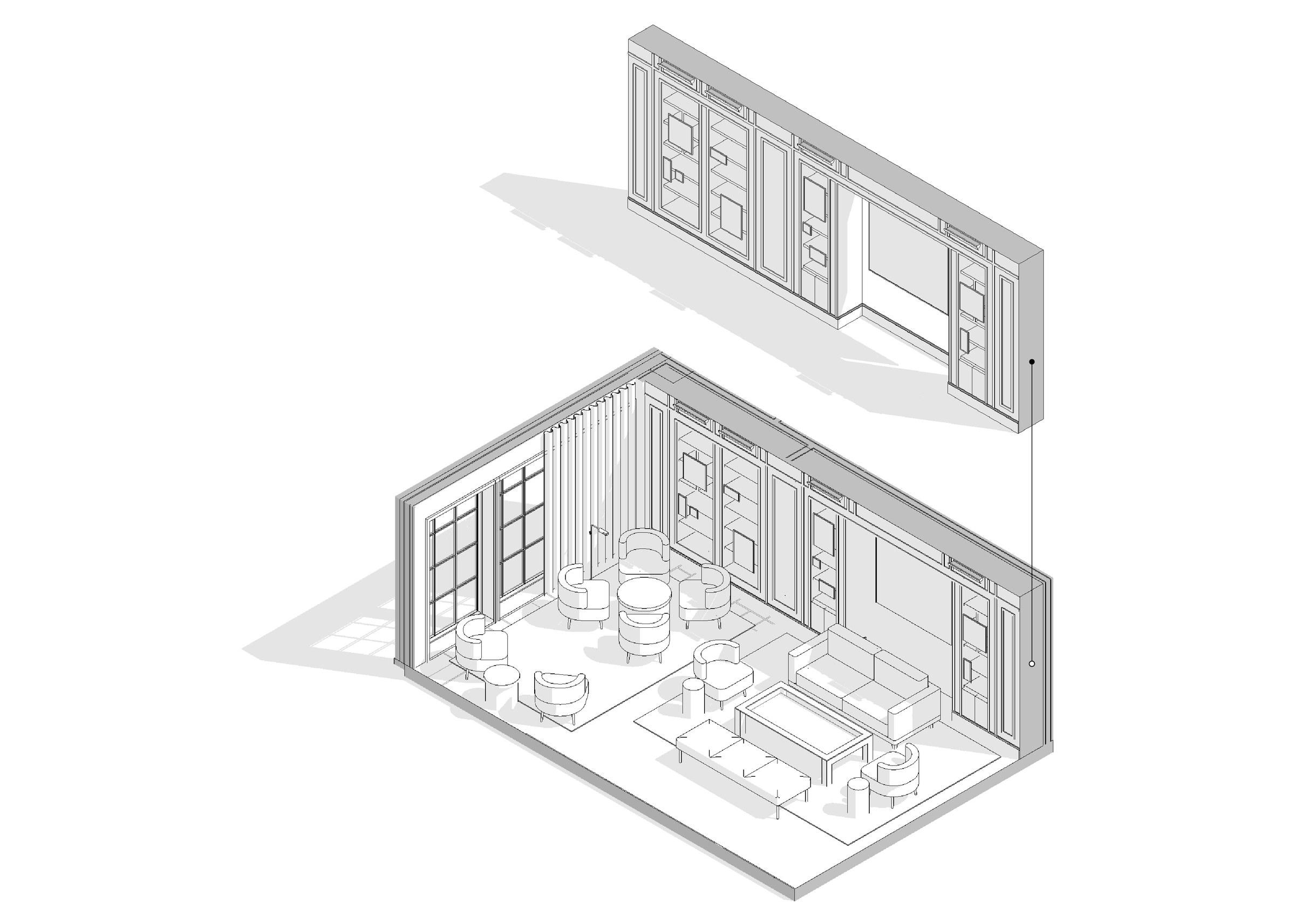
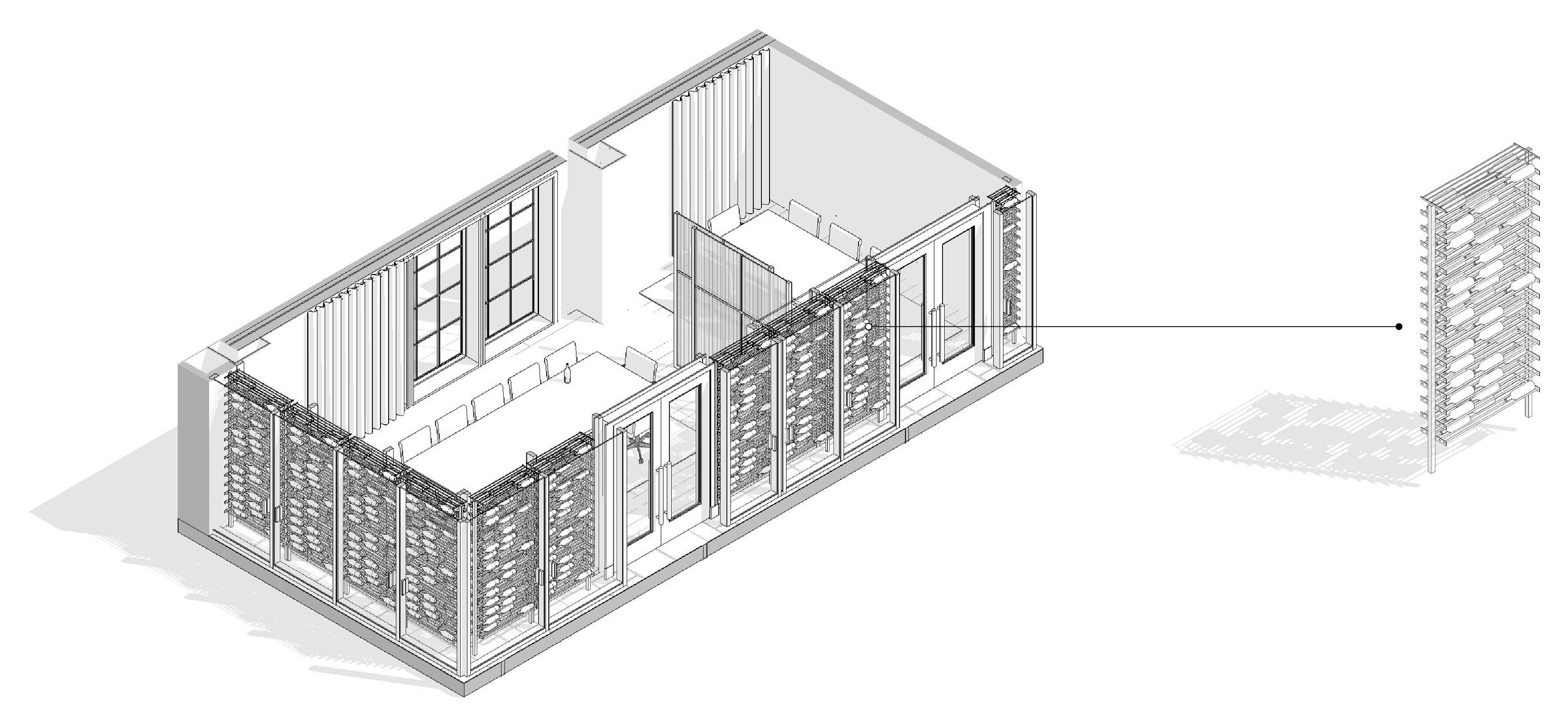
Custom Parametric Revit families built during my internship at The Johnson Studio at Cooper Carry, for the guestrooms and public spaces of a hospitality project. Each drawing shows one room modeled in full, with a few chosen families I developed called out beside it.